Datchet elevation
Datchet (England, Royal Borough of Windsor and Maidenhead), United Kingdom elevation is 20 meters and Datchet elevation in feet is 66 ft above sea level [src 1]. Datchet is a seat of a third-order administrative division (feature code) with elevation that is 52 meters (171 ft) smaller than average city elevation in United Kingdom.
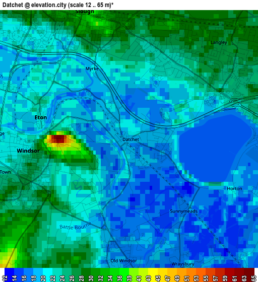
Below is the Elevation map of Datchet, which displays elevation range with different colors. Scale of the first map is from 12 to 65 m (39 to 213 ft) with average elevation of 22.3 meters (=73 ft) [note 1]
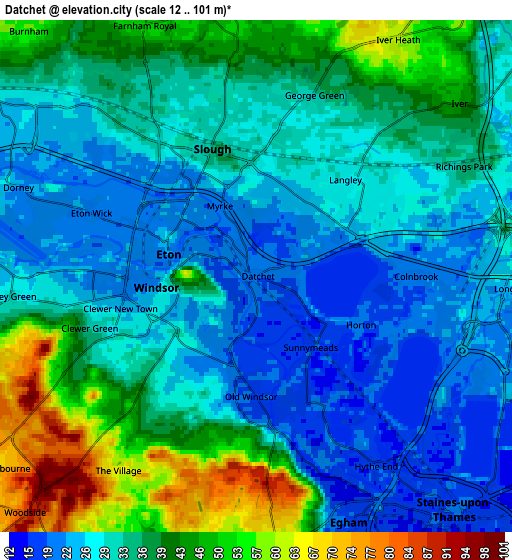
These maps also provides idea of topography and contour of this city, they are displayed at different zoom levels. More info about maps, scale and edge coordinates you can find below images.
| \ | Map #1 | Map #2 | Topo.Map |
| Scale [m] | 12..65 m | 12..101 m | × |
| Scale [ft] | 39..213 ft | 39..331 ft | × |
| Average | 22.3 m = 73 ft | 33.6 m = 110 ft | × |
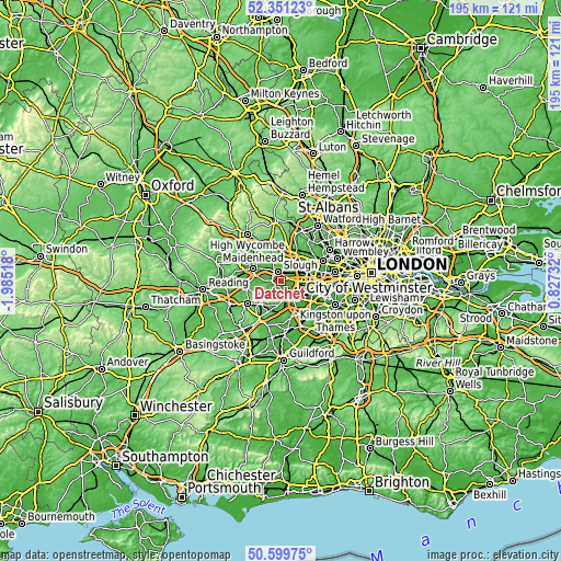
| Width | 6.09 km = 3.8 mi | 12.17 km = 7.6 mi | 194.7 km = 121 mi |
| Height | 6.09 km = 3.8 mi | 12.17 km = 7.6 mi | 194.7 km = 121 mi |
| ↑Max Latitude | 51.511258° | 51.5386° | 52.35123° |
| Latitude at center | 51.4839° | 51.4839° | 51.4839° |
| ↓Min Latitude | 51.456526° | 51.429135° | 50.59975° |
| ← Min Longitude | -0.622875° | -0.666821° | -1.98518° |
| Longitude center | -0.57893° | -0.57893° | -0.57893° |
| →Max Longitude | -0.534985° | -0.491039° | 0.82732° |
Nearby cities:
Cities around Datchet sort by population:
• Slough elevation 33 m
3.1 km,  338°
338°
• Windsor 49 m
1.5 km,  267°
267°
• Egham 20 m
6.1 km,  162°
162°
• Iver Heath 53 m
7.2 km,  35°
35°
• Iver 25 m
5.8 km,  71°
71°
• Old Windsor 19 m
2.9 km,  190°
190°
• Farnham Royal 54 m
7 km, 338°
• Colnbrook 20 m
4 km,  90°
90°
• Stoke Poges 54 m
6.8 km,  354°
354°
• Eton 23 m
2.1 km,  283°
283°
• Eton Wick 21 m
4.1 km,  291°
291°
• Horton 19 m
2.8 km,  115°
115°
Multilingual:
 En español:
Datchet elevación 20 m.
 En France:
Datchet élévation 20 m.


Sources and notes:
- [note 1] Map square and city borders are not equal. Map elevation data is calculated only from area inside that square.
- [src 1] Elevation data from geonames database provided with same terms of usage.
- [src 2] The elevation map of Datchet is generated using elevation data from NASA's 3 arcsec (90m) resolution SRTM data.
- [src 3] Base (background) map © OpenStreetMap contributors tiles are generated by Geofabrik and OpenTopoMap.
Copyright & License:
This Datchet Elevation Map is licensed under CC BY-SA. You may reuse any part from this page, if you give a proper credit by linking to this URL:
 More info on terms of use page.