Daventry elevation
Daventry (England, Northamptonshire), United Kingdom elevation is 152 meters and Daventry elevation in feet is 499 ft above sea level [src 1]. Daventry is a populated place (feature code) with elevation that is 80 meters (262 ft) bigger than average city elevation in United Kingdom.
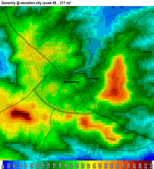
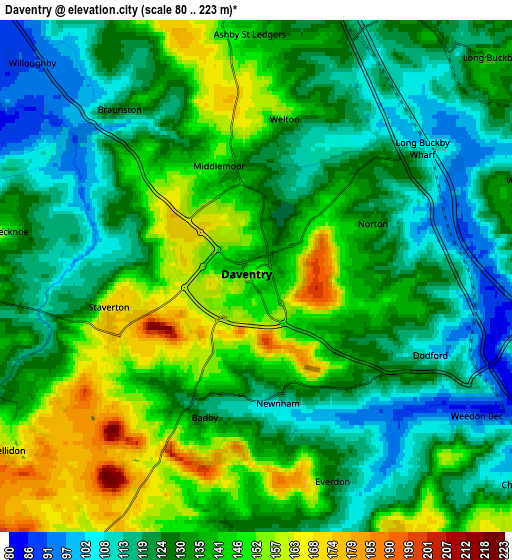
Below is the Elevation map of Daventry, which displays elevation range with different colors. Scale of the first map is from 98 to 217 m (322 to 712 ft) with average elevation of 145.6 meters (=478 ft) [note 1]
These maps also provides idea of topography and contour of this city, they are displayed at different zoom levels. More info about maps, scale and edge coordinates you can find below images.
| \ | Map #1 | Map #2 | Topo.Map |
| Scale [m] | 98..217 m | 80..223 m | × |
| Scale [ft] | 322..712 ft | 262..732 ft | × |
| Average | 145.6 m = 478 ft | 132.1 m = 433 ft | × |
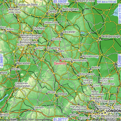
| Width | 5.98 km = 3.7 mi | 11.96 km = 7.4 mi | 191.4 km = 118.9 mi |
| Height | 5.98 km = 3.7 mi | 11.96 km = 7.4 mi | 191.4 km = 118.9 mi |
| ↑Max Latitude | 52.283772° | 52.310647° | 53.10935° |
| Latitude at center | 52.25688° | 52.25688° | 52.25688° |
| ↓Min Latitude | 52.229972° | 52.203048° | 51.38771° |
| ← Min Longitude | -1.204605° | -1.248551° | -2.56691° |
| Longitude center | -1.16066° | -1.16066° | -1.16066° |
| →Max Longitude | -1.116715° | -1.072769° | 0.24559° |
Nearby cities:
Cities around Daventry sort by population:
• Long Buckby elevation 141 m
7.4 km,  46°
46°
• Hinton 135 m
10.6 km,  201°
201°
• Weedon Beck 84 m
6.1 km,  120°
120°
• Bugbrooke 81 m
11.3 km, 117°
• Crick 135 m
10.3 km,  8°
8°
• West Haddon 164 m
11 km,  30°
30°
• Nether Heyford 79 m
9.5 km,  114°
114°
• Braunston 110 m
4.6 km,  322°
322°
• Harpole 88 m
11.8 km,  97°
97°
• Byfield 156 m
10.7 km,  212°
212°
• Kilsby 137 m
8.6 km,  353°
353°
• Flore 94 m
7.4 km, 107°
Multilingual:
 En español:
Daventry elevación 152 m.
 En France:
Daventry élévation 152 m.
 Auf Deutsch:
Daventry höhe über dem Meeresspiegel ist 152 m.

Sources and notes:
- [note 1] Map square and city borders are not equal. Map elevation data is calculated only from area inside that square.
- [src 1] Elevation data from geonames database provided with same terms of usage.
- [src 2] The elevation map of Daventry is generated using elevation data from NASA's 3 arcsec (90m) resolution SRTM data.
- [src 3] Base (background) map © OpenStreetMap contributors tiles are generated by Geofabrik and OpenTopoMap.
Copyright & License:
This Daventry Elevation Map is licensed under CC BY-SA. You may reuse any part from this page, if you give a proper credit by linking to this URL:
 More info on terms of use page.