Flore elevation
Flore (England, Northamptonshire), United Kingdom elevation is 94 meters and Flore elevation in feet is 308 ft above sea level [src 1]. Flore is a populated place (feature code) with elevation that is 22 meters (72 ft) bigger than average city elevation in United Kingdom.
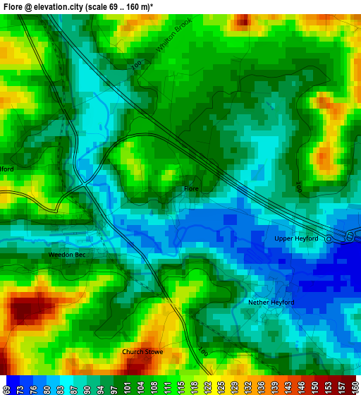
Below is the Elevation map of Flore, which displays elevation range with different colors. Scale of the first map is from 69 to 160 m (226 to 525 ft) with average elevation of 100.8 meters (=331 ft) [note 1]
These maps also provides idea of topography and contour of this city, they are displayed at different zoom levels. More info about maps, scale and edge coordinates you can find below images.
| \ | Map #1 | Topo.Map |
| Scale [m] | 69..160 m | × |
| Scale [ft] | 226..525 ft | × |
| Average | 100.8 m = 331 ft | × |
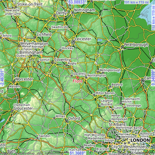
| Width | 5.98 km = 3.7 mi | 191.5 km = 119 mi |
| Height | 5.98 km = 3.7 mi | 191.5 km = 119 mi |
| ↑Max Latitude | 52.263374° | 53.08933° |
| Latitude at center | 52.23647° | 52.23647° |
| ↓Min Latitude | 52.20955° | 51.3669° |
| ← Min Longitude | -1.101205° | -2.46351° |
| Longitude center | -1.05726° | -1.05726° |
| →Max Longitude | -1.013315° | 0.34899° |
Nearby cities:
Cities around Flore sort by population:
• Northampton elevation 97 m
11.9 km,  82°
82°
• Daventry 152 m
7.4 km,  287°
287°
• Hardingstone 106 m
12 km,  102°
102°
• Long Buckby 141 m
7.5 km,  347°
347°
• Weedon Beck 84 m
2 km,  246°
246°
• Bugbrooke 81 m
4.2 km,  134°
134°
• West Haddon 164 m
11.8 km, 353°
• Nether Heyford 79 m
2.3 km,  137°
137°
• Blisworth 97 m
10.4 km, 130°
• Braunston 110 m
11.5 km,  300°
300°
• Harpole 88 m
4.7 km, 81°
• Kislingbury 69 m
5.4 km, 97°
Multilingual:
 En español:
Flore elevación 94 m.
 En France:
Flore élévation 94 m.


Sources and notes:
- [note 1] Map square and city borders are not equal. Map elevation data is calculated only from area inside that square.
- [src 1] Elevation data from geonames database provided with same terms of usage.
- [src 2] The elevation map of Flore is generated using elevation data from NASA's 3 arcsec (90m) resolution SRTM data.
- [src 3] Base (background) map © OpenStreetMap contributors tiles are generated by Geofabrik and OpenTopoMap.
Copyright & License:
This Flore Elevation Map is licensed under CC BY-SA. You may reuse any part from this page, if you give a proper credit by linking to this URL:
 More info on terms of use page.