Eglinton elevation
Eglinton (Northern Ireland, Derry City and Strabane), United Kingdom elevation is 26 meters and Eglinton elevation in feet is 85 ft above sea level [src 1]. Eglinton is a populated place (feature code) with elevation that is 46 meters (151 ft) smaller than average city elevation in United Kingdom.
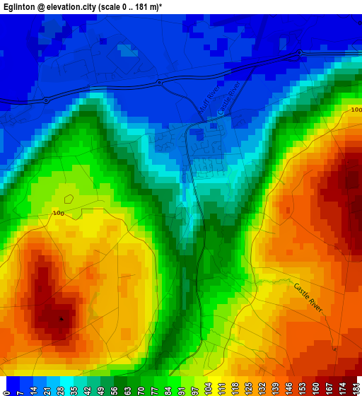
Below is the Elevation map of Eglinton, which displays elevation range with different colors. Scale of the first map is from 0 to 181 m (0 to 594 ft) with average elevation of 74.9 meters (=246 ft) [note 1]
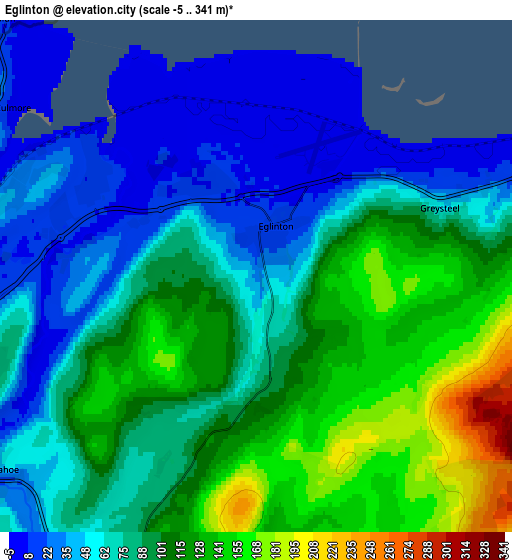
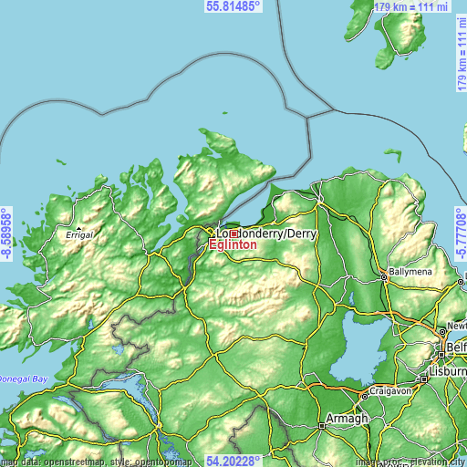
These maps also provides idea of topography and contour of this city, they are displayed at different zoom levels. More info about maps, scale and edge coordinates you can find below images.
| \ | Map #1 | Map #2 | Topo.Map |
| Scale [m] | 0..181 m | -5..341 m | × |
| Scale [ft] | 0..594 ft | -16..1119 ft | × |
| Average | 74.9 m = 246 ft | 85.7 m = 281 ft | × |
| Width | 5.6 km = 3.5 mi | 11.21 km = 7 mi | 179.3 km = 111.4 mi |
| Height | 5.6 km = 3.5 mi | 11.21 km = 7 mi | 179.3 km = 111.4 mi |
| ↑Max Latitude | 55.041858° | 55.067029° | 55.81485° |
| Latitude at center | 55.01667° | 55.01667° | 55.01667° |
| ↓Min Latitude | 54.991467° | 54.966247° | 54.20228° |
| ← Min Longitude | -7.227275° | -7.271221° | -8.58958° |
| Longitude center | -7.18333° | -7.18333° | -7.18333° |
| →Max Longitude | -7.139385° | -7.095439° | -5.77708° |
Nearby cities:
Cities around Eglinton sort by population:
• Londonderry County Borough elevation 24 m
8.3 km,  254°
254°
• Derry 24 m
8.3 km,  255°
255°
• Coleraine 5 m
35.4 km,  68°
68°
• Strabane 7 m
28.2 km,  220°
220°
• Limavady 20 m
15.3 km,  75°
75°
• Portstewart 26 m
35 km,  58°
58°
• Culmore 5 m
6.5 km,  304°
304°
• Dungiven 75 m
19.4 km,  118°
118°
• Sion Mills 30 m
31.5 km, 215°
• Ballykelly 22 m
10.9 km, 73°
• Castlerock 54 m
29.5 km, 59°
• Garvagh 66 m
33.2 km,  96°
96°
Multilingual:
 En español:
Eglinton elevación 26 m.
 En France:
Eglinton élévation 26 m.


Sources and notes:
- [note 1] Map square and city borders are not equal. Map elevation data is calculated only from area inside that square.
- [src 1] Elevation data from geonames database provided with same terms of usage.
- [src 2] The elevation map of Eglinton is generated using elevation data from NASA's 3 arcsec (90m) resolution SRTM data.
- [src 3] Base (background) map © OpenStreetMap contributors tiles are generated by Geofabrik and OpenTopoMap.
Copyright & License:
This Eglinton Elevation Map is licensed under CC BY-SA. You may reuse any part from this page, if you give a proper credit by linking to this URL:
 More info on terms of use page.