Falkirk elevation
Falkirk (Scotland), United Kingdom elevation is 25 meters and Falkirk elevation in feet is 82 ft above sea level [src 1]. Falkirk is a seat of a second-order administrative division (feature code) with elevation that is 47 meters (154 ft) smaller than average city elevation in United Kingdom.
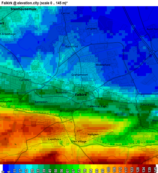
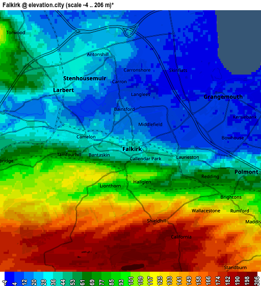
Below is the Elevation map of Falkirk, which displays elevation range with different colors. Scale of the first map is from 0 to 145 m (0 to 476 ft) with average elevation of 45.2 meters (=148 ft) [note 1]
These maps also provides idea of topography and contour of this city, they are displayed at different zoom levels. More info about maps, scale and edge coordinates you can find below images.
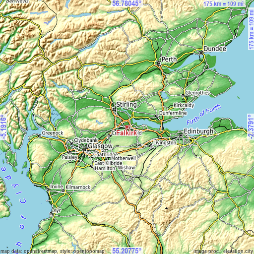
| \ | Map #1 | Map #2 | Topo.Map |
| Scale [m] | 0..145 m | -4..206 m | × |
| Scale [ft] | 0..476 ft | -13..676 ft | × |
| Average | 45.2 m = 148 ft | 73.7 m = 242 ft | × |
| Width | 5.46 km = 3.4 mi | 10.93 km = 6.8 mi | 174.9 km = 108.7 mi |
| Height | 5.46 km = 3.4 mi | 10.93 km = 6.8 mi | 174.8 km = 108.6 mi |
| ↑Max Latitude | 56.026665° | 56.051214° | 56.78045° |
| Latitude at center | 56.0021° | 56.0021° | 56.0021° |
| ↓Min Latitude | 55.97752° | 55.952924° | 55.20775° |
| ← Min Longitude | -3.829295° | -3.873241° | -5.1916° |
| Longitude center | -3.78535° | -3.78535° | -3.78535° |
| →Max Longitude | -3.741405° | -3.697459° | -2.3791° |
Nearby cities:
Cities around Falkirk sort by population:
• Grangemouth elevation 6 m
4.1 km,  75°
75°
• Stenhousemuir 28 m
3.3 km,  326°
326°
• Larbert 34 m
3.5 km,  310°
310°
• Brightons 101 m
4.9 km,  119°
119°
• Hallglen 103 m
1.8 km,  180°
180°
• Carronshore 9 m
3.3 km,  2°
2°
• Laurieston 41 m
2.4 km,  107°
107°
• Redding 72 m
3.6 km, 114°
• Carron 8 m
2.7 km,  350°
350°
• Shieldhill 166 m
3.4 km,  161°
161°
• Reddingmuirhead 117 m
3.3 km,  136°
136°
• Westquarter 41 m
3.1 km, 112°
Multilingual:
 En español:
Falkirk elevación 25 m.
 En France:
Falkirk élévation 25 m.


Sources and notes:
- [note 1] Map square and city borders are not equal. Map elevation data is calculated only from area inside that square.
- [src 1] Elevation data from geonames database provided with same terms of usage.
- [src 2] The elevation map of Falkirk is generated using elevation data from NASA's 3 arcsec (90m) resolution SRTM data.
- [src 3] Base (background) map © OpenStreetMap contributors tiles are generated by Geofabrik and OpenTopoMap.
Copyright & License:
This Falkirk Elevation Map is licensed under CC BY-SA. You may reuse any part from this page, if you give a proper credit by linking to this URL:
 More info on terms of use page.