Fordingbridge elevation
Fordingbridge (England, Hampshire), United Kingdom elevation is 27 meters and Fordingbridge elevation in feet is 89 ft above sea level [src 1]. Fordingbridge is a populated place (feature code) with elevation that is 45 meters (148 ft) smaller than average city elevation in United Kingdom.
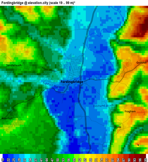
Below is the Elevation map of Fordingbridge, which displays elevation range with different colors. Scale of the first map is from 19 to 99 m (62 to 325 ft) with average elevation of 44.8 meters (=147 ft) [note 1]
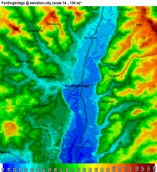
These maps also provides idea of topography and contour of this city, they are displayed at different zoom levels. More info about maps, scale and edge coordinates you can find below images.
| \ | Map #1 | Map #2 | Topo.Map |
| Scale [m] | 19..99 m | 14..136 m | × |
| Scale [ft] | 62..325 ft | 46..446 ft | × |
| Average | 44.8 m = 147 ft | 59.2 m = 194 ft | × |
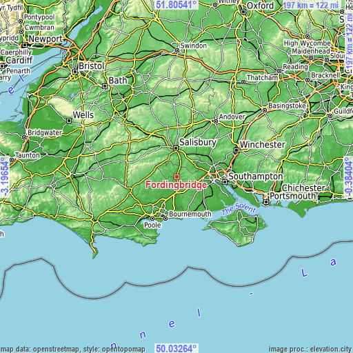
| Width | 6.16 km = 3.8 mi | 12.32 km = 7.7 mi | 197.1 km = 122.5 mi |
| Height | 6.16 km = 3.8 mi | 12.32 km = 7.7 mi | 197.1 km = 122.5 mi |
| ↑Max Latitude | 50.955161° | 50.982835° | 51.80541° |
| Latitude at center | 50.92747° | 50.92747° | 50.92747° |
| ↓Min Latitude | 50.899763° | 50.872039° | 50.03264° |
| ← Min Longitude | -1.834235° | -1.878181° | -3.19654° |
| Longitude center | -1.79029° | -1.79029° | -1.79029° |
| →Max Longitude | -1.746345° | -1.702399° | -0.38404° |
Nearby cities:
Cities around Fordingbridge sort by population:
• Ringwood elevation 16 m
9.1 km,  179°
179°
• Verwood 33 m
8 km,  224°
224°
• St Leonards 18 m
11.4 km,  199°
199°
• Alderholt 51 m
3.3 km,  238°
238°
• Downton 35 m
7.9 km,  20°
20°
• Alderbury 94 m
13.5 km, 17°
• Cadnam 30 m
14.8 km,  93°
93°
• Three Legged Cross 29 m
10.8 km, 217°
• Burley 55 m
12.8 km,  150°
150°
• Whiteparish 74 m
13.5 km,  47°
47°
• Bower Chalke 208 m
14.8 km,  303°
303°
• Bishopstone 70 m
13.9 km,  325°
325°
Multilingual:
 En español:
Fordingbridge elevación 27 m.
 En France:
Fordingbridge élévation 27 m.
 Auf Deutsch:
Fordingbridge höhe über dem Meeresspiegel ist 27 m.

Sources and notes:
- [note 1] Map square and city borders are not equal. Map elevation data is calculated only from area inside that square.
- [src 1] Elevation data from geonames database provided with same terms of usage.
- [src 2] The elevation map of Fordingbridge is generated using elevation data from NASA's 3 arcsec (90m) resolution SRTM data.
- [src 3] Base (background) map © OpenStreetMap contributors tiles are generated by Geofabrik and OpenTopoMap.
Copyright & License:
This Fordingbridge Elevation Map is licensed under CC BY-SA. You may reuse any part from this page, if you give a proper credit by linking to this URL:
 More info on terms of use page.