Hailsham elevation
Hailsham (England, East Sussex), United Kingdom elevation is 28 meters and Hailsham elevation in feet is 92 ft above sea level [src 1]. Hailsham is a populated place (feature code) with elevation that is 44 meters (144 ft) smaller than average city elevation in United Kingdom.
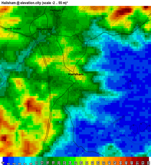
Below is the Elevation map of Hailsham, which displays elevation range with different colors. Scale of the first map is from -2 to 55 m (-7 to 180 ft) with average elevation of 16.3 meters (=53 ft) [note 1]
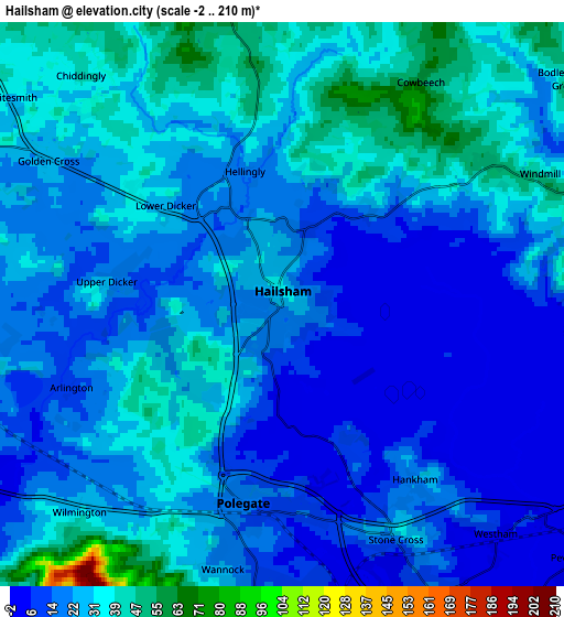
These maps also provides idea of topography and contour of this city, they are displayed at different zoom levels. More info about maps, scale and edge coordinates you can find below images.
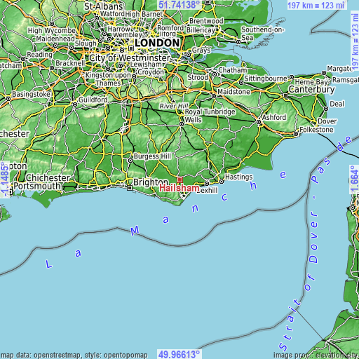
| \ | Map #1 | Map #2 | Topo.Map |
| Scale [m] | -2..55 m | -2..210 m | × |
| Scale [ft] | -7..180 ft | -7..689 ft | × |
| Average | 16.3 m = 53 ft | 23.4 m = 77 ft | × |
| Width | 6.17 km = 3.8 mi | 12.34 km = 7.7 mi | 197.4 km = 122.7 mi |
| Height | 6.17 km = 3.8 mi | 12.34 km = 7.7 mi | 197.4 km = 122.7 mi |
| ↑Max Latitude | 50.889929° | 50.917642° | 51.74138° |
| Latitude at center | 50.8622° | 50.8622° | 50.8622° |
| ↓Min Latitude | 50.834454° | 50.806692° | 49.96613° |
| ← Min Longitude | 0.213805° | 0.169859° | -1.1485° |
| Longitude center | 0.25775° | 0.25775° | 0.25775° |
| →Max Longitude | 0.301695° | 0.345641° | 1.664° |
Nearby cities:
Cities around Hailsham sort by population:
• Eastbourne elevation 8 m
10.6 km,  169°
169°
• Bexhill-on-Sea 15 m
15 km,  95°
95°
• Seaford 10 m
14.9 km,  227°
227°
• Ringmer 28 m
14.6 km,  283°
283°
• Pevensey 3 m
7.4 km,  129°
129°
• Pevensey Bay 3 m
8.4 km, 130°
• Horam 70 m
8.2 km,  353°
353°
• Friston 113 m
11.7 km,  200°
200°
• Bodle Street 54 m
8.2 km,  46°
46°
• Ninfield 75 m
12.1 km,  77°
77°
• Herstmonceux 50 m
5.5 km,  56°
56°
• Heathfield 148 m
11.7 km,  359°
359°
Multilingual:
 En español:
Hailsham elevación 28 m.
 En France:
Hailsham élévation 28 m.


Sources and notes:
- [note 1] Map square and city borders are not equal. Map elevation data is calculated only from area inside that square.
- [src 1] Elevation data from geonames database provided with same terms of usage.
- [src 2] The elevation map of Hailsham is generated using elevation data from NASA's 3 arcsec (90m) resolution SRTM data.
- [src 3] Base (background) map © OpenStreetMap contributors tiles are generated by Geofabrik and OpenTopoMap.
Copyright & License:
This Hailsham Elevation Map is licensed under CC BY-SA. You may reuse any part from this page, if you give a proper credit by linking to this URL:
 More info on terms of use page.