Kidlington elevation
Kidlington (England, Oxfordshire), United Kingdom elevation is 64 meters and Kidlington elevation in feet is 210 ft above sea level [src 1]. Kidlington is a populated place (feature code) with elevation that is 8 meters (26 ft) smaller than average city elevation in United Kingdom.
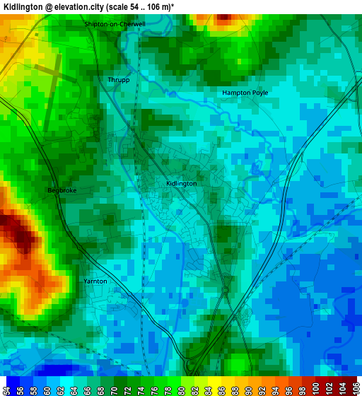
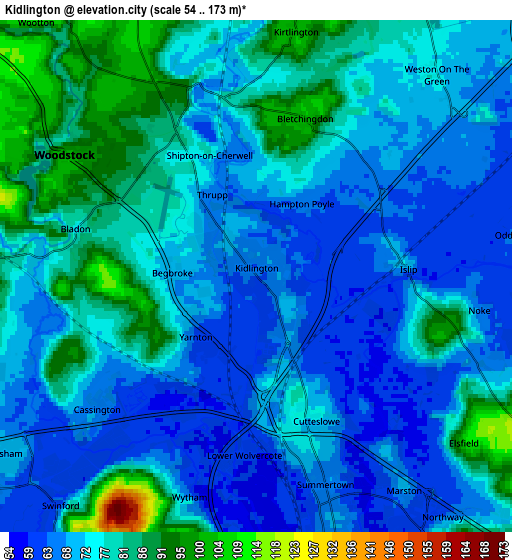
Below is the Elevation map of Kidlington, which displays elevation range with different colors. Scale of the first map is from 54 to 106 m (177 to 348 ft) with average elevation of 67.5 meters (=221 ft) [note 1]
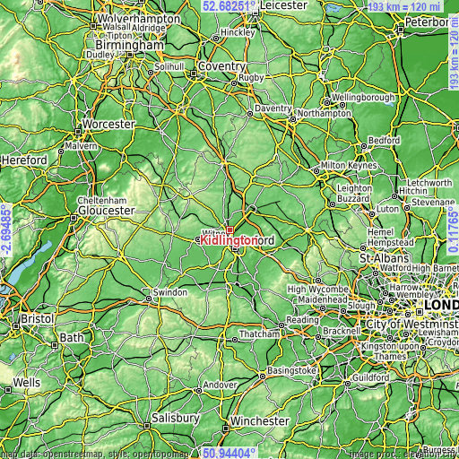
These maps also provides idea of topography and contour of this city, they are displayed at different zoom levels. More info about maps, scale and edge coordinates you can find below images.
| \ | Map #1 | Map #2 | Topo.Map |
| Scale [m] | 54..106 m | 54..173 m | × |
| Scale [ft] | 177..348 ft | 177..568 ft | × |
| Average | 67.5 m = 221 ft | 74.1 m = 243 ft | × |
| Width | 6.04 km = 3.8 mi | 12.08 km = 7.5 mi | 193.3 km = 120.1 mi |
| Height | 6.04 km = 3.8 mi | 12.08 km = 7.5 mi | 193.3 km = 120.1 mi |
| ↑Max Latitude | 51.848815° | 51.875953° | 52.68251° |
| Latitude at center | 51.82166° | 51.82166° | 51.82166° |
| ↓Min Latitude | 51.794489° | 51.767301° | 50.94404° |
| ← Min Longitude | -1.332545° | -1.376491° | -2.69485° |
| Longitude center | -1.2886° | -1.2886° | -1.2886° |
| →Max Longitude | -1.244655° | -1.200709° | 0.11765° |
Nearby cities:
Cities around Kidlington sort by population:
• Oxford elevation 72 m
8 km,  163°
163°
• Bicester 75 m
12.7 km,  46°
46°
• Cowley 75 m
11.5 km,  150°
150°
• Wheatley 79 m
13.2 km,  128°
128°
• Eynsham 70 m
7.5 km,  232°
232°
• Yarnton 63 m
2.5 km,  219°
219°
• Woodstock 97 m
5.2 km,  304°
304°
• Ambrosden 68 m
12.7 km,  64°
64°
• North Leigh 139 m
10.5 km,  265°
265°
• Stonesfield 122 m
10.2 km,  288°
288°
• Wolvercote 60 m
4.2 km,  184°
184°
• Standlake 68 m
14.1 km, 221°
Multilingual:
 En español:
Kidlington elevación 64 m.
 En France:
Kidlington élévation 64 m.
 Auf Deutsch:
Kidlington höhe über dem Meeresspiegel ist 64 m.

Sources and notes:
- [note 1] Map square and city borders are not equal. Map elevation data is calculated only from area inside that square.
- [src 1] Elevation data from geonames database provided with same terms of usage.
- [src 2] The elevation map of Kidlington is generated using elevation data from NASA's 3 arcsec (90m) resolution SRTM data.
- [src 3] Base (background) map © OpenStreetMap contributors tiles are generated by Geofabrik and OpenTopoMap.
Copyright & License:
This Kidlington Elevation Map is licensed under CC BY-SA. You may reuse any part from this page, if you give a proper credit by linking to this URL:
 More info on terms of use page.