Kingsclere elevation
Kingsclere (England, Hampshire), United Kingdom elevation is 109 meters and Kingsclere elevation in feet is 358 ft above sea level [src 1]. Kingsclere is a populated place (feature code) with elevation that is 37 meters (121 ft) bigger than average city elevation in United Kingdom.
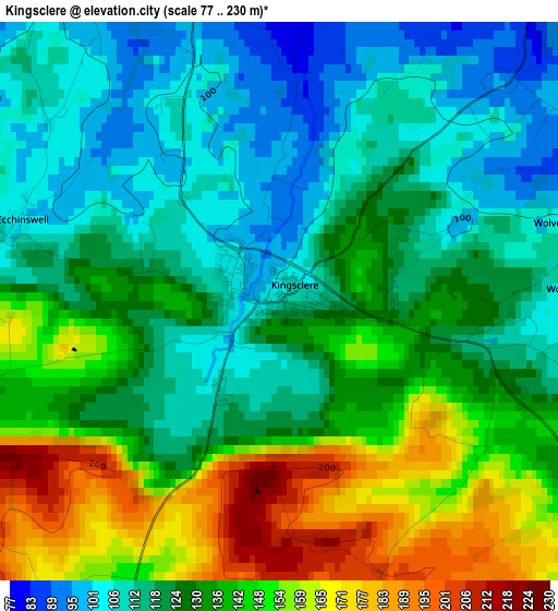
Below is the Elevation map of Kingsclere, which displays elevation range with different colors. Scale of the first map is from 77 to 230 m (253 to 755 ft) with average elevation of 130.3 meters (=427 ft) [note 1]
These maps also provides idea of topography and contour of this city, they are displayed at different zoom levels. More info about maps, scale and edge coordinates you can find below images.
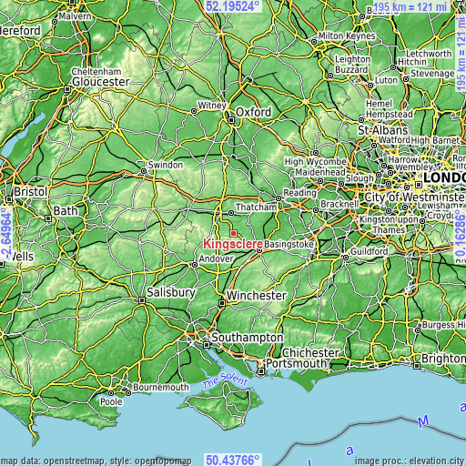
| \ | Map #1 | Topo.Map |
| Scale [m] | 77..230 m | × |
| Scale [ft] | 253..755 ft | × |
| Average | 130.3 m = 427 ft | × |
| Width | 6.11 km = 3.8 mi | 195.4 km = 121.4 mi |
| Height | 6.11 km = 3.8 mi | 195.4 km = 121.4 mi |
| ↑Max Latitude | 51.352323° | 52.19524° |
| Latitude at center | 51.32487° | 51.32487° |
| ↓Min Latitude | 51.2974° | 50.43766° |
| ← Min Longitude | -1.287335° | -2.64964° |
| Longitude center | -1.24339° | -1.24339° |
| →Max Longitude | -1.199445° | 0.16286° |
Nearby cities:
Cities around Kingsclere sort by population:
• Basingstoke elevation 96 m
12.9 km,  122°
122°
• Newbury 78 m
10.2 km,  326°
326°
• Thatcham 78 m
8.8 km,  352°
352°
• Tadley 84 m
8.5 km,  70°
70°
• Bramley 60 m
12.8 km,  89°
89°
• Overton 87 m
9.1 km,  187°
187°
• Highclere 135 m
9.3 km,  279°
279°
• Cold Ash 139 m
11.1 km, 352°
• Winterbourne 97 m
15.3 km, 332°
• Hermitage 121 m
14.6 km, 353°
• Sherborne St John 82 m
9.5 km,  108°
108°
• Greenham 121 m
8.4 km, 325°
Multilingual:
 En español:
Kingsclere elevación 109 m.
 En France:
Kingsclere élévation 109 m.
 Auf Deutsch:
Kingsclere höhe über dem Meeresspiegel ist 109 m.

Sources and notes:
- [note 1] Map square and city borders are not equal. Map elevation data is calculated only from area inside that square.
- [src 1] Elevation data from geonames database provided with same terms of usage.
- [src 2] The elevation map of Kingsclere is generated using elevation data from NASA's 3 arcsec (90m) resolution SRTM data.
- [src 3] Base (background) map © OpenStreetMap contributors tiles are generated by Geofabrik and OpenTopoMap.
Copyright & License:
This Kingsclere Elevation Map is licensed under CC BY-SA. You may reuse any part from this page, if you give a proper credit by linking to this URL:
 More info on terms of use page.