Tadley elevation
Tadley (England, Hampshire), United Kingdom elevation is 84 meters and Tadley elevation in feet is 276 ft above sea level [src 1]. Tadley is a populated place (feature code) with elevation that is 12 meters (39 ft) bigger than average city elevation in United Kingdom.
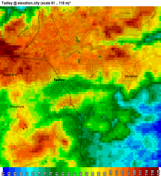
Below is the Elevation map of Tadley, which displays elevation range with different colors. Scale of the first map is from 61 to 118 m (200 to 387 ft) with average elevation of 92.5 meters (=303 ft) [note 1]
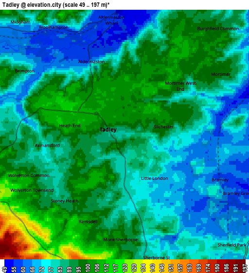
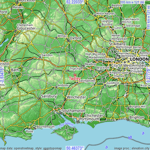
These maps also provides idea of topography and contour of this city, they are displayed at different zoom levels. More info about maps, scale and edge coordinates you can find below images.
| \ | Map #1 | Map #2 | Topo.Map |
| Scale [m] | 61..118 m | 49..197 m | × |
| Scale [ft] | 200..387 ft | 161..646 ft | × |
| Average | 92.5 m = 303 ft | 87.1 m = 286 ft | × |
| Width | 6.1 km = 3.8 mi | 12.21 km = 7.6 mi | 195.3 km = 121.4 mi |
| Height | 6.1 km = 3.8 mi | 12.21 km = 7.6 mi | 195.3 km = 121.4 mi |
| ↑Max Latitude | 51.377888° | 51.40531° | 52.22033° |
| Latitude at center | 51.35045° | 51.35045° | 51.35045° |
| ↓Min Latitude | 51.322996° | 51.295525° | 50.46373° |
| ← Min Longitude | -1.172445° | -1.216391° | -2.53475° |
| Longitude center | -1.1285° | -1.1285° | -1.1285° |
| →Max Longitude | -1.084555° | -1.040609° | 0.27775° |
Nearby cities:
Cities around Tadley sort by population:
• Basingstoke elevation 96 m
10.2 km,  163°
163°
• Thatcham 78 m
10.9 km,  302°
302°
• Calcot 53 m
11.4 km,  28°
28°
• Bramley 60 m
5.5 km,  118°
118°
• Old Basing 79 m
11.4 km,  144°
144°
• Stratfield Mortimer 51 m
7 km,  68°
68°
• Kingsclere 109 m
8.5 km,  250°
250°
• Theale 47 m
10.3 km,  20°
20°
• Cold Ash 139 m
12.5 km,  310°
310°
• Sherborne St John 82 m
6 km,  170°
170°
• Bradfield 69 m
11 km,  359°
359°
• Swallowfield 44 m
12.2 km,  75°
75°
Multilingual:
 En español:
Tadley elevación 84 m.
 En France:
Tadley élévation 84 m.


Sources and notes:
- [note 1] Map square and city borders are not equal. Map elevation data is calculated only from area inside that square.
- [src 1] Elevation data from geonames database provided with same terms of usage.
- [src 2] The elevation map of Tadley is generated using elevation data from NASA's 3 arcsec (90m) resolution SRTM data.
- [src 3] Base (background) map © OpenStreetMap contributors tiles are generated by Geofabrik and OpenTopoMap.
Copyright & License:
This Tadley Elevation Map is licensed under CC BY-SA. You may reuse any part from this page, if you give a proper credit by linking to this URL:
 More info on terms of use page.