Kirkcaldy elevation
Kirkcaldy (Scotland, Fife), United Kingdom elevation is 39 meters and Kirkcaldy elevation in feet is 128 ft above sea level [src 1]. Kirkcaldy is a populated place (feature code) with elevation that is 33 meters (108 ft) smaller than average city elevation in United Kingdom.
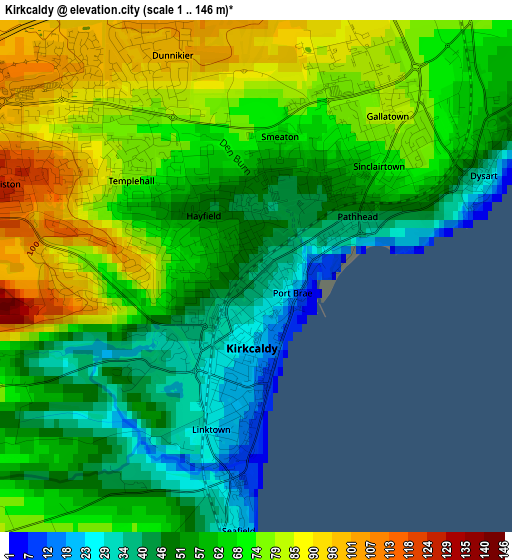
Below is the Elevation map of Kirkcaldy, which displays elevation range with different colors. Scale of the first map is from 1 to 146 m (3 to 479 ft) with average elevation of 63.9 meters (=210 ft) [note 1]
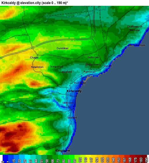
These maps also provides idea of topography and contour of this city, they are displayed at different zoom levels. More info about maps, scale and edge coordinates you can find below images.
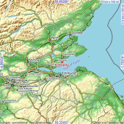
| \ | Map #1 | Map #2 | Topo.Map |
| Scale [m] | 1..146 m | 0..190 m | × |
| Scale [ft] | 3..479 ft | 0..623 ft | × |
| Average | 63.9 m = 210 ft | 78.7 m = 258 ft | × |
| Width | 5.45 km = 3.4 mi | 10.9 km = 6.8 mi | 174.3 km = 108.3 mi |
| Height | 5.45 km = 3.4 mi | 10.9 km = 6.8 mi | 174.3 km = 108.3 mi |
| ↑Max Latitude | 56.141322° | 56.165798° | 56.89286° |
| Latitude at center | 56.11683° | 56.11683° | 56.11683° |
| ↓Min Latitude | 56.092323° | 56.0678° | 55.32483° |
| ← Min Longitude | -3.203935° | -3.247881° | -4.56624° |
| Longitude center | -3.15999° | -3.15999° | -3.15999° |
| →Max Longitude | -3.116045° | -3.072099° | -1.75374° |
Nearby cities:
Cities around Kirkcaldy sort by population:
• Glenrothes elevation 92 m
8.7 km,  354°
354°
• Lochgelly 143 m
9.4 km,  277°
277°
• Burntisland 13 m
7.5 km,  216°
216°
• Cardenden 71 m
6.7 km,  295°
295°
• Buckhaven 28 m
9.9 km,  52°
52°
• Leslie 128 m
9.9 km,  339°
339°
• Kinghorn 33 m
5.4 km,  190°
190°
• Markinch 69 m
9.6 km,  9°
9°
• Thornton 56 m
5.6 km, 6°
• East Wemyss 16 m
7.6 km, 50°
• Kinglassie 77 m
8.1 km,  321°
321°
• Coaltown of Balgonie 80 m
7.8 km,  15°
15°
Multilingual:
 En español:
Kirkcaldy elevación 39 m.
 En France:
Kirkcaldy élévation 39 m.
 Auf Deutsch:
Kirkcaldy höhe über dem Meeresspiegel ist 39 m.

Sources and notes:
- [note 1] Map square and city borders are not equal. Map elevation data is calculated only from area inside that square.
- [src 1] Elevation data from geonames database provided with same terms of usage.
- [src 2] The elevation map of Kirkcaldy is generated using elevation data from NASA's 3 arcsec (90m) resolution SRTM data.
- [src 3] Base (background) map © OpenStreetMap contributors tiles are generated by Geofabrik and OpenTopoMap.
Copyright & License:
This Kirkcaldy Elevation Map is licensed under CC BY-SA. You may reuse any part from this page, if you give a proper credit by linking to this URL:
 More info on terms of use page.