Glenrothes elevation
Glenrothes (Scotland, Fife), United Kingdom elevation is 92 meters and Glenrothes elevation in feet is 302 ft above sea level [src 1]. Glenrothes is a seat of a second-order administrative division (feature code) with elevation that is 20 meters (66 ft) bigger than average city elevation in United Kingdom.
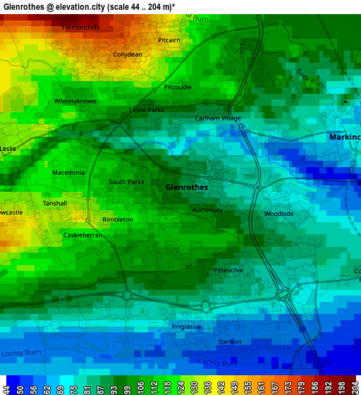
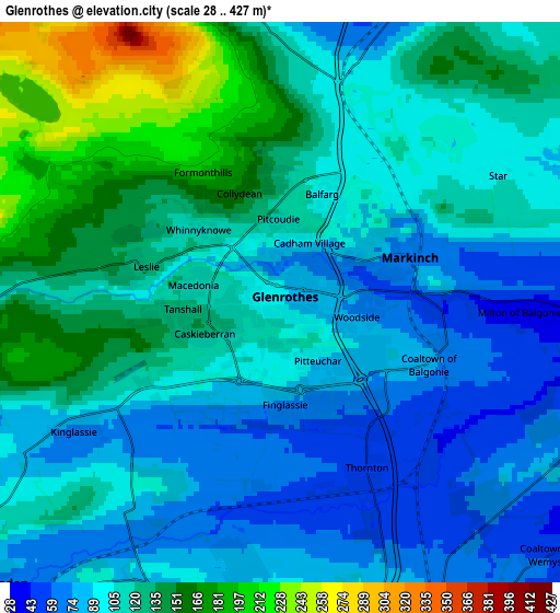
Below is the Elevation map of Glenrothes, which displays elevation range with different colors. Scale of the first map is from 44 to 204 m (144 to 669 ft) with average elevation of 95 meters (=312 ft) [note 1]
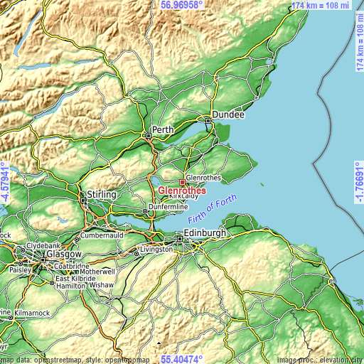
These maps also provides idea of topography and contour of this city, they are displayed at different zoom levels. More info about maps, scale and edge coordinates you can find below images.
| \ | Map #1 | Map #2 | Topo.Map |
| Scale [m] | 44..204 m | 28..427 m | × |
| Scale [ft] | 144..669 ft | 92..1401 ft | × |
| Average | 95 m = 312 ft | 112.2 m = 368 ft | × |
| Width | 5.44 km = 3.4 mi | 10.87 km = 6.8 mi | 174 km = 108.1 mi |
| Height | 5.44 km = 3.4 mi | 10.87 km = 6.8 mi | 174 km = 108.1 mi |
| ↑Max Latitude | 56.219582° | 56.244008° | 56.96958° |
| Latitude at center | 56.19514° | 56.19514° | 56.19514° |
| ↓Min Latitude | 56.170683° | 56.146209° | 55.40474° |
| ← Min Longitude | -3.217105° | -3.261051° | -4.57941° |
| Longitude center | -3.17316° | -3.17316° | -3.17316° |
| →Max Longitude | -3.129215° | -3.085269° | -1.76691° |
Nearby cities:
Cities around Glenrothes sort by population:
• Cardenden elevation 71 m
7.8 km,  221°
221°
• Kennoway 75 m
7.9 km,  77°
77°
• Leslie 128 m
2.7 km,  281°
281°
• Markinch 69 m
2.5 km,  71°
71°
• Thornton 56 m
3.5 km,  155°
155°
• East Wemyss 16 m
7.8 km,  119°
119°
• Windygates 38 m
7.4 km,  89°
89°
• Kinglassie 77 m
4.9 km,  240°
240°
• Freuchie 61 m
5.8 km,  8°
8°
• Falkland 71 m
6.7 km,  343°
343°
• Coaltown of Balgonie 80 m
3.2 km,  111°
111°
• Kingskettle 42 m
8.2 km,  25°
25°
Multilingual:
 En español:
Glenrothes elevación 92 m.
 En France:
Glenrothes élévation 92 m.
 Auf Deutsch:
Glenrothes höhe über dem Meeresspiegel ist 92 m.

Sources and notes:
- [note 1] Map square and city borders are not equal. Map elevation data is calculated only from area inside that square.
- [src 1] Elevation data from geonames database provided with same terms of usage.
- [src 2] The elevation map of Glenrothes is generated using elevation data from NASA's 3 arcsec (90m) resolution SRTM data.
- [src 3] Base (background) map © OpenStreetMap contributors tiles are generated by Geofabrik and OpenTopoMap.
Copyright & License:
This Glenrothes Elevation Map is licensed under CC BY-SA. You may reuse any part from this page, if you give a proper credit by linking to this URL:
 More info on terms of use page.