Lanark elevation
Lanark (Scotland, South Lanarkshire), United Kingdom elevation is 199 meters and Lanark elevation in feet is 653 ft above sea level [src 1]. Lanark is a populated place (feature code) with elevation that is 127 meters (417 ft) bigger than average city elevation in United Kingdom.
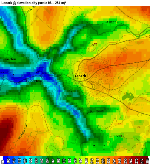
Below is the Elevation map of Lanark, which displays elevation range with different colors. Scale of the first map is from 96 to 284 m (315 to 932 ft) with average elevation of 193.2 meters (=634 ft) [note 1]
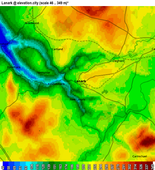
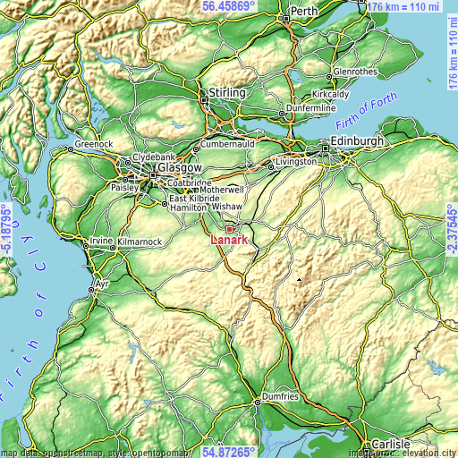
These maps also provides idea of topography and contour of this city, they are displayed at different zoom levels. More info about maps, scale and edge coordinates you can find below images.
| \ | Map #1 | Map #2 | Topo.Map |
| Scale [m] | 96..284 m | 46..349 m | × |
| Scale [ft] | 315..932 ft | 151..1145 ft | × |
| Average | 193.2 m = 634 ft | 208.5 m = 684 ft | × |
| Width | 5.51 km = 3.4 mi | 11.02 km = 6.8 mi | 176.4 km = 109.6 mi |
| Height | 5.51 km = 3.4 mi | 11.02 km = 6.8 mi | 176.3 km = 109.5 mi |
| ↑Max Latitude | 55.698483° | 55.723241° | 56.45869° |
| Latitude at center | 55.67371° | 55.67371° | 55.67371° |
| ↓Min Latitude | 55.648921° | 55.624117° | 54.87265° |
| ← Min Longitude | -3.825645° | -3.869591° | -5.18795° |
| Longitude center | -3.7817° | -3.7817° | -3.7817° |
| →Max Longitude | -3.737755° | -3.693809° | -2.37545° |
Nearby cities:
Cities around Lanark sort by population:
• Dalserf elevation 54 m
10.7 km,  308°
308°
• Larkhall 117 m
13.4 km,  299°
299°
• Carluke 210 m
7.6 km,  336°
336°
• Stonehouse 153 m
13.1 km,  280°
280°
• Lesmahagow 176 m
7.8 km,  238°
238°
• Law 170 m
10.6 km,  323°
323°
• Forth 281 m
11.7 km,  29°
29°
• Overtown 138 m
12.5 km, 317°
• Blackwood 175 m
8.5 km,  264°
264°
• Ashgill 103 m
11.3 km, 304°
• Carnwath 218 m
10.2 km,  73°
73°
• Coalburn 236 m
11.1 km,  216°
216°
Multilingual:
 En español:
Lanark elevación 199 m.
 En France:
Lanark élévation 199 m.


Sources and notes:
- [note 1] Map square and city borders are not equal. Map elevation data is calculated only from area inside that square.
- [src 1] Elevation data from geonames database provided with same terms of usage.
- [src 2] The elevation map of Lanark is generated using elevation data from NASA's 3 arcsec (90m) resolution SRTM data.
- [src 3] Base (background) map © OpenStreetMap contributors tiles are generated by Geofabrik and OpenTopoMap.
Copyright & License:
This Lanark Elevation Map is licensed under CC BY-SA. You may reuse any part from this page, if you give a proper credit by linking to this URL:
 More info on terms of use page.