Leven elevation
Leven (Scotland, Fife), United Kingdom elevation is 13 meters and Leven elevation in feet is 43 ft above sea level [src 1]. Leven is a populated place (feature code) with elevation that is 59 meters (194 ft) smaller than average city elevation in United Kingdom.
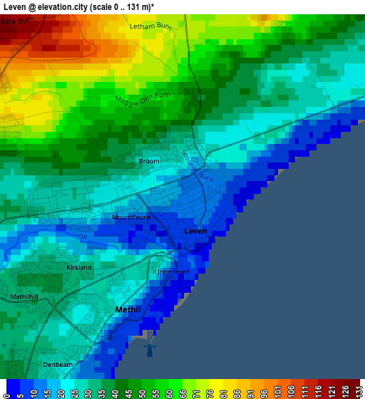
Below is the Elevation map of Leven, which displays elevation range with different colors. Scale of the first map is from 0 to 131 m (0 to 430 ft) with average elevation of 39.7 meters (=130 ft) [note 1]
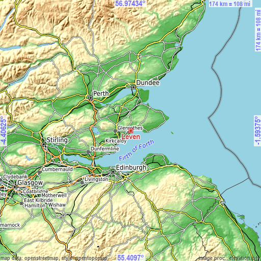
These maps also provides idea of topography and contour of this city, they are displayed at different zoom levels. More info about maps, scale and edge coordinates you can find below images.
| \ | Map #1 | Map #2 | Topo.Map |
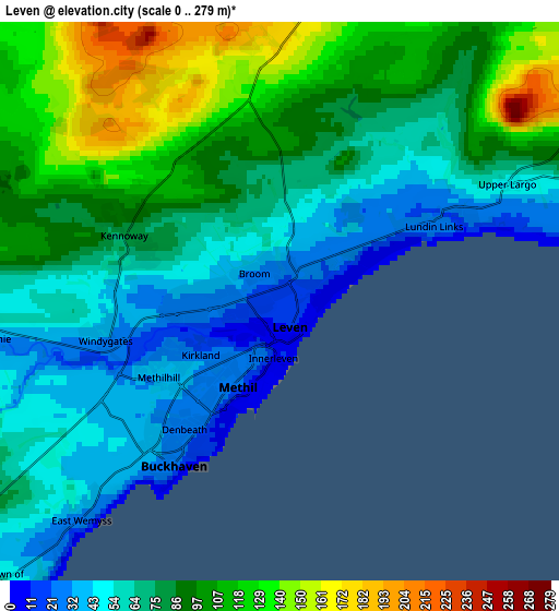
| Scale [m] | 0..131 m | 0..279 m | × |
| Scale [ft] | 0..430 ft | 0..915 ft | × |
| Average | 39.7 m = 130 ft | 81.2 m = 266 ft | × |
| Width | 5.44 km = 3.4 mi | 10.87 km = 6.8 mi | 174 km = 108.1 mi |
| Height | 5.44 km = 3.4 mi | 10.87 km = 6.8 mi | 174 km = 108.1 mi |
| ↑Max Latitude | 56.224439° | 56.248862° | 56.97434° |
| Latitude at center | 56.2° | 56.2° | 56.2° |
| ↓Min Latitude | 56.175546° | 56.151076° | 55.4097° |
| ← Min Longitude | -3.043945° | -3.087891° | -4.40625° |
| Longitude center | -3° | -3° | -3° |
| →Max Longitude | -2.956055° | -2.912109° | -1.59375° |
Nearby cities:
Cities around Leven sort by population:
• Glenrothes elevation 92 m
10.7 km,  267°
267°
• Methil 26 m
2.1 km,  219°
219°
• Kennoway 75 m
3.3 km,  291°
291°
• Buckhaven 28 m
3.8 km,  213°
213°
• Markinch 69 m
8.4 km, 271°
• Lundin Links 25 m
3.2 km,  64°
64°
• Thornton 56 m
10 km,  248°
248°
• East Wemyss 16 m
5.9 km, 221°
• Windygates 38 m
3.3 km,  261°
261°
• Freuchie 61 m
11.1 km,  297°
297°
• Coaltown of Balgonie 80 m
8 km, 257°
• Kingskettle 42 m
10 km,  313°
313°
Multilingual:
 En español:
Leven elevación 13 m.
 En France:
Leven élévation 13 m.


Sources and notes:
- [note 1] Map square and city borders are not equal. Map elevation data is calculated only from area inside that square.
- [src 1] Elevation data from geonames database provided with same terms of usage.
- [src 2] The elevation map of Leven is generated using elevation data from NASA's 3 arcsec (90m) resolution SRTM data.
- [src 3] Base (background) map © OpenStreetMap contributors tiles are generated by Geofabrik and OpenTopoMap.
Copyright & License:
This Leven Elevation Map is licensed under CC BY-SA. You may reuse any part from this page, if you give a proper credit by linking to this URL:
 More info on terms of use page.