Long Ashton elevation
Long Ashton (England, North Somerset), United Kingdom elevation is 56 meters and Long Ashton elevation in feet is 184 ft above sea level [src 1]. Long Ashton is a populated place (feature code) with elevation that is 16 meters (52 ft) smaller than average city elevation in United Kingdom.
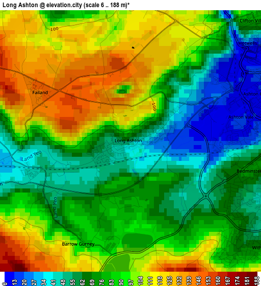
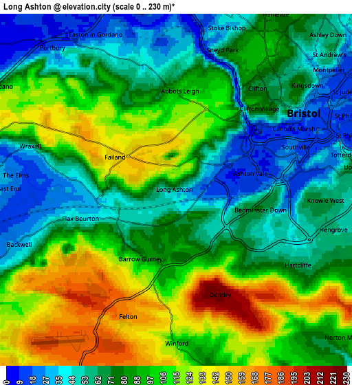
Below is the Elevation map of Long Ashton, which displays elevation range with different colors. Scale of the first map is from 6 to 188 m (20 to 617 ft) with average elevation of 84.2 meters (=276 ft) [note 1]
These maps also provides idea of topography and contour of this city, they are displayed at different zoom levels. More info about maps, scale and edge coordinates you can find below images.
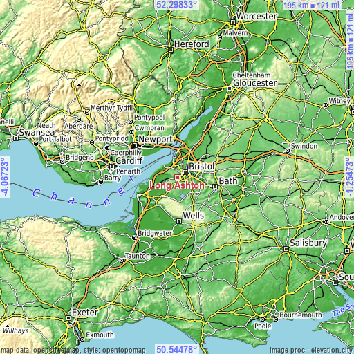
| \ | Map #1 | Map #2 | Topo.Map |
| Scale [m] | 6..188 m | 0..230 m | × |
| Scale [ft] | 20..617 ft | 0..755 ft | × |
| Average | 84.2 m = 276 ft | 85.5 m = 281 ft | × |
| Width | 6.09 km = 3.8 mi | 12.19 km = 7.6 mi | 195 km = 121.2 mi |
| Height | 6.09 km = 3.8 mi | 12.19 km = 7.6 mi | 195 km = 121.2 mi |
| ↑Max Latitude | 51.45736° | 51.484734° | 52.29833° |
| Latitude at center | 51.42997° | 51.42997° | 51.42997° |
| ↓Min Latitude | 51.402563° | 51.37514° | 50.54478° |
| ← Min Longitude | -2.704925° | -2.748871° | -4.06723° |
| Longitude center | -2.66098° | -2.66098° | -2.66098° |
| →Max Longitude | -2.617035° | -2.573089° | -1.25473° |
Nearby cities:
Cities around Long Ashton sort by population:
• Bristol elevation 21 m
5.3 km,  57°
57°
• Portishead 13 m
9.5 km,  307°
307°
• Nailsea 31 m
6.8 km,  272°
272°
• Bishopsworth 52 m
3.3 km,  121°
121°
• Easton-in-Gordano 23 m
5.8 km,  332°
332°
• Winford 107 m
5.2 km,  180°
180°
• Chew Magna 50 m
7.9 km,  153°
153°
• Brockley 25 m
8.1 km,  245°
245°
• Dundry 219 m
3.8 km,  156°
156°
• Butcombe 85 m
9 km,  196°
196°
• Stanton Drew 38 m
8.7 km,  143°
143°
• Whitchurch 77 m
7.3 km,  111°
111°
Multilingual:
 En español:
Long Ashton elevación 56 m.
 En France:
Long Ashton élévation 56 m.
 Auf Deutsch:
Long Ashton höhe über dem Meeresspiegel ist 56 m.

Sources and notes:
- [note 1] Map square and city borders are not equal. Map elevation data is calculated only from area inside that square.
- [src 1] Elevation data from geonames database provided with same terms of usage.
- [src 2] The elevation map of Long Ashton is generated using elevation data from NASA's 3 arcsec (90m) resolution SRTM data.
- [src 3] Base (background) map © OpenStreetMap contributors tiles are generated by Geofabrik and OpenTopoMap.
Copyright & License:
This Long Ashton Elevation Map is licensed under CC BY-SA. You may reuse any part from this page, if you give a proper credit by linking to this URL:
 More info on terms of use page.