Marston elevation
Marston (England, Cheshire West and Chester), United Kingdom elevation is 16 meters and Marston elevation in feet is 52 ft above sea level [src 1]. Marston is a seat of a third-order administrative division (feature code) with elevation that is 56 meters (184 ft) smaller than average city elevation in United Kingdom.
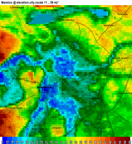
Below is the Elevation map of Marston, which displays elevation range with different colors. Scale of the first map is from 11 to 56 m (36 to 184 ft) with average elevation of 29.2 meters (=96 ft) [note 1]
These maps also provides idea of topography and contour of this city, they are displayed at different zoom levels. More info about maps, scale and edge coordinates you can find below images.
| \ | Map #1 | Topo.Map |
| Scale [m] | 11..56 m | × |
| Scale [ft] | 36..184 ft | × |
| Average | 29.2 m = 96 ft | × |
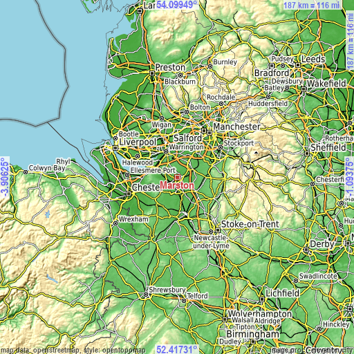
| Width | 5.84 km = 3.6 mi | 187 km = 116.2 mi |
| Height | 5.84 km = 3.6 mi | 187 km = 116.2 mi |
| ↑Max Latitude | 53.292945° | 54.09949° |
| Latitude at center | 53.26667° | 53.26667° |
| ↓Min Latitude | 53.240379° | 52.41731° |
| ← Min Longitude | -2.543945° | -3.90625° |
| Longitude center | -2.5° | -2.5° |
| →Max Longitude | -2.456055° | -1.09375° |
Nearby cities:
Cities around Marston sort by population:
• Northwich elevation 36 m
1.6 km,  237°
237°
• Winsford 36 m
8.5 km,  190°
190°
• Middlewich 30 m
9 km,  155°
155°
• Knutsford 68 m
9.2 km,  64°
64°
• Weaverham 46 m
4.9 km,  261°
261°
• Over 53 m
9.8 km,  199°
199°
• Appleton Thorn 76 m
9.8 km,  342°
342°
• High Legh 81 m
9.9 km,  18°
18°
• Cuddington 70 m
8.3 km,  252°
252°
• Mere 72 m
9.4 km,  39°
39°
• Stretton 80 m
8.6 km,  329°
329°
• Hartford 53 m
4.2 km,  234°
234°
Multilingual:
 En español:
Marston elevación 16 m.
 En France:
Marston élévation 16 m.


Sources and notes:
- [note 1] Map square and city borders are not equal. Map elevation data is calculated only from area inside that square.
- [src 1] Elevation data from geonames database provided with same terms of usage.
- [src 2] The elevation map of Marston is generated using elevation data from NASA's 3 arcsec (90m) resolution SRTM data.
- [src 3] Base (background) map © OpenStreetMap contributors tiles are generated by Geofabrik and OpenTopoMap.
Copyright & License:
This Marston Elevation Map is licensed under CC BY-SA. You may reuse any part from this page, if you give a proper credit by linking to this URL:
 More info on terms of use page.