Newport elevation
Newport (Wales, Pembrokeshire), United Kingdom elevation is 32 meters and Newport elevation in feet is 105 ft above sea level [src 1]. Newport is a seat of a third-order administrative division (feature code) with elevation that is 40 meters (131 ft) smaller than average city elevation in United Kingdom.
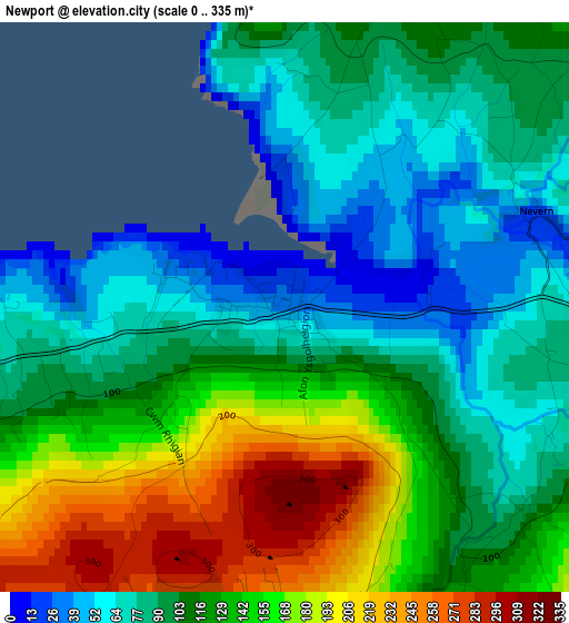
Below is the Elevation map of Newport, which displays elevation range with different colors. Scale of the first map is from 0 to 335 m (0 to 1099 ft) with average elevation of 118.2 meters (=388 ft) [note 1]
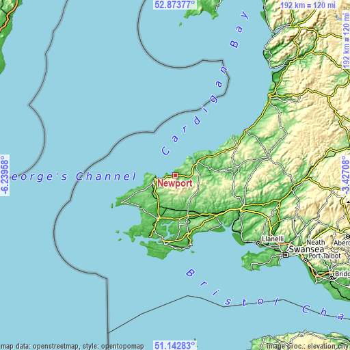
These maps also provides idea of topography and contour of this city, they are displayed at different zoom levels. More info about maps, scale and edge coordinates you can find below images.
| \ | Map #1 | Topo.Map |
| Scale [m] | 0..335 m | × |
| Scale [ft] | 0..1099 ft | × |
| Average | 118.2 m = 388 ft | × |
| Width | 6.01 km = 3.7 mi | 192.5 km = 119.6 mi |
| Height | 6.01 km = 3.7 mi | 192.4 km = 119.6 mi |
| ↑Max Latitude | 52.043707° | 52.87377° |
| Latitude at center | 52.01667° | 52.01667° |
| ↓Min Latitude | 51.989616° | 51.14283° |
| ← Min Longitude | -4.877275° | -6.23958° |
| Longitude center | -4.83333° | -4.83333° |
| →Max Longitude | -4.789385° | -3.42708° |
Nearby cities:
Cities around Newport sort by population:
• Cardigan elevation 10 m
13.9 km,  57°
57°
• Fishguard 63 m
10.1 km,  255°
255°
• Goodwick 25 m
11.1 km, 263°
• Glandwr 130 m
16.9 km,  125°
125°
• Letterston 131 m
14.7 km,  227°
227°
• Crymych 226 m
13.6 km,  110°
110°
• Spittal 97 m
18.1 km,  204°
204°
• Wiston 109 m
21.4 km,  186°
186°
• Mathry 126 m
19 km,  245°
245°
• Ambleston 137 m
14.4 km, 200°
• Scleddau 97 m
12.2 km,  243°
243°
• Nevern 31 m
2.4 km,  70°
70°
Multilingual:
 En español:
Newport elevación 32 m.
 En France:
Newport élévation 32 m.


Sources and notes:
- [note 1] Map square and city borders are not equal. Map elevation data is calculated only from area inside that square.
- [src 1] Elevation data from geonames database provided with same terms of usage.
- [src 2] The elevation map of Newport is generated using elevation data from NASA's 3 arcsec (90m) resolution SRTM data.
- [src 3] Base (background) map © OpenStreetMap contributors tiles are generated by Geofabrik and OpenTopoMap.
Copyright & License:
This Newport Elevation Map is licensed under CC BY-SA. You may reuse any part from this page, if you give a proper credit by linking to this URL:
 More info on terms of use page.