Normandy elevation
Normandy (England, Surrey), United Kingdom elevation is 55 meters and Normandy elevation in feet is 180 ft above sea level [src 1]. Normandy is a populated place (feature code) with elevation that is 17 meters (56 ft) smaller than average city elevation in United Kingdom.
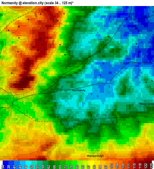
Below is the Elevation map of Normandy, which displays elevation range with different colors. Scale of the first map is from 34 to 125 m (112 to 410 ft) with average elevation of 72.8 meters (=239 ft) [note 1]
These maps also provides idea of topography and contour of this city, they are displayed at different zoom levels. More info about maps, scale and edge coordinates you can find below images.
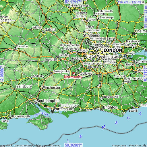
| \ | Map #1 | Topo.Map |
| Scale [m] | 34..125 m | × |
| Scale [ft] | 112..410 ft | × |
| Average | 72.8 m = 239 ft | × |
| Width | 6.12 km = 3.8 mi | 195.7 km = 121.6 mi |
| Height | 6.12 km = 3.8 mi | 195.7 km = 121.6 mi |
| ↑Max Latitude | 51.285004° | 52.12917° |
| Latitude at center | 51.25751° | 51.25751° |
| ↓Min Latitude | 51.23° | 50.36901° |
| ← Min Longitude | -0.718665° | -2.08097° |
| Longitude center | -0.67472° | -0.67472° |
| →Max Longitude | -0.630775° | 0.73153° |
Nearby cities:
Cities around Normandy sort by population:
• Guildford elevation 46 m
7.4 km,  109°
109°
• Aldershot 99 m
6.3 km,  260°
260°
• Farnborough 69 m
7 km,  305°
305°
• Farnham 71 m
10 km,  241°
241°
• Godalming 46 m
9 km,  152°
152°
• Hale 108 m
8.5 km,  248°
248°
• Frimley 64 m
8.2 km,  323°
323°
• Knaphill 57 m
8.1 km,  30°
30°
• Milford 57 m
9.6 km,  169°
169°
• Elstead 51 m
8.3 km,  194°
194°
• Wood Street Village 55 m
2.7 km, 105°
• Fairlands 39 m
3.7 km,  82°
82°
Multilingual:
 En español:
Normandy elevación 55 m.
 En France:
Normandy élévation 55 m.


Sources and notes:
- [note 1] Map square and city borders are not equal. Map elevation data is calculated only from area inside that square.
- [src 1] Elevation data from geonames database provided with same terms of usage.
- [src 2] The elevation map of Normandy is generated using elevation data from NASA's 3 arcsec (90m) resolution SRTM data.
- [src 3] Base (background) map © OpenStreetMap contributors tiles are generated by Geofabrik and OpenTopoMap.
Copyright & License:
This Normandy Elevation Map is licensed under CC BY-SA. You may reuse any part from this page, if you give a proper credit by linking to this URL:
 More info on terms of use page.