Odell elevation
Odell (England, Bedford), United Kingdom elevation is 48 meters and Odell elevation in feet is 157 ft above sea level [src 1]. Odell is a seat of a third-order administrative division (feature code) with elevation that is 24 meters (79 ft) smaller than average city elevation in United Kingdom.
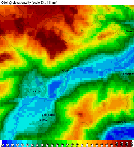
Below is the Elevation map of Odell, which displays elevation range with different colors. Scale of the first map is from 33 to 111 m (108 to 364 ft) with average elevation of 70.6 meters (=232 ft) [note 1]
These maps also provides idea of topography and contour of this city, they are displayed at different zoom levels. More info about maps, scale and edge coordinates you can find below images.
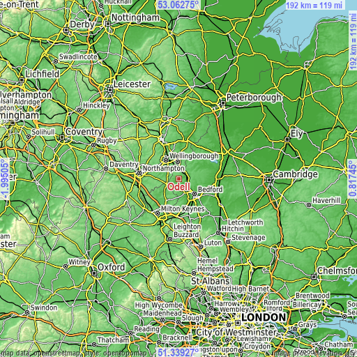
| \ | Map #1 | Topo.Map |
| Scale [m] | 33..111 m | × |
| Scale [ft] | 108..364 ft | × |
| Average | 70.6 m = 232 ft | × |
| Width | 5.99 km = 3.7 mi | 191.6 km = 119.1 mi |
| Height | 5.99 km = 3.7 mi | 191.6 km = 119.1 mi |
| ↑Max Latitude | 52.236291° | 53.06275° |
| Latitude at center | 52.20937° | 52.20937° |
| ↓Min Latitude | 52.182433° | 51.33927° |
| ← Min Longitude | -0.632745° | -1.99505° |
| Longitude center | -0.5888° | -0.5888° |
| →Max Longitude | -0.544855° | 0.81745° |
Nearby cities:
Cities around Odell sort by population:
• Bromham elevation 38 m
8.2 km,  150°
150°
• Clapham 33 m
8.4 km,  130°
130°
• Wollaston 87 m
7.7 km,  314°
314°
• Oakley 43 m
6.2 km,  136°
136°
• Bozeat 84 m
5.9 km,  284°
284°
• Sharnbrook 56 m
3.6 km,  58°
58°
• Harrold 48 m
1.7 km,  238°
238°
• Lavendon 65 m
6.4 km,  230°
230°
• Riseley 58 m
8.8 km, 57°
• Stevington 49 m
5.1 km, 153°
• Podington 75 m
5.6 km,  333°
333°
• Warrington 81 m
7.3 km,  247°
247°
Multilingual:
 En español:
Odell elevación 48 m.
 En France:
Odell élévation 48 m.


Sources and notes:
- [note 1] Map square and city borders are not equal. Map elevation data is calculated only from area inside that square.
- [src 1] Elevation data from geonames database provided with same terms of usage.
- [src 2] The elevation map of Odell is generated using elevation data from NASA's 3 arcsec (90m) resolution SRTM data.
- [src 3] Base (background) map © OpenStreetMap contributors tiles are generated by Geofabrik and OpenTopoMap.
Copyright & License:
This Odell Elevation Map is licensed under CC BY-SA. You may reuse any part from this page, if you give a proper credit by linking to this URL:
 More info on terms of use page.