Prees elevation
Prees (England, Shropshire), United Kingdom elevation is 100 meters and Prees elevation in feet is 328 ft above sea level [src 1]. Prees is a seat of a third-order administrative division (feature code) with elevation that is 28 meters (92 ft) bigger than average city elevation in United Kingdom.
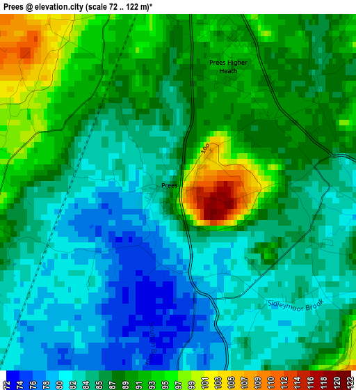
Below is the Elevation map of Prees, which displays elevation range with different colors. Scale of the first map is from 72 to 122 m (236 to 400 ft) with average elevation of 86.8 meters (=285 ft) [note 1]
These maps also provides idea of topography and contour of this city, they are displayed at different zoom levels. More info about maps, scale and edge coordinates you can find below images.
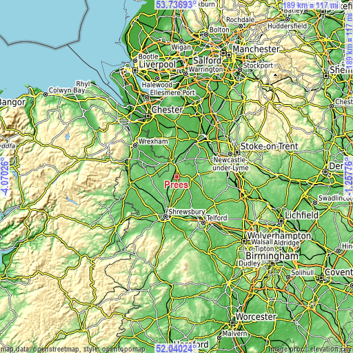
| \ | Map #1 | Topo.Map |
| Scale [m] | 72..122 m | × |
| Scale [ft] | 236..400 ft | × |
| Average | 86.8 m = 285 ft | × |
| Width | 5.9 km = 3.7 mi | 188.7 km = 117.3 mi |
| Height | 5.9 km = 3.7 mi | 188.6 km = 117.2 mi |
| ↑Max Latitude | 52.923392° | 53.73693° |
| Latitude at center | 52.89689° | 52.89689° |
| ↓Min Latitude | 52.870372° | 52.04024° |
| ← Min Longitude | -2.707955° | -4.07026° |
| Longitude center | -2.66401° | -2.66401° |
| →Max Longitude | -2.620065° | -1.25776° |
Nearby cities:
Cities around Prees sort by population:
• Market Drayton elevation 105 m
11.7 km,  85°
85°
• Whitchurch 101 m
7.9 km,  350°
350°
• Wem 82 m
5.6 km,  220°
220°
• Shawbury 73 m
11.8 km,  179°
179°
• Ash 112 m
6 km,  9°
9°
• Audlem 60 m
14.7 km,  45°
45°
• Malpas 100 m
15 km,  332°
332°
• Clive 124 m
10.1 km,  203°
203°
• Bickley 87 m
15.4 km, 350°
• Astley 71 m
14.7 km,  189°
189°
• Petton 119 m
13.4 km,  238°
238°
• Stoke upon Tern 64 m
10.2 km,  120°
120°
Multilingual:
 En español:
Prees elevación 100 m.
 En France:
Prees élévation 100 m.


Sources and notes:
- [note 1] Map square and city borders are not equal. Map elevation data is calculated only from area inside that square.
- [src 1] Elevation data from geonames database provided with same terms of usage.
- [src 2] The elevation map of Prees is generated using elevation data from NASA's 3 arcsec (90m) resolution SRTM data.
- [src 3] Base (background) map © OpenStreetMap contributors tiles are generated by Geofabrik and OpenTopoMap.
Copyright & License:
This Prees Elevation Map is licensed under CC BY-SA. You may reuse any part from this page, if you give a proper credit by linking to this URL:
 More info on terms of use page.