Prescot elevation
Prescot (England, Knowsley), United Kingdom elevation is 81 meters and Prescot elevation in feet is 266 ft above sea level [src 1]. Prescot is a seat of a third-order administrative division (feature code) with elevation that is 9 meters (30 ft) bigger than average city elevation in United Kingdom.
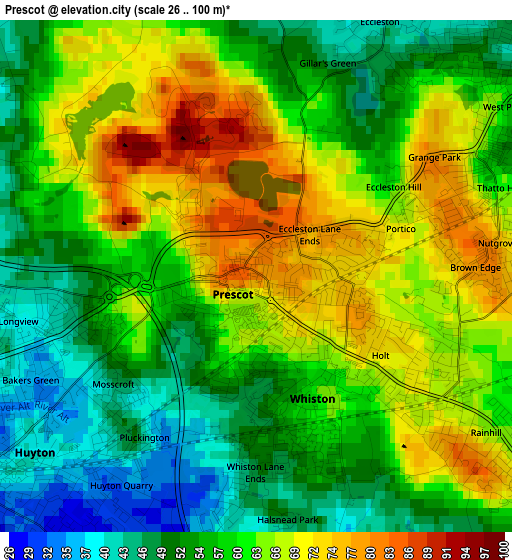
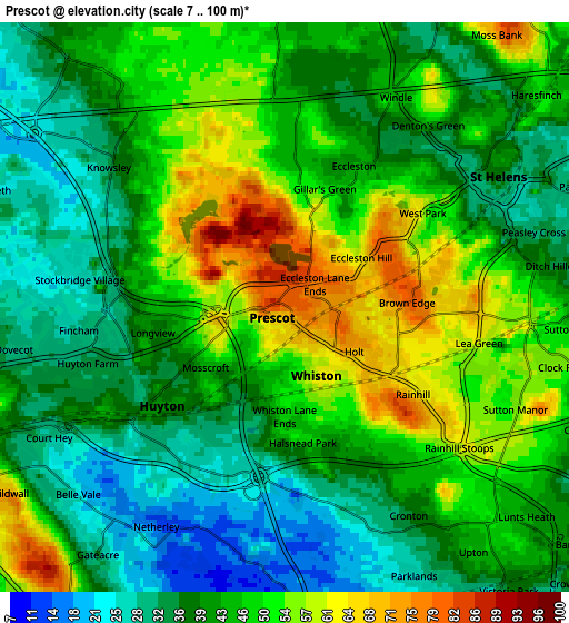
Below is the Elevation map of Prescot, which displays elevation range with different colors. Scale of the first map is from 26 to 100 m (85 to 328 ft) with average elevation of 59.7 meters (=196 ft) [note 1]
These maps also provides idea of topography and contour of this city, they are displayed at different zoom levels. More info about maps, scale and edge coordinates you can find below images.
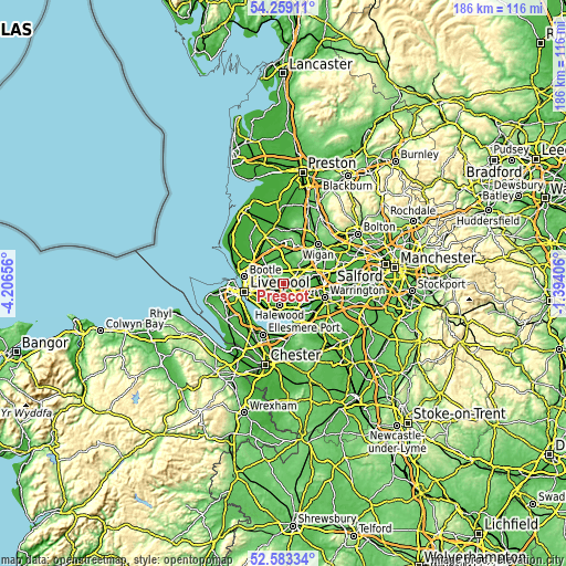
| \ | Map #1 | Map #2 | Topo.Map |
| Scale [m] | 26..100 m | 7..100 m | × |
| Scale [ft] | 85..328 ft | 23..328 ft | × |
| Average | 59.7 m = 196 ft | 43.9 m = 144 ft | × |
| Width | 5.82 km = 3.6 mi | 11.65 km = 7.2 mi | 186.3 km = 115.8 mi |
| Height | 5.82 km = 3.6 mi | 11.65 km = 7.2 mi | 186.3 km = 115.8 mi |
| ↑Max Latitude | 53.455655° | 53.481814° | 54.25911° |
| Latitude at center | 53.42948° | 53.42948° | 53.42948° |
| ↓Min Latitude | 53.403289° | 53.377081° | 52.58334° |
| ← Min Longitude | -2.844255° | -2.888201° | -4.20656° |
| Longitude center | -2.80031° | -2.80031° | -2.80031° |
| →Max Longitude | -2.756365° | -2.712419° | -1.39406° |
Nearby cities:
Cities around Prescot sort by population:
• St Helens elevation 31 m
5 km,  62°
62°
• Widnes 13 m
8.7 km,  149°
149°
• Huyton 40 m
3.3 km,  232°
232°
• Kirkby 25 m
8.4 km,  313°
313°
• Haydock 41 m
8.9 km, 61°
• Rainford 44 m
8.1 km,  5°
5°
• Billinge 111 m
9.8 km,  38°
38°
• Burtonwood 29 m
9.4 km,  90°
90°
• Clubmoor 15 m
8.8 km,  272°
272°
• Knowsley 33 m
4.5 km, 307°
• Eccleston 45 m
2.5 km,  26°
26°
• Whiston 62 m
1.3 km,  144°
144°
Multilingual:
 En español:
Prescot elevación 81 m.
 En France:
Prescot élévation 81 m.


Sources and notes:
- [note 1] Map square and city borders are not equal. Map elevation data is calculated only from area inside that square.
- [src 1] Elevation data from geonames database provided with same terms of usage.
- [src 2] The elevation map of Prescot is generated using elevation data from NASA's 3 arcsec (90m) resolution SRTM data.
- [src 3] Base (background) map © OpenStreetMap contributors tiles are generated by Geofabrik and OpenTopoMap.
Copyright & License:
This Prescot Elevation Map is licensed under CC BY-SA. You may reuse any part from this page, if you give a proper credit by linking to this URL:
 More info on terms of use page.