Preston elevation
Preston (England, Lancashire), United Kingdom elevation is 34 meters and Preston elevation in feet is 112 ft above sea level [src 1]. Preston is a seat of a second-order administrative division (feature code) with elevation that is 38 meters (125 ft) smaller than average city elevation in United Kingdom.
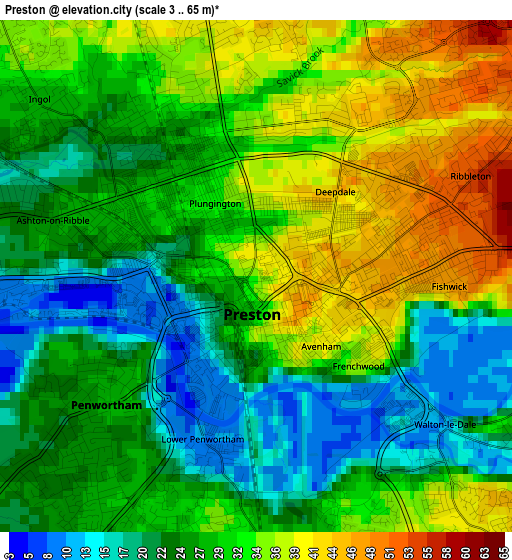
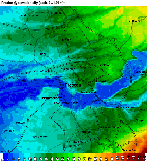
Below is the Elevation map of Preston, which displays elevation range with different colors. Scale of the first map is from 3 to 65 m (10 to 213 ft) with average elevation of 29 meters (=95 ft) [note 1]
These maps also provides idea of topography and contour of this city, they are displayed at different zoom levels. More info about maps, scale and edge coordinates you can find below images.
| \ | Map #1 | Map #2 | Topo.Map |
| Scale [m] | 3..65 m | 2..124 m | × |
| Scale [ft] | 10..213 ft | 7..407 ft | × |
| Average | 29 m = 95 ft | 35.5 m = 116 ft | × |
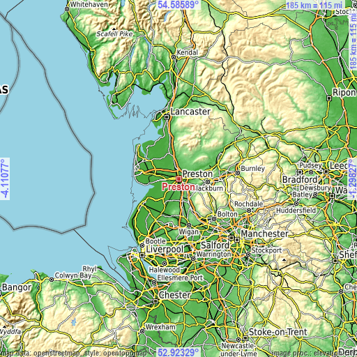
| Width | 5.78 km = 3.6 mi | 11.55 km = 7.2 mi | 184.9 km = 114.9 mi |
| Height | 5.78 km = 3.6 mi | 11.55 km = 7.2 mi | 184.8 km = 114.8 mi |
| ↑Max Latitude | 53.788789° | 53.814743° | 54.58589° |
| Latitude at center | 53.76282° | 53.76282° | 53.76282° |
| ↓Min Latitude | 53.736835° | 53.710833° | 52.92329° |
| ← Min Longitude | -2.748465° | -2.792411° | -4.11077° |
| Longitude center | -2.70452° | -2.70452° | -2.70452° |
| →Max Longitude | -2.660575° | -2.616629° | -1.29827° |
Nearby cities:
Cities around Preston sort by population:
• Leyland elevation 39 m
7.3 km,  171°
171°
• Clayton-le-Woods 63 m
7.7 km,  161°
161°
• Kirkham 24 m
11.2 km,  281°
281°
• Tarleton 19 m
12.3 km,  221°
221°
• Freckleton 21 m
10.6 km,  264°
264°
• Euxton 52 m
10.5 km, 169°
• Longridge 129 m
10.3 km,  41°
41°
• Eccleston 34 m
13.4 km,  184°
184°
• Croston 11 m
12.1 km,  202°
202°
• Brinscall 193 m
12 km,  133°
133°
• Warton 13 m
12.5 km, 263°
• Goosnargh 72 m
7 km,  18°
18°
Multilingual:
 En español:
Preston elevación 34 m.
 En France:
Preston élévation 34 m.


Sources and notes:
- [note 1] Map square and city borders are not equal. Map elevation data is calculated only from area inside that square.
- [src 1] Elevation data from geonames database provided with same terms of usage.
- [src 2] The elevation map of Preston is generated using elevation data from NASA's 3 arcsec (90m) resolution SRTM data.
- [src 3] Base (background) map © OpenStreetMap contributors tiles are generated by Geofabrik and OpenTopoMap.
Copyright & License:
This Preston Elevation Map is licensed under CC BY-SA. You may reuse any part from this page, if you give a proper credit by linking to this URL:
 More info on terms of use page.