Redbourn elevation
Redbourn (England, Hertfordshire), United Kingdom elevation is 102 meters and Redbourn elevation in feet is 335 ft above sea level [src 1]. Redbourn is a populated place (feature code) with elevation that is 30 meters (98 ft) bigger than average city elevation in United Kingdom.
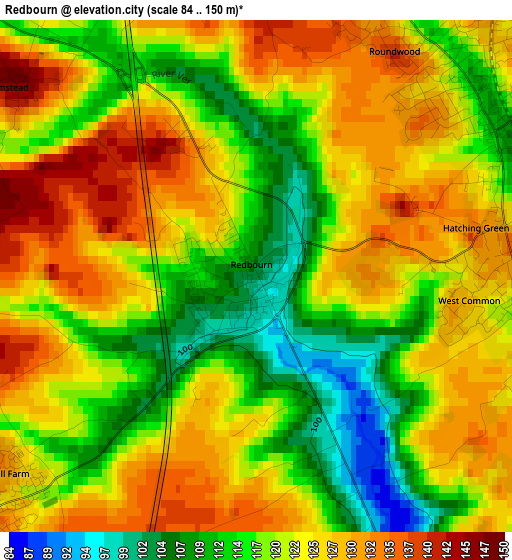
Below is the Elevation map of Redbourn, which displays elevation range with different colors. Scale of the first map is from 84 to 150 m (276 to 492 ft) with average elevation of 121.5 meters (=399 ft) [note 1]
These maps also provides idea of topography and contour of this city, they are displayed at different zoom levels. More info about maps, scale and edge coordinates you can find below images.
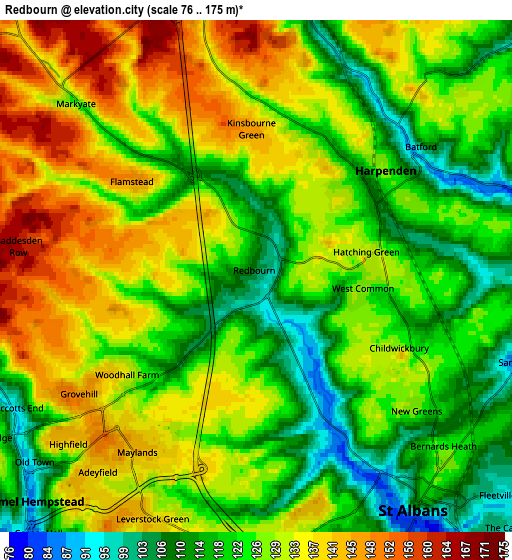
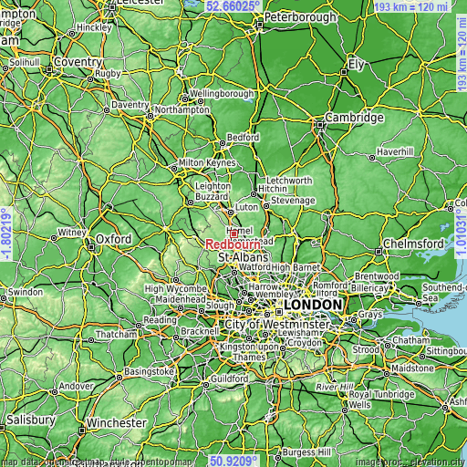
| \ | Map #1 | Map #2 | Topo.Map |
| Scale [m] | 84..150 m | 76..175 m | × |
| Scale [ft] | 276..492 ft | 249..574 ft | × |
| Average | 121.5 m = 399 ft | 126.8 m = 416 ft | × |
| Width | 6.04 km = 3.8 mi | 12.09 km = 7.5 mi | 193.4 km = 120.2 mi |
| Height | 6.04 km = 3.8 mi | 12.09 km = 7.5 mi | 193.4 km = 120.2 mi |
| ↑Max Latitude | 51.826129° | 51.853281° | 52.66025° |
| Latitude at center | 51.79896° | 51.79896° | 51.79896° |
| ↓Min Latitude | 51.771775° | 51.744574° | 50.9209° |
| ← Min Longitude | -0.439885° | -0.483831° | -1.80219° |
| Longitude center | -0.39594° | -0.39594° | -0.39594° |
| →Max Longitude | -0.351995° | -0.308049° | 1.01031° |
Nearby cities:
Cities around Redbourn sort by population:
• Luton elevation 117 m
9.1 km,  350°
350°
• Hemel Hempstead 138 m
6.2 km,  216°
216°
• St Albans 98 m
6.9 km,  141°
141°
• Harpenden 107 m
3.3 km,  53°
53°
• Codicote 106 m
12.4 km,  62°
62°
• Abbots Langley 128 m
10.5 km,  188°
188°
• Kings Langley 93 m
10.2 km,  201°
201°
• Wheathampstead 91 m
7.2 km,  78°
78°
• Caddington 176 m
8.6 km,  330°
330°
• Markyate 133 m
6.4 km,  313°
313°
• Kensworth 188 m
9.5 km, 308°
• Kimpton 90 m
8.8 km, 48°
Multilingual:
 En español:
Redbourn elevación 102 m.
 En France:
Redbourn élévation 102 m.
 Auf Deutsch:
Redbourn höhe über dem Meeresspiegel ist 102 m.

Sources and notes:
- [note 1] Map square and city borders are not equal. Map elevation data is calculated only from area inside that square.
- [src 1] Elevation data from geonames database provided with same terms of usage.
- [src 2] The elevation map of Redbourn is generated using elevation data from NASA's 3 arcsec (90m) resolution SRTM data.
- [src 3] Base (background) map © OpenStreetMap contributors tiles are generated by Geofabrik and OpenTopoMap.
Copyright & License:
This Redbourn Elevation Map is licensed under CC BY-SA. You may reuse any part from this page, if you give a proper credit by linking to this URL:
 More info on terms of use page.