Shap elevation
Shap (England, Cumbria), United Kingdom elevation is 261 meters and Shap elevation in feet is 856 ft above sea level [src 1]. Shap is a populated place (feature code) with elevation that is 189 meters (620 ft) bigger than average city elevation in United Kingdom.
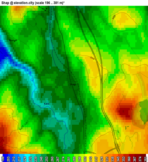
Below is the Elevation map of Shap, which displays elevation range with different colors. Scale of the first map is from 196 to 381 m (643 to 1250 ft) with average elevation of 281.9 meters (=925 ft) [note 1]
These maps also provides idea of topography and contour of this city, they are displayed at different zoom levels. More info about maps, scale and edge coordinates you can find below images.
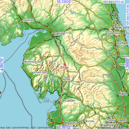
| \ | Map #1 | Topo.Map |
| Scale [m] | 196..381 m | × |
| Scale [ft] | 643..1250 ft | × |
| Average | 281.9 m = 925 ft | × |
| Width | 5.67 km = 3.5 mi | 181.5 km = 112.8 mi |
| Height | 5.67 km = 3.5 mi | 181.4 km = 112.7 mi |
| ↑Max Latitude | 54.556982° | 55.33935° |
| Latitude at center | 54.53149° | 54.53149° |
| ↓Min Latitude | 54.505983° | 53.70732° |
| ← Min Longitude | -2.719455° | -4.08176° |
| Longitude center | -2.67551° | -2.67551° |
| →Max Longitude | -2.631565° | -1.26926° |
Nearby cities:
Cities around Shap sort by population:
• Kendal elevation 55 m
23.2 km,  191°
191°
• Penrith 146 m
15.8 km,  340°
340°
• Windermere 120 m
22.5 km,  221°
221°
• Keswick 93 m
30.4 km,  284°
284°
• Appleby-in-Westmorland 140 m
13 km,  67°
67°
• Ambleside 68 m
21.5 km,  239°
239°
• Milnthorpe 30 m
34.3 km, 190°
• Sedbergh 134 m
25.3 km,  157°
157°
• Kirkby Stephen 176 m
22.1 km,  107°
107°
• Staveley 99 m
19.5 km,  208°
208°
• Alston 298 m
34.4 km,  26°
26°
• Burneside 57 m
20.6 km,  195°
195°
Multilingual:
 En español:
Shap elevación 261 m.
 En France:
Shap élévation 261 m.


Sources and notes:
- [note 1] Map square and city borders are not equal. Map elevation data is calculated only from area inside that square.
- [src 1] Elevation data from geonames database provided with same terms of usage.
- [src 2] The elevation map of Shap is generated using elevation data from NASA's 3 arcsec (90m) resolution SRTM data.
- [src 3] Base (background) map © OpenStreetMap contributors tiles are generated by Geofabrik and OpenTopoMap.
Copyright & License:
This Shap Elevation Map is licensed under CC BY-SA. You may reuse any part from this page, if you give a proper credit by linking to this URL:
 More info on terms of use page.