Shrivenham elevation
Shrivenham (England, Oxfordshire), United Kingdom elevation is 101 meters and Shrivenham elevation in feet is 331 ft above sea level [src 1]. Shrivenham is a populated place (feature code) with elevation that is 29 meters (95 ft) bigger than average city elevation in United Kingdom.
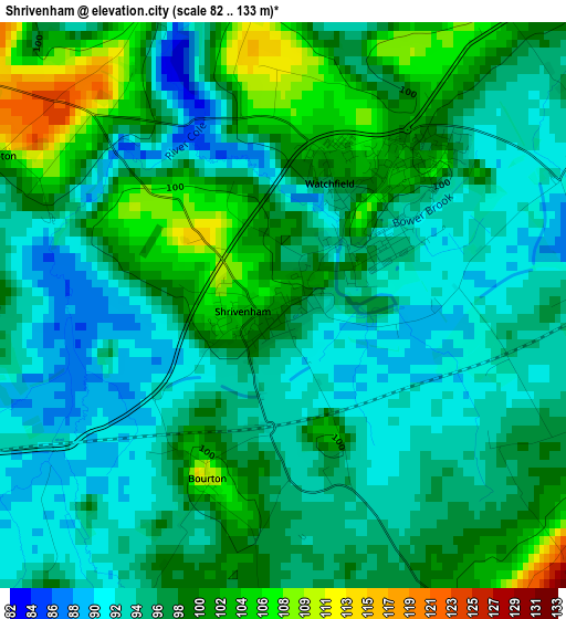
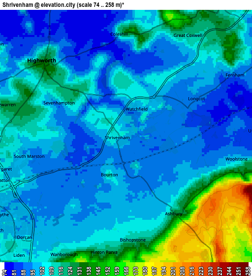
Below is the Elevation map of Shrivenham, which displays elevation range with different colors. Scale of the first map is from 82 to 133 m (269 to 436 ft) with average elevation of 96.4 meters (=316 ft) [note 1]
These maps also provides idea of topography and contour of this city, they are displayed at different zoom levels. More info about maps, scale and edge coordinates you can find below images.
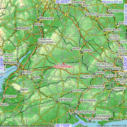
| \ | Map #1 | Map #2 | Topo.Map |
| Scale [m] | 82..133 m | 74..258 m | × |
| Scale [ft] | 269..436 ft | 243..846 ft | × |
| Average | 96.4 m = 316 ft | 109.3 m = 359 ft | × |
| Width | 6.07 km = 3.8 mi | 12.14 km = 7.5 mi | 194.3 km = 120.7 mi |
| Height | 6.07 km = 3.8 mi | 12.14 km = 7.5 mi | 194.2 km = 120.7 mi |
| ↑Max Latitude | 51.625819° | 51.653092° | 52.46367° |
| Latitude at center | 51.59853° | 51.59853° | 51.59853° |
| ↓Min Latitude | 51.571224° | 51.543902° | 50.71659° |
| ← Min Longitude | -1.698555° | -1.742501° | -3.06086° |
| Longitude center | -1.65461° | -1.65461° | -1.65461° |
| →Max Longitude | -1.610665° | -1.566719° | -0.24836° |
Nearby cities:
Cities around Shrivenham sort by population:
• Swindon elevation 113 m
9.8 km,  242°
242°
• Highworth 135 m
5.3 km,  312°
312°
• Faringdon 109 m
8 km,  36°
36°
• Wroughton 118 m
12.8 km,  229°
229°
• Lambourn 130 m
13.2 km,  139°
139°
• Lechlade 79 m
10.9 km,  346°
346°
• Wanborough 151 m
6.9 km,  205°
205°
• Stanford in the Vale 77 m
11.2 km,  65°
65°
• Chiseldon 161 m
10.6 km, 210°
• Broad Blunsdon 142 m
8.7 km,  280°
280°
• Bishopstone 129 m
5.3 km,  174°
174°
• Hannington 118 m
7.6 km,  300°
300°
Multilingual:
 En español:
Shrivenham elevación 101 m.
 En France:
Shrivenham élévation 101 m.
 Auf Deutsch:
Shrivenham höhe über dem Meeresspiegel ist 101 m.

Sources and notes:
- [note 1] Map square and city borders are not equal. Map elevation data is calculated only from area inside that square.
- [src 1] Elevation data from geonames database provided with same terms of usage.
- [src 2] The elevation map of Shrivenham is generated using elevation data from NASA's 3 arcsec (90m) resolution SRTM data.
- [src 3] Base (background) map © OpenStreetMap contributors tiles are generated by Geofabrik and OpenTopoMap.
Copyright & License:
This Shrivenham Elevation Map is licensed under CC BY-SA. You may reuse any part from this page, if you give a proper credit by linking to this URL:
 More info on terms of use page.