Tarporley elevation
Tarporley (England, Cheshire West and Chester), United Kingdom elevation is 98 meters and Tarporley elevation in feet is 322 ft above sea level [src 1]. Tarporley is a populated place (feature code) with elevation that is 26 meters (85 ft) bigger than average city elevation in United Kingdom.
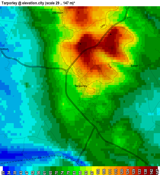
Below is the Elevation map of Tarporley, which displays elevation range with different colors. Scale of the first map is from 29 to 147 m (95 to 482 ft) with average elevation of 73.3 meters (=240 ft) [note 1]
These maps also provides idea of topography and contour of this city, they are displayed at different zoom levels. More info about maps, scale and edge coordinates you can find below images.
| \ | Map #1 | Topo.Map |
| Scale [m] | 29..147 m | × |
| Scale [ft] | 95..482 ft | × |
| Average | 73.3 m = 240 ft | × |
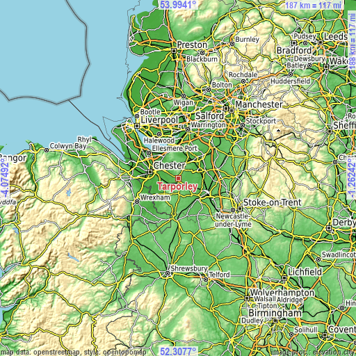
| Width | 5.86 km = 3.6 mi | 187.5 km = 116.5 mi |
| Height | 5.86 km = 3.6 mi | 187.5 km = 116.5 mi |
| ↑Max Latitude | 53.185521° | 53.9941° |
| Latitude at center | 53.15918° | 53.15918° |
| ↓Min Latitude | 53.132823° | 52.3077° |
| ← Min Longitude | -2.712615° | -4.07492° |
| Longitude center | -2.66867° | -2.66867° |
| →Max Longitude | -2.624725° | -1.26242° |
Nearby cities:
Cities around Tarporley sort by population:
• Over elevation 53 m
8.4 km,  71°
71°
• Kelsall 85 m
6.1 km,  331°
331°
• Tarvin 40 m
7.7 km,  303°
303°
• Tattenhall 38 m
7.8 km,  237°
237°
• Bunbury 70 m
5 km,  166°
166°
• Cuddington 70 m
10.1 km,  19°
19°
• Mouldsworth 68 m
9.3 km, 332°
• Harthill 98 m
10 km,  212°
212°
• Waverton 34 m
8.8 km,  275°
275°
• Oakmere 81 m
7 km, 15°
• Beeston 82 m
4.8 km,  191°
191°
• Tiverton 41 m
2.9 km,  177°
177°
Multilingual:
 En español:
Tarporley elevación 98 m.
 En France:
Tarporley élévation 98 m.
 Auf Deutsch:
Tarporley höhe über dem Meeresspiegel ist 98 m.

Sources and notes:
- [note 1] Map square and city borders are not equal. Map elevation data is calculated only from area inside that square.
- [src 1] Elevation data from geonames database provided with same terms of usage.
- [src 2] The elevation map of Tarporley is generated using elevation data from NASA's 3 arcsec (90m) resolution SRTM data.
- [src 3] Base (background) map © OpenStreetMap contributors tiles are generated by Geofabrik and OpenTopoMap.
Copyright & License:
This Tarporley Elevation Map is licensed under CC BY-SA. You may reuse any part from this page, if you give a proper credit by linking to this URL:
 More info on terms of use page.