Thame elevation
Thame (England, Oxfordshire), United Kingdom elevation is 72 meters and Thame elevation in feet is 236 ft above sea level [src 1]. Thame is a populated place (feature code) with elevation that is 0 meters (0 ft) bigger than average city elevation in United Kingdom.
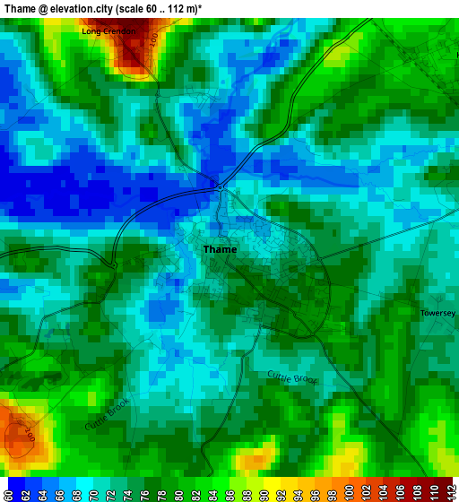
Below is the Elevation map of Thame, which displays elevation range with different colors. Scale of the first map is from 60 to 112 m (197 to 367 ft) with average elevation of 74.4 meters (=244 ft) [note 1]
These maps also provides idea of topography and contour of this city, they are displayed at different zoom levels. More info about maps, scale and edge coordinates you can find below images.
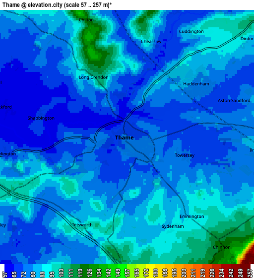
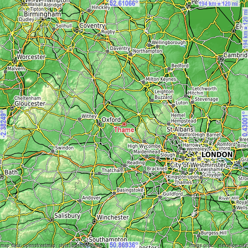
| \ | Map #1 | Map #2 | Topo.Map |
| Scale [m] | 60..112 m | 57..257 m | × |
| Scale [ft] | 197..367 ft | 187..843 ft | × |
| Average | 74.4 m = 244 ft | 81.4 m = 267 ft | × |
| Width | 6.05 km = 3.8 mi | 12.1 km = 7.5 mi | 193.6 km = 120.3 mi |
| Height | 6.05 km = 3.8 mi | 12.1 km = 7.5 mi | 193.6 km = 120.3 mi |
| ↑Max Latitude | 51.775599° | 51.802782° | 52.61066° |
| Latitude at center | 51.7484° | 51.7484° | 51.7484° |
| ↓Min Latitude | 51.721185° | 51.693953° | 50.86936° |
| ← Min Longitude | -1.020185° | -1.064131° | -2.38249° |
| Longitude center | -0.97624° | -0.97624° | -0.97624° |
| →Max Longitude | -0.932295° | -0.888349° | 0.43001° |
Nearby cities:
Cities around Thame sort by population:
• Princes Risborough elevation 112 m
10.3 km,  104°
104°
• Wheatley 79 m
11.2 km,  269°
269°
• Chinnor 120 m
6.8 km,  139°
139°
• Haddenham 79 m
4.4 km,  51°
51°
• Stokenchurch 223 m
11.4 km,  151°
151°
• Chalgrove 68 m
11.6 km,  216°
216°
• Long Crendon 108 m
3.1 km,  332°
332°
• Stone 111 m
9.4 km, 50°
• Waddesdon 100 m
11.6 km,  19°
19°
• Longwick 91 m
8.3 km, 99°
• Brill 166 m
9.1 km, 326°
• Oakley 85 m
9.1 km,  313°
313°
Multilingual:
 En español:
Thame elevación 72 m.
 En France:
Thame élévation 72 m.


Sources and notes:
- [note 1] Map square and city borders are not equal. Map elevation data is calculated only from area inside that square.
- [src 1] Elevation data from geonames database provided with same terms of usage.
- [src 2] The elevation map of Thame is generated using elevation data from NASA's 3 arcsec (90m) resolution SRTM data.
- [src 3] Base (background) map © OpenStreetMap contributors tiles are generated by Geofabrik and OpenTopoMap.
Copyright & License:
This Thame Elevation Map is licensed under CC BY-SA. You may reuse any part from this page, if you give a proper credit by linking to this URL:
 More info on terms of use page.