Truro elevation
Truro (England, Cornwall), United Kingdom elevation is 15 meters and Truro elevation in feet is 49 ft above sea level [src 1]. Truro is a seat of a second-order administrative division (feature code) with elevation that is 57 meters (187 ft) smaller than average city elevation in United Kingdom.
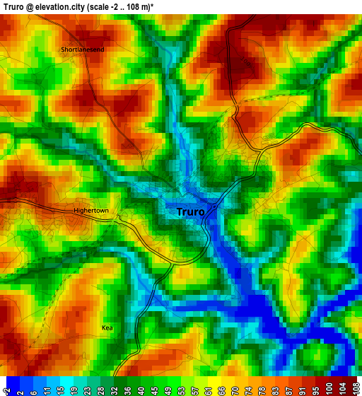
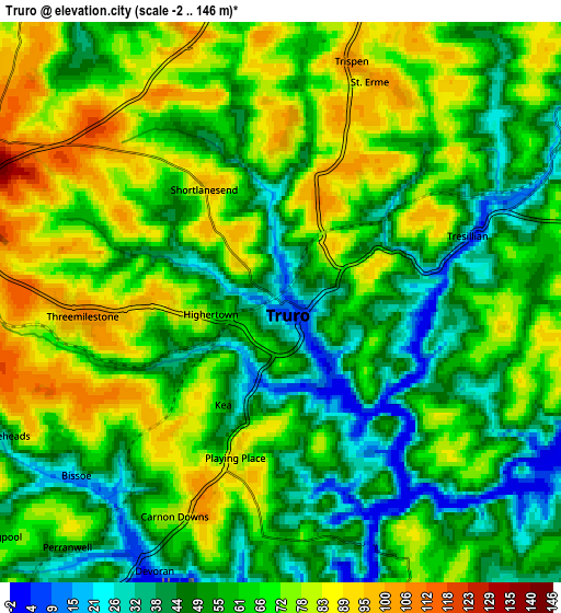
Below is the Elevation map of Truro, which displays elevation range with different colors. Scale of the first map is from -2 to 108 m (-7 to 354 ft) with average elevation of 54.2 meters (=178 ft) [note 1]
These maps also provides idea of topography and contour of this city, they are displayed at different zoom levels. More info about maps, scale and edge coordinates you can find below images.
| \ | Map #1 | Map #2 | Topo.Map |
| Scale [m] | -2..108 m | -2..146 m | × |
| Scale [ft] | -7..354 ft | -7..479 ft | × |
| Average | 54.2 m = 178 ft | 62.1 m = 204 ft | × |
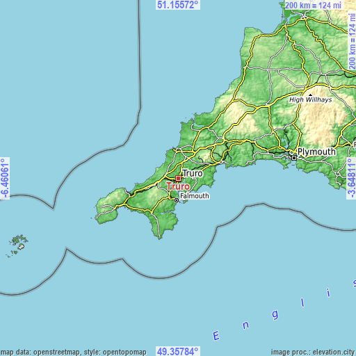
| Width | 6.25 km = 3.9 mi | 12.49 km = 7.8 mi | 199.9 km = 124.2 mi |
| Height | 6.25 km = 3.9 mi | 12.49 km = 7.8 mi | 199.9 km = 124.2 mi |
| ↑Max Latitude | 50.293343° | 50.32141° | 51.15572° |
| Latitude at center | 50.26526° | 50.26526° | 50.26526° |
| ↓Min Latitude | 50.23716° | 50.209044° | 49.35784° |
| ← Min Longitude | -5.098305° | -5.142251° | -6.46061° |
| Longitude center | -5.05436° | -5.05436° | -5.05436° |
| →Max Longitude | -5.010415° | -4.966469° | -3.64811° |
Nearby cities:
Cities around Truro sort by population:
• Penryn elevation 29 m
11.4 km,  198°
198°
• Perranporth 12 m
11.3 km,  320°
320°
• Saint Agnes 100 m
11.9 km,  296°
296°
• Probus 73 m
7.8 km,  66°
66°
• Mount Hawke 115 m
11.1 km,  279°
279°
• Portscatho 30 m
11.8 km,  150°
150°
• Mylor Bridge 9 m
9.1 km,  191°
191°
• Chacewater 61 m
7.4 km,  262°
262°
• Perranwell 22 m
7.4 km,  219°
219°
• St. Day 128 m
9.8 km,  252°
252°
• Tregoney 11 m
9.8 km,  88°
88°
• Perranarworthal 33 m
8.1 km, 215°
Multilingual:
 En español:
Truro elevación 15 m.
 En France:
Truro élévation 15 m.


Sources and notes:
- [note 1] Map square and city borders are not equal. Map elevation data is calculated only from area inside that square.
- [src 1] Elevation data from geonames database provided with same terms of usage.
- [src 2] The elevation map of Truro is generated using elevation data from NASA's 3 arcsec (90m) resolution SRTM data.
- [src 3] Base (background) map © OpenStreetMap contributors tiles are generated by Geofabrik and OpenTopoMap.
Copyright & License:
This Truro Elevation Map is licensed under CC BY-SA. You may reuse any part from this page, if you give a proper credit by linking to this URL:
 More info on terms of use page.