Wallsend elevation
Wallsend (England, Borough of North Tyneside), United Kingdom elevation is 30 meters and Wallsend elevation in feet is 98 ft above sea level [src 1]. Wallsend is a seat of a second-order administrative division (feature code) with elevation that is 42 meters (138 ft) smaller than average city elevation in United Kingdom.
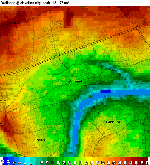
Below is the Elevation map of Wallsend, which displays elevation range with different colors. Scale of the first map is from -13 to 73 m (-43 to 240 ft) with average elevation of 36.3 meters (=119 ft) [note 1]
These maps also provides idea of topography and contour of this city, they are displayed at different zoom levels. More info about maps, scale and edge coordinates you can find below images.
| \ | Map #1 | Map #2 | Topo.Map |
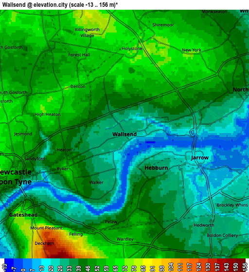
| Scale [m] | -13..73 m | -13..156 m | × |
| Scale [ft] | -43..240 ft | -43..512 ft | × |
| Average | 36.3 m = 119 ft | 44.6 m = 146 ft | × |
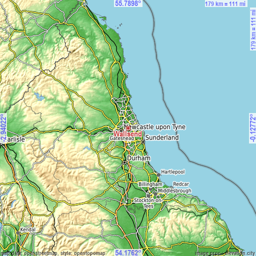
| Width | 5.61 km = 3.5 mi | 11.21 km = 7 mi | 179.4 km = 111.5 mi |
| Height | 5.61 km = 3.5 mi | 11.21 km = 7 mi | 179.4 km = 111.5 mi |
| ↑Max Latitude | 55.016314° | 55.041501° | 55.7898° |
| Latitude at center | 54.99111° | 54.99111° | 54.99111° |
| ↓Min Latitude | 54.96589° | 54.940655° | 54.1762° |
| ← Min Longitude | -1.577915° | -1.621861° | -2.94022° |
| Longitude center | -1.53397° | -1.53397° | -1.53397° |
| →Max Longitude | -1.490025° | -1.446079° | -0.12772° |
Nearby cities:
Cities around Wallsend sort by population:
• Newcastle upon Tyne elevation 54 m
5.5 km,  248°
248°
• South Shields 12 m
6.5 km,  82°
82°
• Gateshead 53 m
5.4 km,  233°
233°
• North Shields 42 m
6.1 km,  62°
62°
• Felling 42 m
4.9 km,  209°
209°
• Jarrow 15 m
3.4 km,  110°
110°
• Gosforth 67 m
5.4 km,  280°
280°
• Hebburn 38 m
2.3 km,  149°
149°
• Tynemouth 35 m
7.5 km,  66°
66°
• The Boldons 53 m
7.4 km,  136°
136°
• Shiremoor 62 m
5.2 km,  17°
17°
• Backworth 59 m
5.7 km,  3°
3°
Multilingual:
 En español:
Wallsend elevación 30 m.
 En France:
Wallsend élévation 30 m.


Sources and notes:
- [note 1] Map square and city borders are not equal. Map elevation data is calculated only from area inside that square.
- [src 1] Elevation data from geonames database provided with same terms of usage.
- [src 2] The elevation map of Wallsend is generated using elevation data from NASA's 3 arcsec (90m) resolution SRTM data.
- [src 3] Base (background) map © OpenStreetMap contributors tiles are generated by Geofabrik and OpenTopoMap.
Copyright & License:
This Wallsend Elevation Map is licensed under CC BY-SA. You may reuse any part from this page, if you give a proper credit by linking to this URL:
 More info on terms of use page.