Welford elevation
Welford (England, Northamptonshire), United Kingdom elevation is 155 meters and Welford elevation in feet is 509 ft above sea level [src 1]. Welford is a populated place (feature code) with elevation that is 83 meters (272 ft) bigger than average city elevation in United Kingdom.
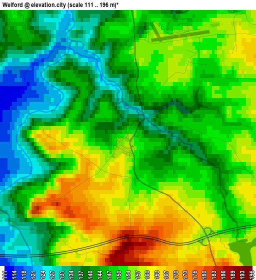
Below is the Elevation map of Welford, which displays elevation range with different colors. Scale of the first map is from 111 to 196 m (364 to 643 ft) with average elevation of 148.6 meters (=488 ft) [note 1]
These maps also provides idea of topography and contour of this city, they are displayed at different zoom levels. More info about maps, scale and edge coordinates you can find below images.
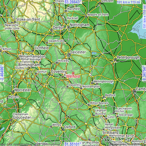
| \ | Map #1 | Topo.Map |
| Scale [m] | 111..196 m | × |
| Scale [ft] | 364..643 ft | × |
| Average | 148.6 m = 488 ft | × |
| Width | 5.96 km = 3.7 mi | 190.7 km = 118.5 mi |
| Height | 5.96 km = 3.7 mi | 190.7 km = 118.5 mi |
| ↑Max Latitude | 52.443855° | 53.26643° |
| Latitude at center | 52.41706° | 52.41706° |
| ↓Min Latitude | 52.390249° | 51.55101° |
| ← Min Longitude | -1.102655° | -2.46496° |
| Longitude center | -1.05871° | -1.05871° |
| →Max Longitude | -1.014765° | 0.34754° |
Nearby cities:
Cities around Welford sort by population:
• Rugby elevation 120 m
14.9 km,  249°
249°
• Market Harborough 81 m
11.5 km,  54°
54°
• Lutterworth 131 m
10.7 km,  294°
294°
• Kibworth Harcourt 120 m
14.8 km,  16°
16°
• Brixworth 125 m
14.4 km,  132°
132°
• Fleckney 109 m
13.1 km,  3°
3°
• Long Buckby 141 m
12.8 km,  186°
186°
• Crick 135 m
9.3 km,  214°
214°
• West Haddon 164 m
8.5 km, 188°
• Kilsby 137 m
12.2 km,  220°
220°
• Spratton 138 m
12.5 km,  145°
145°
• Husbands Bosworth 162 m
3.9 km, 3°
Multilingual:
 En español:
Welford elevación 155 m.
 En France:
Welford élévation 155 m.


Sources and notes:
- [note 1] Map square and city borders are not equal. Map elevation data is calculated only from area inside that square.
- [src 1] Elevation data from geonames database provided with same terms of usage.
- [src 2] The elevation map of Welford is generated using elevation data from NASA's 3 arcsec (90m) resolution SRTM data.
- [src 3] Base (background) map © OpenStreetMap contributors tiles are generated by Geofabrik and OpenTopoMap.
Copyright & License:
This Welford Elevation Map is licensed under CC BY-SA. You may reuse any part from this page, if you give a proper credit by linking to this URL:
 More info on terms of use page.