Wells elevation
Wells (England, Somerset), United Kingdom elevation is 42 meters and Wells elevation in feet is 138 ft above sea level [src 1]. Wells is a populated place (feature code) with elevation that is 30 meters (98 ft) smaller than average city elevation in United Kingdom.
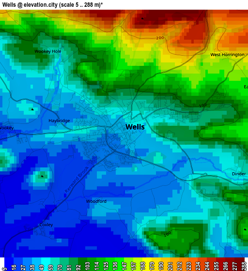
Below is the Elevation map of Wells, which displays elevation range with different colors. Scale of the first map is from 5 to 288 m (16 to 945 ft) with average elevation of 81.4 meters (=267 ft) [note 1]
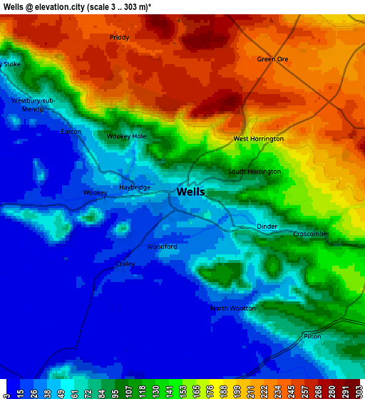
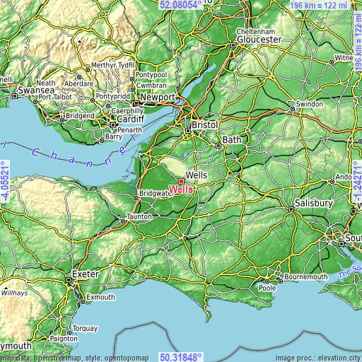
These maps also provides idea of topography and contour of this city, they are displayed at different zoom levels. More info about maps, scale and edge coordinates you can find below images.
| \ | Map #1 | Map #2 | Topo.Map |
| Scale [m] | 5..288 m | 3..303 m | × |
| Scale [ft] | 16..945 ft | 10..994 ft | × |
| Average | 81.4 m = 267 ft | 108.2 m = 355 ft | × |
| Width | 6.12 km = 3.8 mi | 12.24 km = 7.6 mi | 195.9 km = 121.7 mi |
| Height | 6.12 km = 3.8 mi | 12.24 km = 7.6 mi | 195.9 km = 121.7 mi |
| ↑Max Latitude | 51.235463° | 51.26297° | 52.08054° |
| Latitude at center | 51.20794° | 51.20794° | 51.20794° |
| ↓Min Latitude | 51.1804° | 51.152844° | 50.31848° |
| ← Min Longitude | -2.692905° | -2.736851° | -4.05521° |
| Longitude center | -2.64896° | -2.64896° | -2.64896° |
| →Max Longitude | -2.605015° | -2.561069° | -1.24271° |
Nearby cities:
Cities around Wells sort by population:
• Mendip elevation 293 m
3.6 km,  25°
25°
• Street 22 m
11.2 km,  214°
214°
• Shepton Mallet 144 m
7.4 km,  105°
105°
• Glastonbury 13 m
8.4 km,  216°
216°
• Cheddar 12 m
11.6 km,  310°
310°
• Bradley Cross 54 m
10.9 km, 313°
• Chilcompton 143 m
11.8 km,  58°
58°
• Evercreech 87 m
12 km,  123°
123°
• Wedmore 25 m
11.5 km,  280°
280°
• Draycott 47 m
8.9 km, 306°
• East Harptree 107 m
10.5 km,  10°
10°
• Compton Martin 100 m
11.4 km,  357°
357°
Multilingual:
 En español:
Wells elevación 42 m.
 En France:
Wells élévation 42 m.


Sources and notes:
- [note 1] Map square and city borders are not equal. Map elevation data is calculated only from area inside that square.
- [src 1] Elevation data from geonames database provided with same terms of usage.
- [src 2] The elevation map of Wells is generated using elevation data from NASA's 3 arcsec (90m) resolution SRTM data.
- [src 3] Base (background) map © OpenStreetMap contributors tiles are generated by Geofabrik and OpenTopoMap.
Copyright & License:
This Wells Elevation Map is licensed under CC BY-SA. You may reuse any part from this page, if you give a proper credit by linking to this URL:
 More info on terms of use page.