Cheddar elevation
Cheddar (England, Somerset), United Kingdom elevation is 12 meters and Cheddar elevation in feet is 39 ft above sea level [src 1]. Cheddar is a populated place (feature code) with elevation that is 60 meters (197 ft) smaller than average city elevation in United Kingdom.
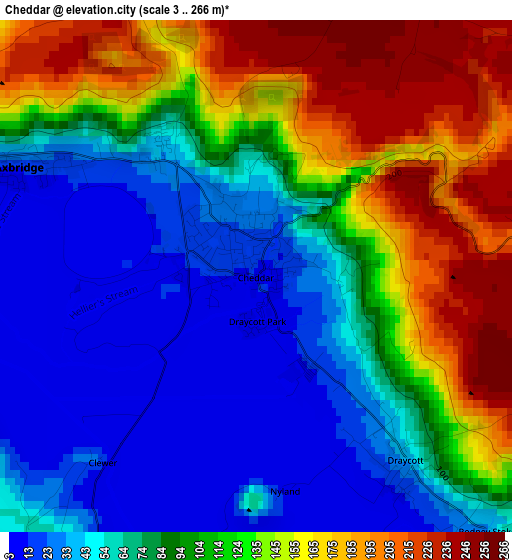
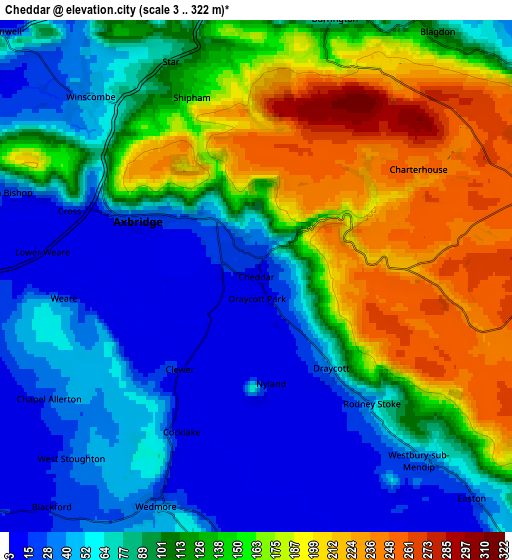
Below is the Elevation map of Cheddar, which displays elevation range with different colors. Scale of the first map is from 3 to 266 m (10 to 873 ft) with average elevation of 94.7 meters (=311 ft) [note 1]
These maps also provides idea of topography and contour of this city, they are displayed at different zoom levels. More info about maps, scale and edge coordinates you can find below images.
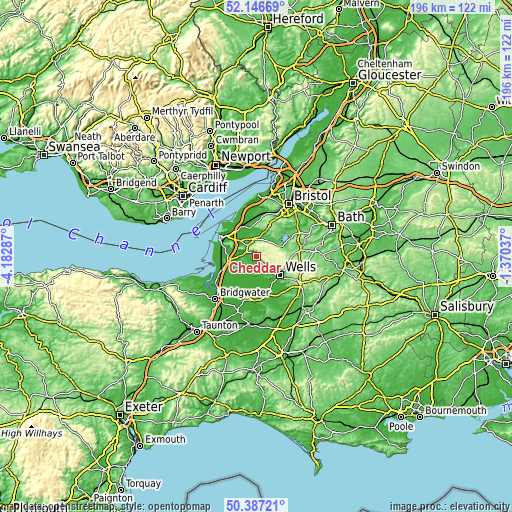
| \ | Map #1 | Map #2 | Topo.Map |
| Scale [m] | 3..266 m | 3..322 m | × |
| Scale [ft] | 10..873 ft | 10..1056 ft | × |
| Average | 94.7 m = 311 ft | 107.1 m = 351 ft | × |
| Width | 6.11 km = 3.8 mi | 12.23 km = 7.6 mi | 195.6 km = 121.5 mi |
| Height | 6.11 km = 3.8 mi | 12.23 km = 7.6 mi | 195.6 km = 121.5 mi |
| ↑Max Latitude | 51.302853° | 51.33032° | 52.14669° |
| Latitude at center | 51.27537° | 51.27537° | 51.27537° |
| ↓Min Latitude | 51.247871° | 51.220355° | 50.38721° |
| ← Min Longitude | -2.820565° | -2.864511° | -4.18287° |
| Longitude center | -2.77662° | -2.77662° | -2.77662° |
| →Max Longitude | -2.732675° | -2.688729° | -1.37037° |
Nearby cities:
Cities around Cheddar sort by population:
• Winscombe elevation 40 m
6.1 km,  320°
320°
• Bradley Cross 54 m
1 km,  93°
93°
• Sandford 23 m
7.4 km,  329°
329°
• Axbridge 9 m
3.2 km,  288°
288°
• Banwell 13 m
8.8 km,  312°
312°
• Wedmore 25 m
5.9 km,  204°
204°
• Churchill 31 m
7.5 km,  356°
356°
• Shipham 133 m
4.6 km,  339°
339°
• Draycott 47 m
2.8 km,  140°
140°
• Blagdon 121 m
7.1 km,  35°
35°
• Compton Martin 100 m
9.3 km,  65°
65°
• Burrington 84 m
6.3 km,  18°
18°
Multilingual:
 En español:
Cheddar elevación 12 m.
 En France:
Cheddar élévation 12 m.


Sources and notes:
- [note 1] Map square and city borders are not equal. Map elevation data is calculated only from area inside that square.
- [src 1] Elevation data from geonames database provided with same terms of usage.
- [src 2] The elevation map of Cheddar is generated using elevation data from NASA's 3 arcsec (90m) resolution SRTM data.
- [src 3] Base (background) map © OpenStreetMap contributors tiles are generated by Geofabrik and OpenTopoMap.
Copyright & License:
This Cheddar Elevation Map is licensed under CC BY-SA. You may reuse any part from this page, if you give a proper credit by linking to this URL:
 More info on terms of use page.