Whitefield elevation
Whitefield (England, Borough of Bury), United Kingdom elevation is 124 meters and Whitefield elevation in feet is 407 ft above sea level [src 1]. Whitefield is a populated place (feature code) with elevation that is 52 meters (171 ft) bigger than average city elevation in United Kingdom.
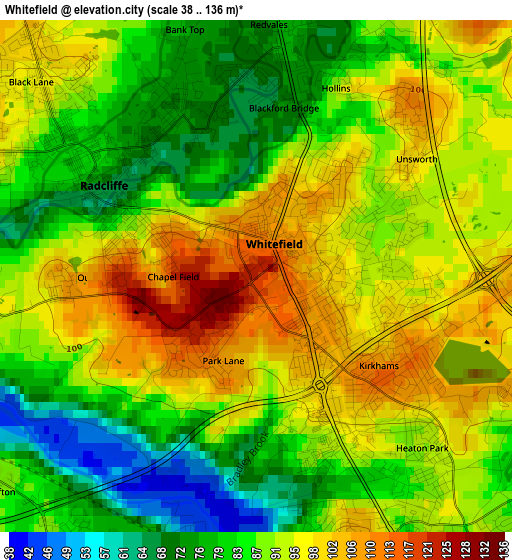
Below is the Elevation map of Whitefield, which displays elevation range with different colors. Scale of the first map is from 38 to 136 m (125 to 446 ft) with average elevation of 89 meters (=292 ft) [note 1]
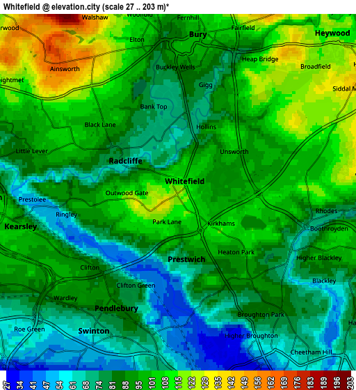
These maps also provides idea of topography and contour of this city, they are displayed at different zoom levels. More info about maps, scale and edge coordinates you can find below images.
| \ | Map #1 | Map #2 | Topo.Map |
| Scale [m] | 38..136 m | 27..203 m | × |
| Scale [ft] | 125..446 ft | 89..666 ft | × |
| Average | 89 m = 292 ft | 90.3 m = 296 ft | × |
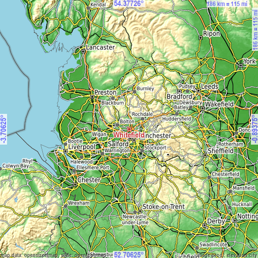
| Width | 5.81 km = 3.6 mi | 11.61 km = 7.2 mi | 185.8 km = 115.5 mi |
| Height | 5.81 km = 3.6 mi | 11.61 km = 7.2 mi | 185.8 km = 115.5 mi |
| ↑Max Latitude | 53.576101° | 53.602185° | 54.37726° |
| Latitude at center | 53.55° | 53.55° | 53.55° |
| ↓Min Latitude | 53.523883° | 53.49775° | 52.70625° |
| ← Min Longitude | -2.343945° | -2.387891° | -3.70625° |
| Longitude center | -2.3° | -2.3° | -2.3° |
| →Max Longitude | -2.256055° | -2.212109° | -0.89375° |
Nearby cities:
Cities around Whitefield sort by population:
• Salford elevation 44 m
7 km,  174°
174°
• Bury 93 m
5.6 km,  0°
0°
• Middleton 87 m
6.6 km,  90°
90°
• Radcliffe 76 m
2.1 km,  308°
308°
• Prestwich 97 m
2.2 km,  149°
149°
• Farnworth 102 m
6.6 km,  270°
270°
• Swinton 46 m
6.5 km,  210°
210°
• Cheetham Hill 58 m
7 km,  144°
144°
• Crumpsall 80 m
5.1 km,  133°
133°
• Little Lever 85 m
5.4 km,  286°
286°
• Blackley 81 m
6.7 km,  122°
122°
• Kearsley 100 m
5.8 km,  251°
251°
Multilingual:
 En español:
Whitefield elevación 124 m.
 En France:
Whitefield élévation 124 m.
 Auf Deutsch:
Whitefield höhe über dem Meeresspiegel ist 124 m.

Sources and notes:
- [note 1] Map square and city borders are not equal. Map elevation data is calculated only from area inside that square.
- [src 1] Elevation data from geonames database provided with same terms of usage.
- [src 2] The elevation map of Whitefield is generated using elevation data from NASA's 3 arcsec (90m) resolution SRTM data.
- [src 3] Base (background) map © OpenStreetMap contributors tiles are generated by Geofabrik and OpenTopoMap.
Copyright & License:
This Whitefield Elevation Map is licensed under CC BY-SA. You may reuse any part from this page, if you give a proper credit by linking to this URL:
 More info on terms of use page.