Bitam elevation
Bitam (Woleu-Ntem), Gabon elevation is 575 meters and Bitam elevation in feet is 1886 ft above sea level [src 1]. Bitam is a populated place (feature code) with elevation that is 318 meters (1043 ft) bigger than average city elevation in Gabon.
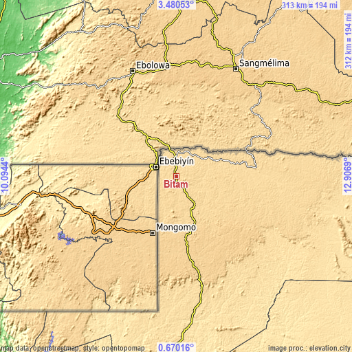
Below is the Elevation map of Bitam, which displays elevation range with different colors. Scale of the first map is from 560 to 685 m (1837 to 2247 ft) with average elevation of 596.2 meters (=1956 ft) [note 1]
These maps also provides idea of topography and contour of this city, they are displayed at different zoom levels. More info about maps, scale and edge coordinates you can find below images.


| \ | Map #1 | Map #2 | Topo.Map |
| Scale [m] | 560..685 m | 560..789 m | × |
| Scale [ft] | 1837..2247 ft | 1837..2589 ft | × |
| Average | 596.2 m = 1956 ft | 606.1 m = 1989 ft | × |
| Width | 9.77 km = 6.1 mi | 19.53 km = 12.1 mi | 312.5 km = 194.2 mi |
| Height | 9.77 km = 6.1 mi | 19.53 km = 12.1 mi | 312.5 km = 194.2 mi |
| ↑Max Latitude | 2.119886° | 2.1638° | 3.48053° |
| Latitude at center | 2.07597° | 2.07597° | 2.07597° |
| ↓Min Latitude | 2.032053° | 1.988135° | 0.67016° |
| ← Min Longitude | 11.456705° | 11.412759° | 10.0944° |
| Longitude center | 11.50065° | 11.50065° | 11.50065° |
| →Max Longitude | 11.544595° | 11.588541° | 12.9069° |
Nearby cities:
Cities around Bitam sort by population:
• Libreville elevation 8 m
294.7 km,  230°
230°
• Oyem 656 m
53.7 km,  170°
170°
• Lambaréné 26 m
339 km,  204°
204°
• Koulamoutou 282 m
372.9 km,  163°
163°
• Makokou 489 m
225.5 km,  137°
137°
• Ntoum 11 m
269.3 km, 225°
• Lastoursville 251 m
348.6 km, 157°
• Booué 217 m
245.9 km, 168°
• Fougamou 93 m
379.9 km, 195°
• Ndjolé 53 m
263.7 km, 198°
• Mitzic 583 m
144 km,  177°
177°
• Cocobeach 18 m
244.5 km,  240°
240°
Multilingual:
 En español:
Bitam elevación 575 m.
 En France:
Bitam élévation 575 m.


Sources and notes:
- [note 1] Map square and city borders are not equal. Map elevation data is calculated only from area inside that square.
- [src 1] Elevation data from geonames database provided with same terms of usage.
- [src 2] The elevation map of Bitam is generated using elevation data from NASA's 3 arcsec (90m) resolution SRTM data.
- [src 3] Base (background) map © OpenStreetMap contributors tiles are generated by Geofabrik and OpenTopoMap.
Copyright & License:
This Bitam Elevation Map is licensed under CC BY-SA. You may reuse any part from this page, if you give a proper credit by linking to this URL:
 More info on terms of use page.