Anduze elevation
Anduze (Occitanie, Gard), France elevation is 140 meters and Anduze elevation in feet is 459 ft above sea level [src 1]. Anduze is a populated place (feature code) with elevation that is 34 meters (112 ft) smaller than average city elevation in France.
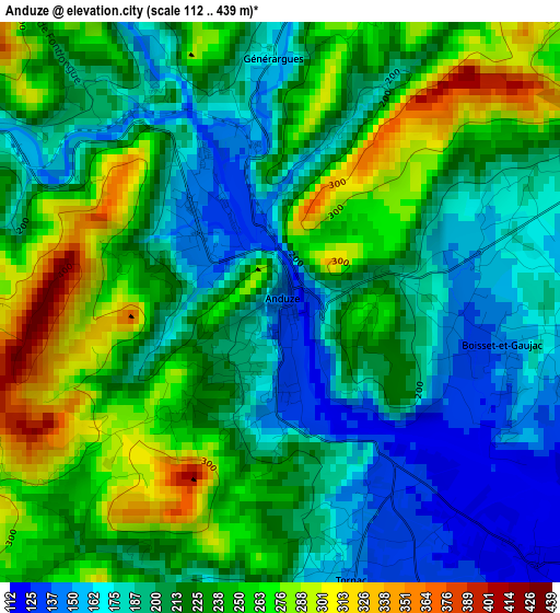
Below is the Elevation map of Anduze, which displays elevation range with different colors. Scale of the first map is from 112 to 439 m (367 to 1440 ft) with average elevation of 219 meters (=719 ft) [note 1]
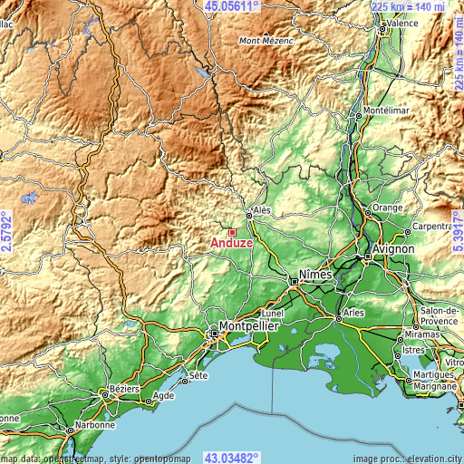
These maps also provides idea of topography and contour of this city, they are displayed at different zoom levels. More info about maps, scale and edge coordinates you can find below images.
| \ | Map #1 | Topo.Map |
| Scale [m] | 112..439 m | × |
| Scale [ft] | 367..1440 ft | × |
| Average | 219 m = 719 ft | × |
| Width | 7.02 km = 4.4 mi | 224.7 km = 139.6 mi |
| Height | 7.02 km = 4.4 mi | 224.7 km = 139.6 mi |
| ↑Max Latitude | 44.085664° | 45.05611° |
| Latitude at center | 44.05409° | 44.05409° |
| ↓Min Latitude | 44.022499° | 43.03482° |
| ← Min Longitude | 3.941505° | 2.5792° |
| Longitude center | 3.98545° | 3.98545° |
| →Max Longitude | 4.029395° | 5.3917° |
Nearby cities:
Cities around Anduze sort by population:
• Alès elevation 135 m
11 km,  44°
44°
• Saint-Christol-lès-Alès 136 m
7.8 km,  66°
66°
• Saint-Hilaire-de-Brethmas 136 m
11.5 km,  75°
75°
• Saint-Jean-du-Gard 192 m
9.8 km,  305°
305°
• Bagard 152 m
5.7 km, 70°
• Boisset-et-Gaujac 167 m
2 km,  111°
111°
• Cendras 215 m
12.5 km,  31°
31°
• Vézénobres 153 m
12.2 km,  91°
91°
• Ribaute-les-Tavernes 125 m
7.8 km,  103°
103°
• Lasalle 284 m
10.5 km,  264°
264°
• Lédignan 158 m
12.2 km,  127°
127°
• Lézan 115 m
6.6 km, 128°
Multilingual:
 En español:
Anduze elevación 140 m.
 En France:
Anduze élévation 140 m.


Sources and notes:
- [note 1] Map square and city borders are not equal. Map elevation data is calculated only from area inside that square.
- [src 1] Elevation data from geonames database provided with same terms of usage.
- [src 2] The elevation map of Anduze is generated using elevation data from NASA's 3 arcsec (90m) resolution SRTM data.
- [src 3] Base (background) map © OpenStreetMap contributors tiles are generated by Geofabrik and OpenTopoMap.
Copyright & License:
This Anduze Elevation Map is licensed under CC BY-SA. You may reuse any part from this page, if you give a proper credit by linking to this URL:
 More info on terms of use page.