Arudy elevation
Arudy (Nouvelle-Aquitaine, Département des Pyrénées-Atlantiques), France elevation is 407 meters and Arudy elevation in feet is 1335 ft above sea level [src 1]. Arudy is a populated place (feature code) with elevation that is 233 meters (764 ft) bigger than average city elevation in France.
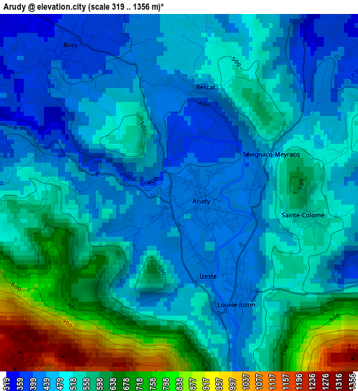
Below is the Elevation map of Arudy, which displays elevation range with different colors. Scale of the first map is from 319 to 1356 m (1047 to 4449 ft) with average elevation of 532.1 meters (=1746 ft) [note 1]
These maps also provides idea of topography and contour of this city, they are displayed at different zoom levels. More info about maps, scale and edge coordinates you can find below images.
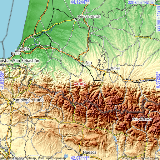
| \ | Map #1 | Topo.Map |
| Scale [m] | 319..1356 m | × |
| Scale [ft] | 1047..4449 ft | × |
| Average | 532.1 m = 1746 ft | × |
| Width | 7.13 km = 4.4 mi | 228.3 km = 141.9 mi |
| Height | 7.13 km = 4.4 mi | 228.3 km = 141.9 mi |
| ↑Max Latitude | 43.138475° | 44.12447° |
| Latitude at center | 43.1064° | 43.1064° |
| ↓Min Latitude | 43.074308° | 42.07111° |
| ← Min Longitude | -0.477275° | -1.83958° |
| Longitude center | -0.43333° | -0.43333° |
| →Max Longitude | -0.389385° | 0.97292° |
Nearby cities:
Cities around Arudy sort by population:
• Oloron-Sainte-Marie elevation 221 m
17.4 km,  304°
304°
• Gan 244 m
14.7 km,  16°
16°
• Nay 315 m
16 km,  57°
57°
• Coarraze 271 m
17.6 km,  67°
67°
• Asson 338 m
15.6 km, 71°
• Lasseube 186 m
14.7 km,  343°
343°
• Laruns 528 m
13.1 km,  177°
177°
• Ogeu-les-Bains 323 m
7.3 km,  311°
311°
• Louvie-Juzon 421 m
2.5 km,  152°
152°
• Mirepeix 262 m
17.2 km, 60°
• Igon 271 m
17.6 km, 67°
• Bosdarros 277 m
13.4 km, 23°
Multilingual:
 En español:
Arudy elevación 407 m.
 En France:
Arudy élévation 407 m.


Sources and notes:
- [note 1] Map square and city borders are not equal. Map elevation data is calculated only from area inside that square.
- [src 1] Elevation data from geonames database provided with same terms of usage.
- [src 2] The elevation map of Arudy is generated using elevation data from NASA's 3 arcsec (90m) resolution SRTM data.
- [src 3] Base (background) map © OpenStreetMap contributors tiles are generated by Geofabrik and OpenTopoMap.
Copyright & License:
This Arudy Elevation Map is licensed under CC BY-SA. You may reuse any part from this page, if you give a proper credit by linking to this URL:
 More info on terms of use page.