Barentin elevation
Barentin (Normandy, Seine-Maritime), France elevation is 44 meters and Barentin elevation in feet is 144 ft above sea level [src 1]. Barentin is a populated place (feature code) with elevation that is 130 meters (427 ft) smaller than average city elevation in France.
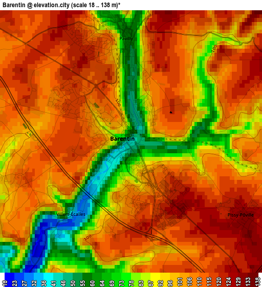
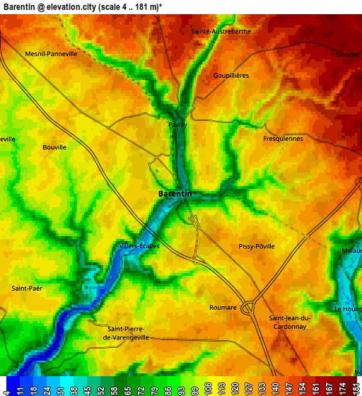
Below is the Elevation map of Barentin, which displays elevation range with different colors. Scale of the first map is from 18 to 138 m (59 to 453 ft) with average elevation of 101.1 meters (=332 ft) [note 1]
These maps also provides idea of topography and contour of this city, they are displayed at different zoom levels. More info about maps, scale and edge coordinates you can find below images.
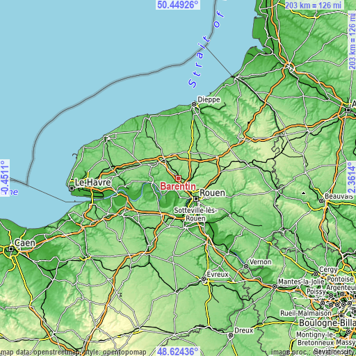
| \ | Map #1 | Map #2 | Topo.Map |
| Scale [m] | 18..138 m | 4..181 m | × |
| Scale [ft] | 59..453 ft | 13..594 ft | × |
| Average | 101.1 m = 332 ft | 113.4 m = 372 ft | × |
| Width | 6.34 km = 3.9 mi | 12.68 km = 7.9 mi | 202.9 km = 126.1 mi |
| Height | 6.34 km = 3.9 mi | 12.68 km = 7.9 mi | 202.9 km = 126.1 mi |
| ↑Max Latitude | 49.573835° | 49.602324° | 50.44926° |
| Latitude at center | 49.54533° | 49.54533° | 49.54533° |
| ↓Min Latitude | 49.516808° | 49.488269° | 48.62436° |
| ← Min Longitude | 0.911205° | 0.867259° | -0.4511° |
| Longitude center | 0.95515° | 0.95515° | 0.95515° |
| →Max Longitude | 0.999095° | 1.043041° | 2.3614° |
Nearby cities:
Cities around Barentin sort by population:
• Pavilly elevation 56 m
2.4 km,  358°
358°
• Malaunay 40 m
6.6 km,  107°
107°
• Le Houlme 32 m
7 km,  124°
124°
• Saint-Pierre-de-Varengeville 119 m
5.1 km,  199°
199°
• Villers-Écalles 110 m
2.6 km,  260°
260°
• Eslettes 147 m
7.2 km,  87°
87°
• Saint-Jean-du-Cardonnay 128 m
6.1 km,  138°
138°
• Pissy-Pôville 131 m
3.2 km, 122°
• Saint-Paër 116 m
6.5 km,  237°
237°
• Roumare 124 m
4.2 km,  160°
160°
• La Vaupalière 131 m
7 km, 155°
• Bouville 118 m
4.7 km,  293°
293°
Multilingual:
 En español:
Barentin elevación 44 m.
 En France:
Barentin élévation 44 m.


Sources and notes:
- [note 1] Map square and city borders are not equal. Map elevation data is calculated only from area inside that square.
- [src 1] Elevation data from geonames database provided with same terms of usage.
- [src 2] The elevation map of Barentin is generated using elevation data from NASA's 3 arcsec (90m) resolution SRTM data.
- [src 3] Base (background) map © OpenStreetMap contributors tiles are generated by Geofabrik and OpenTopoMap.
Copyright & License:
This Barentin Elevation Map is licensed under CC BY-SA. You may reuse any part from this page, if you give a proper credit by linking to this URL:
 More info on terms of use page.