Villers-Écalles elevation
Villers-Écalles (Normandy, Seine-Maritime), France elevation is 110 meters and Villers-Écalles elevation in feet is 361 ft above sea level [src 1]. Villers-Écalles is a populated place (feature code) with elevation that is 64 meters (210 ft) smaller than average city elevation in France.
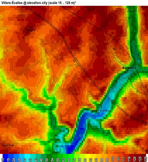
Below is the Elevation map of Villers-Écalles, which displays elevation range with different colors. Scale of the first map is from 15 to 129 m (49 to 423 ft) with average elevation of 96 meters (=315 ft) [note 1]
These maps also provides idea of topography and contour of this city, they are displayed at different zoom levels. More info about maps, scale and edge coordinates you can find below images.
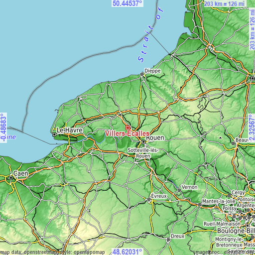
| \ | Map #1 | Topo.Map |
| Scale [m] | 15..129 m | × |
| Scale [ft] | 49..423 ft | × |
| Average | 96 m = 315 ft | × |
| Width | 6.34 km = 3.9 mi | 202.9 km = 126.1 mi |
| Height | 6.34 km = 3.9 mi | 202.9 km = 126.1 mi |
| ↑Max Latitude | 49.569868° | 50.44537° |
| Latitude at center | 49.54136° | 49.54136° |
| ↓Min Latitude | 49.512836° | 48.62031° |
| ← Min Longitude | 0.875475° | -0.48683° |
| Longitude center | 0.91942° | 0.91942° |
| →Max Longitude | 0.963365° | 2.32567° |
Nearby cities:
Cities around Villers-Écalles sort by population:
• Barentin elevation 44 m
2.6 km,  80°
80°
• Pavilly 56 m
3.8 km,  41°
41°
• Duclair 9 m
7.1 km,  206°
206°
• Saint-Pierre-de-Varengeville 119 m
4.4 km,  168°
168°
• Sainte-Marguerite-sur-Duclair 111 m
6.6 km,  236°
236°
• Limésy 149 m
7.9 km,  2°
2°
• Saint-Jean-du-Cardonnay 128 m
7.8 km,  121°
121°
• Pissy-Pôville 131 m
5.4 km,  103°
103°
• Hénouville 131 m
7.6 km,  155°
155°
• Saint-Paër 116 m
4.2 km,  224°
224°
• Roumare 124 m
5.3 km,  131°
131°
• Bouville 118 m
2.9 km,  322°
322°
Multilingual:
 En español:
Villers-Écalles elevación 110 m.
 En France:
Villers-Écalles élévation 110 m.
 Auf Deutsch:
Villers-Écalles höhe über dem Meeresspiegel ist 110 m.

Sources and notes:
- [note 1] Map square and city borders are not equal. Map elevation data is calculated only from area inside that square.
- [src 1] Elevation data from geonames database provided with same terms of usage.
- [src 2] The elevation map of Villers-Écalles is generated using elevation data from NASA's 3 arcsec (90m) resolution SRTM data.
- [src 3] Base (background) map © OpenStreetMap contributors tiles are generated by Geofabrik and OpenTopoMap.
Copyright & License:
This Villers-Écalles Elevation Map is licensed under CC BY-SA. You may reuse any part from this page, if you give a proper credit by linking to this URL:
 More info on terms of use page.