Bégard elevation
Bégard (Brittany, Département des Côtes-d’Armor), France elevation is 144 meters and Bégard elevation in feet is 472 ft above sea level [src 1]. Bégard is a populated place (feature code) with elevation that is 30 meters (98 ft) smaller than average city elevation in France.
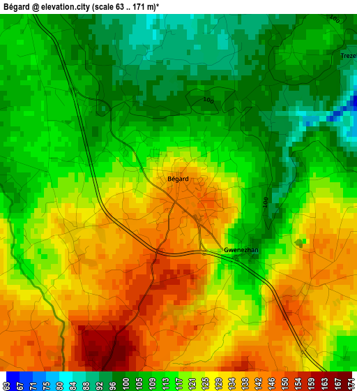
Below is the Elevation map of Bégard, which displays elevation range with different colors. Scale of the first map is from 63 to 171 m (207 to 561 ft) with average elevation of 119.3 meters (=391 ft) [note 1]
These maps also provides idea of topography and contour of this city, they are displayed at different zoom levels. More info about maps, scale and edge coordinates you can find below images.
| \ | Map #1 | Map #2 | Topo.Map |
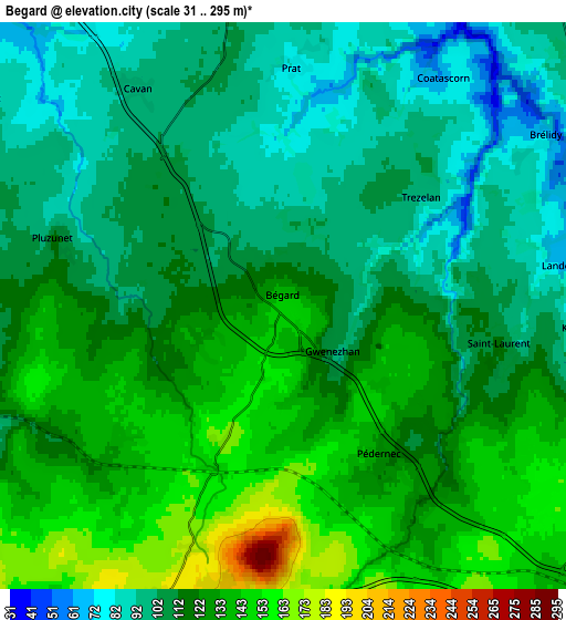
| Scale [m] | 63..171 m | 31..295 m | × |
| Scale [ft] | 207..561 ft | 102..968 ft | × |
| Average | 119.3 m = 391 ft | 117.1 m = 384 ft | × |
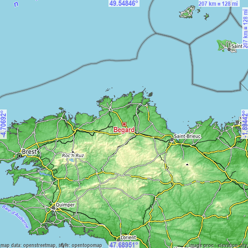
| Width | 6.46 km = 4 mi | 12.92 km = 8 mi | 206.7 km = 128.4 mi |
| Height | 6.46 km = 4 mi | 12.92 km = 8 mi | 206.7 km = 128.4 mi |
| ↑Max Latitude | 48.656577° | 48.685598° | 49.54846° |
| Latitude at center | 48.62754° | 48.62754° | 48.62754° |
| ↓Min Latitude | 48.598486° | 48.569415° | 47.68951° |
| ← Min Longitude | -3.344615° | -3.388561° | -4.70692° |
| Longitude center | -3.30067° | -3.30067° | -3.30067° |
| →Max Longitude | -3.256725° | -3.212779° | -1.89442° |
Nearby cities:
Cities around Bégard sort by population:
• Grâces elevation 125 m
11.6 km,  132°
132°
• Louargat 187 m
7.4 km,  201°
201°
• Plouisy 133 m
10.2 km,  122°
122°
• Pédernec 128 m
4.1 km,  146°
146°
• Ploëzal 75 m
12.1 km,  36°
36°
• Cavan 97 m
6 km,  326°
326°
• Belle-Isle-en-Terre 94 m
11.5 km,  217°
217°
• Le Vieux-Marché 133 m
11.4 km,  254°
254°
• Plouëc-du-Trieux 85 m
9.7 km,  50°
50°
• Tonquédec 93 m
8.4 km,  302°
302°
• Prat 80 m
5.5 km,  2°
2°
• Pluzunet 116 m
5.4 km,  285°
285°
Multilingual:
 En español:
Bégard elevación 144 m.
 En France:
Bégard élévation 144 m.


Sources and notes:
- [note 1] Map square and city borders are not equal. Map elevation data is calculated only from area inside that square.
- [src 1] Elevation data from geonames database provided with same terms of usage.
- [src 2] The elevation map of Bégard is generated using elevation data from NASA's 3 arcsec (90m) resolution SRTM data.
- [src 3] Base (background) map © OpenStreetMap contributors tiles are generated by Geofabrik and OpenTopoMap.
Copyright & License:
This Bégard Elevation Map is licensed under CC BY-SA. You may reuse any part from this page, if you give a proper credit by linking to this URL:
 More info on terms of use page.