Beynes elevation
Beynes (Île-de-France, Yvelines), France elevation is 54 meters and Beynes elevation in feet is 177 ft above sea level [src 1]. Beynes is a populated place (feature code) with elevation that is 120 meters (394 ft) smaller than average city elevation in France.
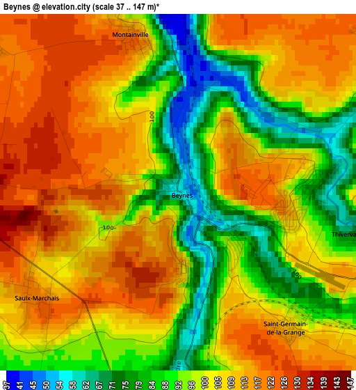
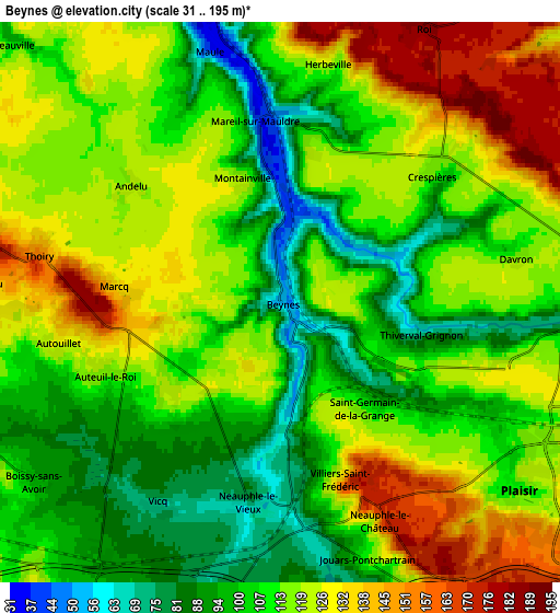
Below is the Elevation map of Beynes, which displays elevation range with different colors. Scale of the first map is from 37 to 147 m (121 to 482 ft) with average elevation of 101.6 meters (=333 ft) [note 1]
These maps also provides idea of topography and contour of this city, they are displayed at different zoom levels. More info about maps, scale and edge coordinates you can find below images.
| \ | Map #1 | Map #2 | Topo.Map |
| Scale [m] | 37..147 m | 31..195 m | × |
| Scale [ft] | 121..482 ft | 102..640 ft | × |
| Average | 101.6 m = 333 ft | 113.1 m = 371 ft | × |
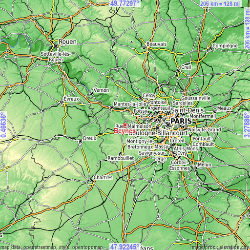
| Width | 6.43 km = 4 mi | 12.86 km = 8 mi | 205.8 km = 127.9 mi |
| Height | 6.43 km = 4 mi | 12.86 km = 8 mi | 205.7 km = 127.8 mi |
| ↑Max Latitude | 48.885165° | 48.914054° | 49.77297° |
| Latitude at center | 48.85626° | 48.85626° | 48.85626° |
| ↓Min Latitude | 48.827338° | 48.798399° | 47.92245° |
| ← Min Longitude | 1.828665° | 1.784719° | 0.46636° |
| Longitude center | 1.87261° | 1.87261° | 1.87261° |
| →Max Longitude | 1.916555° | 1.960501° | 3.27886° |
Nearby cities:
Cities around Beynes sort by population:
• Plaisir elevation 120 m
7 km,  121°
121°
• Maule 34 m
6.2 km,  346°
346°
• Jouars-Pontchartrain 100 m
7.7 km,  165°
165°
• Feucherolles 128 m
7.6 km,  78°
78°
• Neauphle-le-Château 170 m
5.3 km,  152°
152°
• Villiers-Saint-Fréderic 102 m
4.5 km, 169°
• Mareil-sur-Mauldre 40 m
4.3 km,  356°
356°
• Saint-Germain-de-la-Grange 110 m
3.1 km,  141°
141°
• Crespières 116 m
4.7 km,  50°
50°
• Les Alluets-le-Roi 183 m
7.2 km,  27°
27°
• Thiverval-Grignon 68 m
3.4 km,  102°
102°
• Thoiry 145 m
5.6 km,  282°
282°
Multilingual:
 En español:
Beynes elevación 54 m.
 En France:
Beynes élévation 54 m.


Sources and notes:
- [note 1] Map square and city borders are not equal. Map elevation data is calculated only from area inside that square.
- [src 1] Elevation data from geonames database provided with same terms of usage.
- [src 2] The elevation map of Beynes is generated using elevation data from NASA's 3 arcsec (90m) resolution SRTM data.
- [src 3] Base (background) map © OpenStreetMap contributors tiles are generated by Geofabrik and OpenTopoMap.
Copyright & License:
This Beynes Elevation Map is licensed under CC BY-SA. You may reuse any part from this page, if you give a proper credit by linking to this URL:
 More info on terms of use page.