Jouars-Pontchartrain elevation
Jouars-Pontchartrain (Île-de-France, Yvelines), France elevation is 100 meters and Jouars-Pontchartrain elevation in feet is 328 ft above sea level [src 1]. Jouars-Pontchartrain is a populated place (feature code) with elevation that is 74 meters (243 ft) smaller than average city elevation in France.
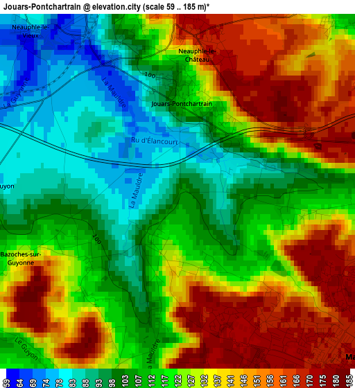
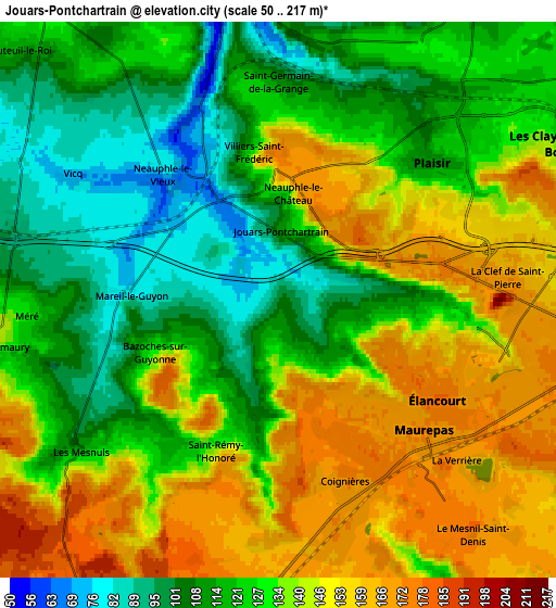
Below is the Elevation map of Jouars-Pontchartrain, which displays elevation range with different colors. Scale of the first map is from 59 to 185 m (194 to 607 ft) with average elevation of 121.8 meters (=400 ft) [note 1]
These maps also provides idea of topography and contour of this city, they are displayed at different zoom levels. More info about maps, scale and edge coordinates you can find below images.
| \ | Map #1 | Map #2 | Topo.Map |
| Scale [m] | 59..185 m | 50..217 m | × |
| Scale [ft] | 194..607 ft | 164..712 ft | × |
| Average | 121.8 m = 400 ft | 131.8 m = 432 ft | × |
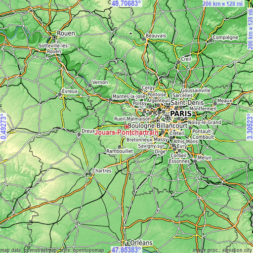
| Width | 6.44 km = 4 mi | 12.88 km = 8 mi | 206 km = 128 mi |
| Height | 6.44 km = 4 mi | 12.88 km = 8 mi | 206 km = 128 mi |
| ↑Max Latitude | 48.817824° | 48.846752° | 49.70683° |
| Latitude at center | 48.78888° | 48.78888° | 48.78888° |
| ↓Min Latitude | 48.759919° | 48.730941° | 47.85383° |
| ← Min Longitude | 1.855035° | 1.811089° | 0.49273° |
| Longitude center | 1.89898° | 1.89898° | 1.89898° |
| →Max Longitude | 1.942925° | 1.986871° | 3.30523° |
Nearby cities:
Cities around Jouars-Pontchartrain sort by population:
• Plaisir elevation 120 m
5.6 km,  46°
46°
• Élancourt 133 m
4.2 km,  97°
97°
• Maurepas 172 m
3.5 km,  140°
140°
• Les Clayes-sous-Bois 132 m
7.4 km,  60°
60°
• Le Mesnil-Saint-Denis 174 m
6.4 km, 139°
• La Verrière 173 m
5.4 km, 139°
• Coignières 176 m
4.6 km,  159°
159°
• Neauphle-le-Château 170 m
2.9 km,  9°
9°
• Villiers-Saint-Fréderic 102 m
3.3 km,  339°
339°
• Saint-Germain-de-la-Grange 110 m
5.1 km,  359°
359°
• Méré 141 m
6.4 km,  265°
265°
• Thiverval-Grignon 68 m
6.9 km, 11°
Multilingual:
 En español:
Jouars-Pontchartrain elevación 100 m.
 En France:
Jouars-Pontchartrain élévation 100 m.
 Auf Deutsch:
Jouars-Pontchartrain höhe über dem Meeresspiegel ist 100 m.
 На русском:
Jouars-Pontchartrain высота над уровнем моря 100 м
Sources and notes:
- [note 1] Map square and city borders are not equal. Map elevation data is calculated only from area inside that square.
- [src 1] Elevation data from geonames database provided with same terms of usage.
- [src 2] The elevation map of Jouars-Pontchartrain is generated using elevation data from NASA's 3 arcsec (90m) resolution SRTM data.
- [src 3] Base (background) map © OpenStreetMap contributors tiles are generated by Geofabrik and OpenTopoMap.
Copyright & License:
This Jouars-Pontchartrain Elevation Map is licensed under CC BY-SA. You may reuse any part from this page, if you give a proper credit by linking to this URL:
 More info on terms of use page.