Bram elevation
Bram (Occitanie, Département de l'Aude), France elevation is 137 meters and Bram elevation in feet is 449 ft above sea level [src 1]. Bram is a populated place (feature code) with elevation that is 37 meters (121 ft) smaller than average city elevation in France.
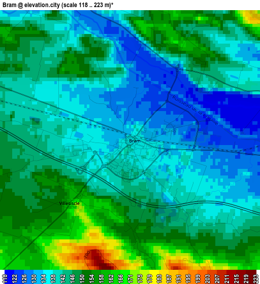
Below is the Elevation map of Bram, which displays elevation range with different colors. Scale of the first map is from 118 to 223 m (387 to 732 ft) with average elevation of 144.8 meters (=475 ft) [note 1]
These maps also provides idea of topography and contour of this city, they are displayed at different zoom levels. More info about maps, scale and edge coordinates you can find below images.
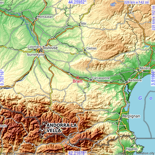
| \ | Map #1 | Topo.Map |
| Scale [m] | 118..223 m | × |
| Scale [ft] | 387..732 ft | × |
| Average | 144.8 m = 475 ft | × |
| Width | 7.12 km = 4.4 mi | 227.8 km = 141.5 mi |
| Height | 7.12 km = 4.4 mi | 227.8 km = 141.5 mi |
| ↑Max Latitude | 43.275763° | 44.25952° |
| Latitude at center | 43.24376° | 43.24376° |
| ↓Min Latitude | 43.21174° | 42.21078° |
| ← Min Longitude | 2.069465° | 0.70716° |
| Longitude center | 2.11341° | 2.11341° |
| →Max Longitude | 2.157355° | 3.51966° |
Nearby cities:
Cities around Bram sort by population:
• Carcassonne elevation 103 m
19.6 km,  99°
99°
• Castelnaudary 187 m
15.3 km,  302°
302°
• Pennautier 117 m
16.6 km,  89°
89°
• Montréal 260 m
5.4 km,  155°
155°
• Pezens 122 m
12.6 km,  84°
84°
• Alzonne 125 m
5.3 km, 78°
• Villepinte 142 m
4.8 km,  333°
333°
• Lavalette 187 m
14.2 km,  117°
117°
• Villeneuve-la-Comptal 210 m
16.6 km,  287°
287°
• Arzens 198 m
9.3 km, 122°
• Saint-Martin-Lalande 171 m
9.8 km,  309°
309°
• Cuxac-Cabardès 519 m
19.7 km,  44°
44°
Multilingual:
 En español:
Bram elevación 137 m.
 En France:
Bram élévation 137 m.


Sources and notes:
- [note 1] Map square and city borders are not equal. Map elevation data is calculated only from area inside that square.
- [src 1] Elevation data from geonames database provided with same terms of usage.
- [src 2] The elevation map of Bram is generated using elevation data from NASA's 3 arcsec (90m) resolution SRTM data.
- [src 3] Base (background) map © OpenStreetMap contributors tiles are generated by Geofabrik and OpenTopoMap.
Copyright & License:
This Bram Elevation Map is licensed under CC BY-SA. You may reuse any part from this page, if you give a proper credit by linking to this URL:
 More info on terms of use page.