Brindas elevation
Brindas (Auvergne-Rhône-Alpes, Département du Rhône), France elevation is 289 meters and Brindas elevation in feet is 948 ft above sea level [src 1]. Brindas is a populated place (feature code) with elevation that is 115 meters (377 ft) bigger than average city elevation in France.
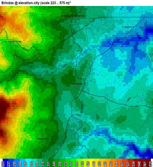
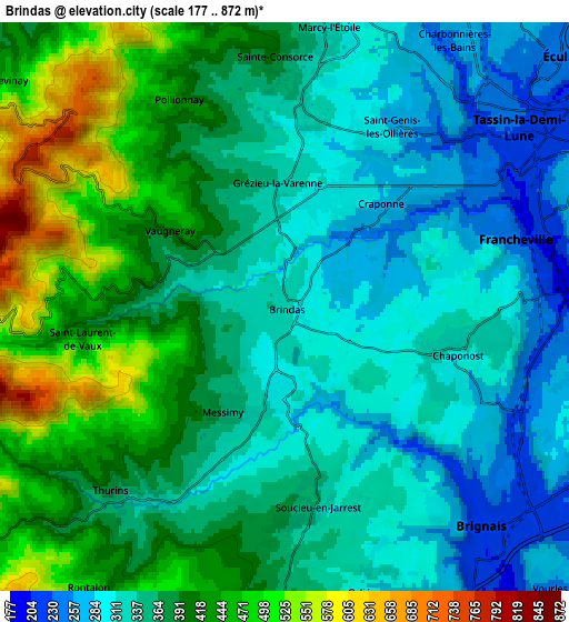
Below is the Elevation map of Brindas, which displays elevation range with different colors. Scale of the first map is from 223 to 575 m (732 to 1886 ft) with average elevation of 332.7 meters (=1092 ft) [note 1]
These maps also provides idea of topography and contour of this city, they are displayed at different zoom levels. More info about maps, scale and edge coordinates you can find below images.
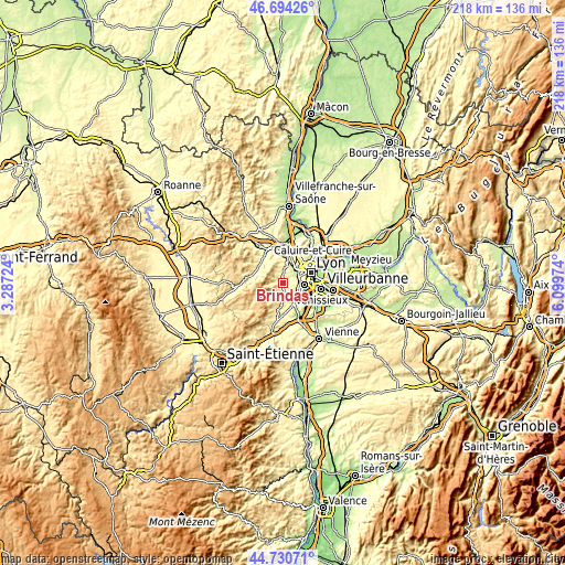
| \ | Map #1 | Map #2 | Topo.Map |
| Scale [m] | 223..575 m | 177..872 m | × |
| Scale [ft] | 732..1886 ft | 581..2861 ft | × |
| Average | 332.7 m = 1092 ft | 368.3 m = 1208 ft | × |
| Width | 6.82 km = 4.2 mi | 13.65 km = 8.5 mi | 218.3 km = 135.6 mi |
| Height | 6.82 km = 4.2 mi | 13.65 km = 8.5 mi | 218.3 km = 135.6 mi |
| ↑Max Latitude | 45.751782° | 45.782437° | 46.69426° |
| Latitude at center | 45.72111° | 45.72111° | 45.72111° |
| ↓Min Latitude | 45.690421° | 45.659715° | 44.73071° |
| ← Min Longitude | 4.649545° | 4.605599° | 3.28724° |
| Longitude center | 4.69349° | 4.69349° | 4.69349° |
| →Max Longitude | 4.737435° | 4.781381° | 6.09974° |
Nearby cities:
Cities around Brindas sort by population:
• Brignais elevation 209 m
7.1 km,  138°
138°
• Francheville 208 m
5.7 km,  72°
72°
• Craponne 275 m
3.5 km,  40°
40°
• Chaponost 317 m
4 km,  107°
107°
• Saint-Genis-les-Ollières 255 m
4.7 km,  32°
32°
• Vaugneray 415 m
3.4 km,  303°
303°
• Grézieu-la-Varenne 312 m
2.9 km,  355°
355°
• Soucieu-en-Jarrest 320 m
4.9 km,  170°
170°
• Messimy 331 m
3 km,  210°
210°
• Thurins 347 m
6 km,  223°
223°
• Sainte-Consorce 363 m
6.1 km, 357°
• Pollionnay 427 m
5.4 km,  332°
332°
Multilingual:
 En español:
Brindas elevación 289 m.
 En France:
Brindas élévation 289 m.


Sources and notes:
- [note 1] Map square and city borders are not equal. Map elevation data is calculated only from area inside that square.
- [src 1] Elevation data from geonames database provided with same terms of usage.
- [src 2] The elevation map of Brindas is generated using elevation data from NASA's 3 arcsec (90m) resolution SRTM data.
- [src 3] Base (background) map © OpenStreetMap contributors tiles are generated by Geofabrik and OpenTopoMap.
Copyright & License:
This Brindas Elevation Map is licensed under CC BY-SA. You may reuse any part from this page, if you give a proper credit by linking to this URL:
 More info on terms of use page.