Brinon-sur-Sauldre elevation
Brinon-sur-Sauldre (Centre, Cher), France elevation is 135 meters and Brinon-sur-Sauldre elevation in feet is 443 ft above sea level [src 1]. Brinon-sur-Sauldre is a populated place (feature code) with elevation that is 39 meters (128 ft) smaller than average city elevation in France.
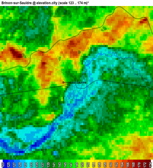
Below is the Elevation map of Brinon-sur-Sauldre, which displays elevation range with different colors. Scale of the first map is from 123 to 174 m (404 to 571 ft) with average elevation of 144.3 meters (=473 ft) [note 1]
These maps also provides idea of topography and contour of this city, they are displayed at different zoom levels. More info about maps, scale and edge coordinates you can find below images.
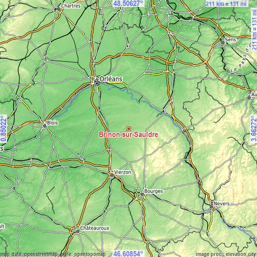
| \ | Map #1 | Topo.Map |
| Scale [m] | 123..174 m | × |
| Scale [ft] | 404..571 ft | × |
| Average | 144.3 m = 473 ft | × |
| Width | 6.59 km = 4.1 mi | 211 km = 131.1 mi |
| Height | 6.59 km = 4.1 mi | 211 km = 131.1 mi |
| ↑Max Latitude | 47.595643° | 48.50627° |
| Latitude at center | 47.566° | 47.566° |
| ↓Min Latitude | 47.53634° | 46.60854° |
| ← Min Longitude | 2.212525° | 0.85022° |
| Longitude center | 2.25647° | 2.25647° |
| →Max Longitude | 2.300415° | 3.66272° |
Nearby cities:
Cities around Brinon-sur-Sauldre sort by population:
• Sully-sur-Loire elevation 116 m
23.6 km,  21°
21°
• Aubigny-sur-Nère 186 m
16.2 km,  122°
122°
• Salbris 108 m
22.1 km,  224°
224°
• Lamotte-Beuvron 115 m
17.6 km,  283°
283°
• Argent-sur-Sauldre 169 m
14.1 km,  93°
93°
• Nouan-le-Fuzelier 112 m
16.8 km,  258°
258°
• Coullons 165 m
18.7 km,  70°
70°
• Ménestreau-en-Villette 121 m
22.9 km,  310°
310°
• Vouzon 139 m
17.4 km,  300°
300°
• Souesmes 127 m
13.6 km,  206°
206°
• Cerdon 146 m
11.1 km,  45°
45°
• Blancafort 175 m
20.9 km,  100°
100°
Multilingual:
 En español:
Brinon-sur-Sauldre elevación 135 m.
 En France:
Brinon-sur-Sauldre élévation 135 m.
 Auf Deutsch:
Brinon-sur-Sauldre höhe über dem Meeresspiegel ist 135 m.
 На русском:
Brinon-sur-Sauldre высота над уровнем моря 135 м
Sources and notes:
- [note 1] Map square and city borders are not equal. Map elevation data is calculated only from area inside that square.
- [src 1] Elevation data from geonames database provided with same terms of usage.
- [src 2] The elevation map of Brinon-sur-Sauldre is generated using elevation data from NASA's 3 arcsec (90m) resolution SRTM data.
- [src 3] Base (background) map © OpenStreetMap contributors tiles are generated by Geofabrik and OpenTopoMap.
Copyright & License:
This Brinon-sur-Sauldre Elevation Map is licensed under CC BY-SA. You may reuse any part from this page, if you give a proper credit by linking to this URL:
 More info on terms of use page.