Cépet elevation
Cépet (Occitanie, Haute-Garonne), France elevation is 131 meters and Cépet elevation in feet is 430 ft above sea level [src 1]. Cépet is a populated place (feature code) with elevation that is 43 meters (141 ft) smaller than average city elevation in France.
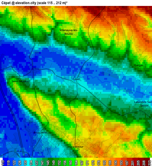
Below is the Elevation map of Cépet, which displays elevation range with different colors. Scale of the first map is from 115 to 212 m (377 to 696 ft) with average elevation of 151.3 meters (=496 ft) [note 1]
These maps also provides idea of topography and contour of this city, they are displayed at different zoom levels. More info about maps, scale and edge coordinates you can find below images.
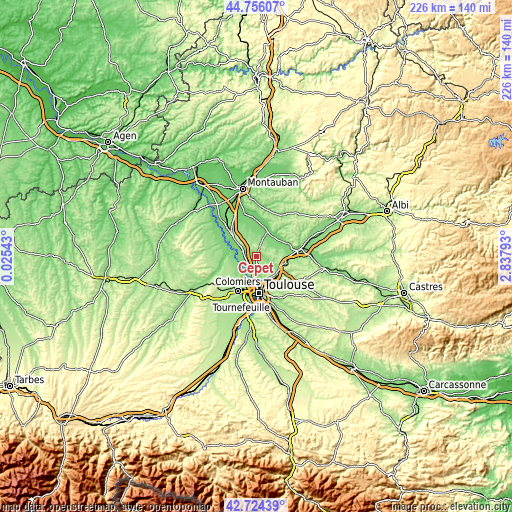
| \ | Map #1 | Topo.Map |
| Scale [m] | 115..212 m | × |
| Scale [ft] | 377..696 ft | × |
| Average | 151.3 m = 496 ft | × |
| Width | 7.06 km = 4.4 mi | 225.9 km = 140.4 mi |
| Height | 7.06 km = 4.4 mi | 225.9 km = 140.4 mi |
| ↑Max Latitude | 43.780587° | 44.75607° |
| Latitude at center | 43.74885° | 43.74885° |
| ↓Min Latitude | 43.717096° | 42.72439° |
| ← Min Longitude | 1.387735° | 0.02543° |
| Longitude center | 1.43168° | 1.43168° |
| →Max Longitude | 1.475625° | 2.83793° |
Nearby cities:
Cities around Cépet sort by population:
• Castelginest elevation 131 m
6.1 km,  177°
177°
• Saint-Jory 120 m
5 km,  260°
260°
• Bruguières 120 m
3.1 km,  218°
218°
• Gratentour 176 m
2.8 km, 178°
• Pechbonnieu 194 m
5.8 km,  152°
152°
• Bouloc 204 m
4.2 km,  329°
329°
• Montberon 182 m
5.3 km,  133°
133°
• Lespinasse 122 m
5.6 km, 222°
• Saint-Sauveur 145 m
2.5 km,  268°
268°
• Labastide-Saint-Sernin 139 m
3.3 km,  112°
112°
• Vacquiers 187 m
5 km,  52°
52°
• Villeneuve-lès-Bouloc 157 m
2.2 km,  341°
341°
Multilingual:
 En español:
Cépet elevación 131 m.
 En France:
Cépet élévation 131 m.


Sources and notes:
- [note 1] Map square and city borders are not equal. Map elevation data is calculated only from area inside that square.
- [src 1] Elevation data from geonames database provided with same terms of usage.
- [src 2] The elevation map of Cépet is generated using elevation data from NASA's 3 arcsec (90m) resolution SRTM data.
- [src 3] Base (background) map © OpenStreetMap contributors tiles are generated by Geofabrik and OpenTopoMap.
Copyright & License:
This Cépet Elevation Map is licensed under CC BY-SA. You may reuse any part from this page, if you give a proper credit by linking to this URL:
 More info on terms of use page.