Céreste elevation
Céreste (Provence-Alpes-Côte d'Azur, Alpes-de-Haute-Provence), France elevation is 397 meters and Céreste elevation in feet is 1302 ft above sea level [src 1]. Céreste is a populated place (feature code) with elevation that is 223 meters (732 ft) bigger than average city elevation in France.
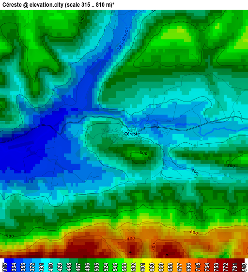
Below is the Elevation map of Céreste, which displays elevation range with different colors. Scale of the first map is from 315 to 810 m (1033 to 2657 ft) with average elevation of 467 meters (=1532 ft) [note 1]
These maps also provides idea of topography and contour of this city, they are displayed at different zoom levels. More info about maps, scale and edge coordinates you can find below images.
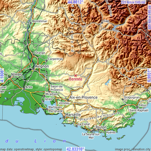
| \ | Map #1 | Topo.Map |
| Scale [m] | 315..810 m | × |
| Scale [ft] | 1033..2657 ft | × |
| Average | 467 m = 1532 ft | × |
| Width | 7.05 km = 4.4 mi | 225.5 km = 140.1 mi |
| Height | 7.05 km = 4.4 mi | 225.5 km = 140.1 mi |
| ↑Max Latitude | 43.88748° | 44.8612° |
| Latitude at center | 43.8558° | 43.8558° |
| ↓Min Latitude | 43.824103° | 42.83316° |
| ← Min Longitude | 5.542905° | 4.1806° |
| Longitude center | 5.58685° | 5.58685° |
| →Max Longitude | 5.630795° | 6.9931° |
Nearby cities:
Cities around Céreste sort by population:
• Manosque elevation 364 m
16.3 km,  100°
100°
• Apt 243 m
15.4 km,  278°
278°
• Pierrevert 394 m
14 km,  110°
110°
• Sainte-Tulle 304 m
16.3 km,  118°
118°
• Cucuron 352 m
15 km,  232°
232°
• Reillanne 560 m
6.3 km,  66°
66°
• Grambois 366 m
10.4 km,  179°
179°
• Saint-Michel-l’Observatoire 561 m
12 km,  59°
59°
• Ansouis 265 m
16.4 km,  217°
217°
• La Bastide-des-Jourdans 450 m
8.7 km,  154°
154°
• Saignon 430 m
12.7 km,  273°
273°
• Beaumont-de-Pertuis 333 m
15.5 km, 147°
Multilingual:
 En español:
Céreste elevación 397 m.
 En France:
Céreste élévation 397 m.


Sources and notes:
- [note 1] Map square and city borders are not equal. Map elevation data is calculated only from area inside that square.
- [src 1] Elevation data from geonames database provided with same terms of usage.
- [src 2] The elevation map of Céreste is generated using elevation data from NASA's 3 arcsec (90m) resolution SRTM data.
- [src 3] Base (background) map © OpenStreetMap contributors tiles are generated by Geofabrik and OpenTopoMap.
Copyright & License:
This Céreste Elevation Map is licensed under CC BY-SA. You may reuse any part from this page, if you give a proper credit by linking to this URL:
 More info on terms of use page.