Ceret elevation
Ceret (Occitanie, Département des Pyrénées-Orientales), France elevation is 181 meters and Ceret elevation in feet is 594 ft above sea level [src 1]. Ceret is a seat of a third-order administrative division (feature code) with elevation that is 7 meters (23 ft) bigger than average city elevation in France.
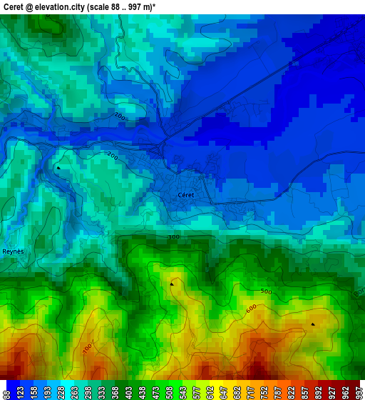
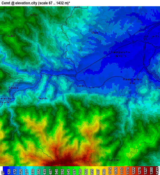
Below is the Elevation map of Ceret, which displays elevation range with different colors. Scale of the first map is from 88 to 997 m (289 to 3271 ft) with average elevation of 322.6 meters (=1058 ft) [note 1]
These maps also provides idea of topography and contour of this city, they are displayed at different zoom levels. More info about maps, scale and edge coordinates you can find below images.
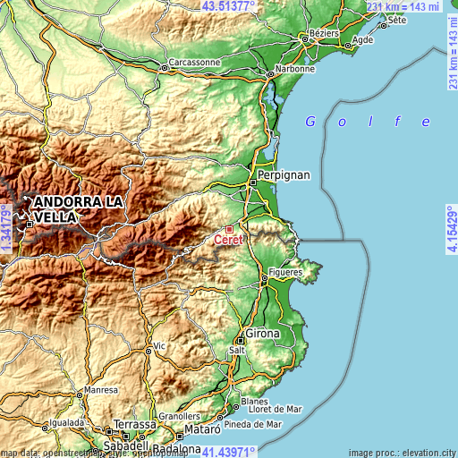
| \ | Map #1 | Map #2 | Topo.Map |
| Scale [m] | 88..997 m | 67..1432 m | × |
| Scale [ft] | 289..3271 ft | 220..4698 ft | × |
| Average | 322.6 m = 1058 ft | 428.9 m = 1407 ft | × |
| Width | 7.21 km = 4.5 mi | 14.41 km = 9 mi | 230.6 km = 143.3 mi |
| Height | 7.21 km = 4.5 mi | 14.41 km = 9 mi | 230.6 km = 143.3 mi |
| ↑Max Latitude | 42.517729° | 42.550111° | 43.51377° |
| Latitude at center | 42.48533° | 42.48533° | 42.48533° |
| ↓Min Latitude | 42.452914° | 42.420481° | 41.43971° |
| ← Min Longitude | 2.704095° | 2.660149° | 1.34179° |
| Longitude center | 2.74804° | 2.74804° | 2.74804° |
| →Max Longitude | 2.791985° | 2.835931° | 4.15429° |
Nearby cities:
Cities around Ceret sort by population:
• el Voló elevation 87 m
8.2 km,  58°
58°
• els Banys d'Arles 231 m
6.6 km,  257°
257°
• Arles 291 m
9.8 km,  251°
251°
• Maureillas-las-Illas 131 m
4.9 km,  83°
83°
• Sant Joan de Pladecorts 108 m
4.5 km,  51°
51°
• Llupia 108 m
15.2 km,  6°
6°
• Trouillas 99 m
14.8 km,  19°
19°
• Reynès 263 m
3.5 km, 254°
• Vilallonga dels Monts 120 m
13.6 km,  70°
70°
• Banyuls-dels-Aspres 119 m
13.2 km, 47°
• Montesquiu d'Albera 174 m
11.6 km, 71°
• Villemolaque 92 m
13.6 km,  33°
33°
Multilingual:
 En español:
Ceret elevación 181 m.
 En France:
Céret élévation 181 m.


Sources and notes:
- [note 1] Map square and city borders are not equal. Map elevation data is calculated only from area inside that square.
- [src 1] Elevation data from geonames database provided with same terms of usage.
- [src 2] The elevation map of Ceret is generated using elevation data from NASA's 3 arcsec (90m) resolution SRTM data.
- [src 3] Base (background) map © OpenStreetMap contributors tiles are generated by Geofabrik and OpenTopoMap.
Copyright & License:
This Ceret Elevation Map is licensed under CC BY-SA. You may reuse any part from this page, if you give a proper credit by linking to this URL:
 More info on terms of use page.