Cesson elevation
Cesson (Île-de-France, Seine-et-Marne), France elevation is 82 meters and Cesson elevation in feet is 269 ft above sea level [src 1]. Cesson is a populated place (feature code) with elevation that is 92 meters (302 ft) smaller than average city elevation in France.
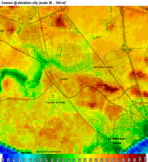
Below is the Elevation map of Cesson, which displays elevation range with different colors. Scale of the first map is from 36 to 104 m (118 to 341 ft) with average elevation of 78.3 meters (=257 ft) [note 1]
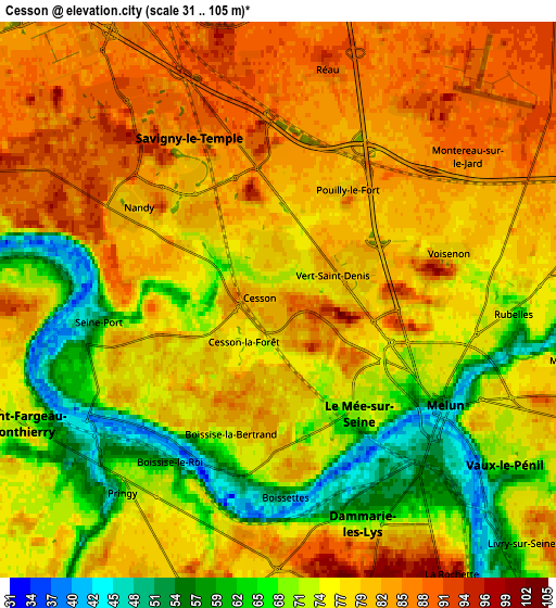
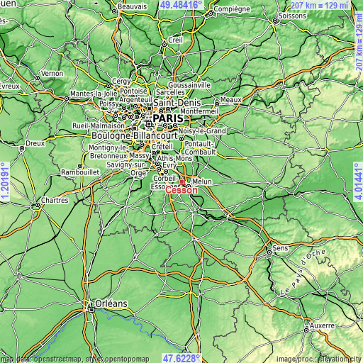
These maps also provides idea of topography and contour of this city, they are displayed at different zoom levels. More info about maps, scale and edge coordinates you can find below images.
| \ | Map #1 | Map #2 | Topo.Map |
| Scale [m] | 36..104 m | 31..105 m | × |
| Scale [ft] | 118..341 ft | 102..344 ft | × |
| Average | 78.3 m = 257 ft | 76.6 m = 251 ft | × |
| Width | 6.47 km = 4 mi | 12.94 km = 8 mi | 207 km = 128.6 mi |
| Height | 6.47 km = 4 mi | 12.94 km = 8 mi | 206.9 km = 128.6 mi |
| ↑Max Latitude | 48.591115° | 48.620173° | 49.48416° |
| Latitude at center | 48.56204° | 48.56204° | 48.56204° |
| ↓Min Latitude | 48.532948° | 48.50384° | 47.6228° |
| ← Min Longitude | 2.564215° | 2.520269° | 1.20191° |
| Longitude center | 2.60816° | 2.60816° | 2.60816° |
| →Max Longitude | 2.652105° | 2.696051° | 4.01441° |
Nearby cities:
Cities around Cesson sort by population:
• Melun elevation 70 m
3.8 km,  118°
118°
• Savigny-le-Temple 75 m
2.3 km,  305°
305°
• Le Mée-sur-Seine 71 m
3.7 km,  156°
156°
• Dammarie-les-Lys 61 m
5.9 km,  148°
148°
• Ponthierry 45 m
5.7 km,  236°
236°
• Vert-Saint-Denis 80 m
1.1 km,  52°
52°
• Nandy 82 m
4.1 km, 305°
• Boissise-le-Roi 68 m
5 km,  214°
214°
• Pringy 74 m
5.9 km, 214°
• Seine-Port 54 m
4.1 km,  262°
262°
• Rubelles 71 m
5.1 km,  101°
101°
• Voisenon 79 m
4.3 km,  75°
75°
Multilingual:
 En español:
Cesson elevación 82 m.
 En France:
Cesson élévation 82 m.


Sources and notes:
- [note 1] Map square and city borders are not equal. Map elevation data is calculated only from area inside that square.
- [src 1] Elevation data from geonames database provided with same terms of usage.
- [src 2] The elevation map of Cesson is generated using elevation data from NASA's 3 arcsec (90m) resolution SRTM data.
- [src 3] Base (background) map © OpenStreetMap contributors tiles are generated by Geofabrik and OpenTopoMap.
Copyright & License:
This Cesson Elevation Map is licensed under CC BY-SA. You may reuse any part from this page, if you give a proper credit by linking to this URL:
 More info on terms of use page.