Le Mée-sur-Seine elevation
Le Mée-sur-Seine (Île-de-France, Seine-et-Marne), France elevation is 71 meters and Le Mée-sur-Seine elevation in feet is 233 ft above sea level [src 1]. Le Mée-sur-Seine is a populated place (feature code) with elevation that is 103 meters (338 ft) smaller than average city elevation in France.
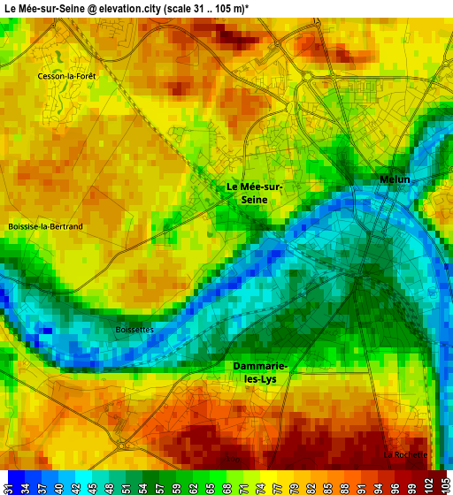
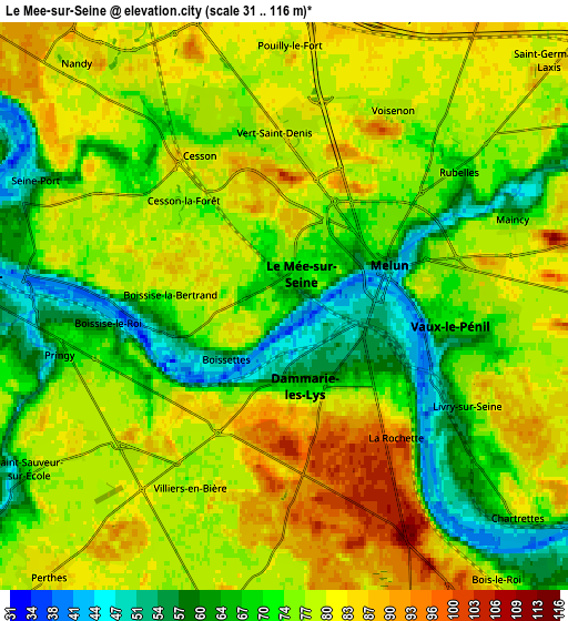
Below is the Elevation map of Le Mée-sur-Seine, which displays elevation range with different colors. Scale of the first map is from 31 to 105 m (102 to 344 ft) with average elevation of 71 meters (=233 ft) [note 1]
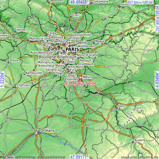
These maps also provides idea of topography and contour of this city, they are displayed at different zoom levels. More info about maps, scale and edge coordinates you can find below images.
| \ | Map #1 | Map #2 | Topo.Map |
| Scale [m] | 31..105 m | 31..116 m | × |
| Scale [ft] | 102..344 ft | 102..381 ft | × |
| Average | 71 m = 233 ft | 75.3 m = 247 ft | × |
| Width | 6.47 km = 4 mi | 12.94 km = 8 mi | 207.1 km = 128.7 mi |
| Height | 6.47 km = 4 mi | 12.94 km = 8 mi | 207.1 km = 128.7 mi |
| ↑Max Latitude | 48.560663° | 48.589738° | 49.45425° |
| Latitude at center | 48.53157° | 48.53157° | 48.53157° |
| ↓Min Latitude | 48.502461° | 48.473335° | 47.59177° |
| ← Min Longitude | 2.584345° | 2.540399° | 1.22204° |
| Longitude center | 2.62829° | 2.62829° | 2.62829° |
| →Max Longitude | 2.672235° | 2.716181° | 4.03454° |
Nearby cities:
Cities around Le Mée-sur-Seine sort by population:
• Melun elevation 70 m
2.4 km,  49°
49°
• Dammarie-les-Lys 61 m
2.3 km,  136°
136°
• Vaux-le-Pénil 69 m
4.7 km,  94°
94°
• Vert-Saint-Denis 80 m
4.1 km,  351°
351°
• Cesson 82 m
3.7 km,  336°
336°
• Boissise-le-Roi 68 m
4.4 km,  260°
260°
• La Rochette 77 m
3.6 km,  134°
134°
• Pringy 74 m
5 km,  252°
252°
• Livry-sur-Seine 70 m
4 km,  112°
112°
• Maincy 62 m
5.7 km,  69°
69°
• Rubelles 71 m
4.3 km,  55°
55°
• Voisenon 79 m
5.2 km,  31°
31°
Multilingual:
 En español:
Le Mée-sur-Seine elevación 71 m.
 En France:
Le Mée-sur-Seine élévation 71 m.
 Auf Deutsch:
Le Mée-sur-Seine höhe über dem Meeresspiegel ist 71 m.

Sources and notes:
- [note 1] Map square and city borders are not equal. Map elevation data is calculated only from area inside that square.
- [src 1] Elevation data from geonames database provided with same terms of usage.
- [src 2] The elevation map of Le Mée-sur-Seine is generated using elevation data from NASA's 3 arcsec (90m) resolution SRTM data.
- [src 3] Base (background) map © OpenStreetMap contributors tiles are generated by Geofabrik and OpenTopoMap.
Copyright & License:
This Le Mée-sur-Seine Elevation Map is licensed under CC BY-SA. You may reuse any part from this page, if you give a proper credit by linking to this URL:
 More info on terms of use page.