Chambly elevation
Chambly (Hauts-de-France, Département de l'Oise), France elevation is 37 meters and Chambly elevation in feet is 121 ft above sea level [src 1]. Chambly is a populated place (feature code) with elevation that is 137 meters (449 ft) smaller than average city elevation in France.
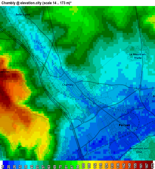
Below is the Elevation map of Chambly, which displays elevation range with different colors. Scale of the first map is from 14 to 173 m (46 to 568 ft) with average elevation of 60.5 meters (=198 ft) [note 1]
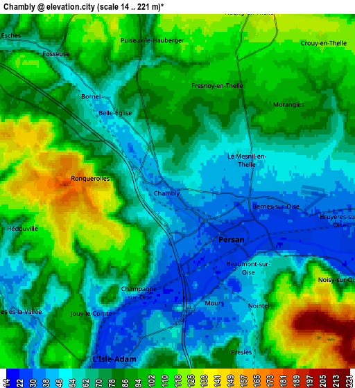
These maps also provides idea of topography and contour of this city, they are displayed at different zoom levels. More info about maps, scale and edge coordinates you can find below images.
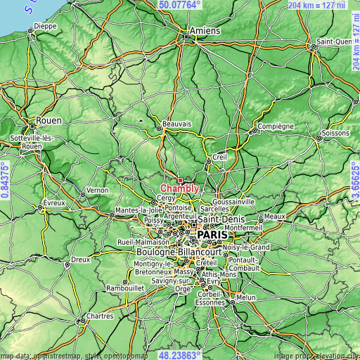
| \ | Map #1 | Map #2 | Topo.Map |
| Scale [m] | 14..173 m | 14..221 m | × |
| Scale [ft] | 46..568 ft | 46..725 ft | × |
| Average | 60.5 m = 198 ft | 80.3 m = 263 ft | × |
| Width | 6.39 km = 4 mi | 12.78 km = 7.9 mi | 204.5 km = 127.1 mi |
| Height | 6.39 km = 4 mi | 12.78 km = 7.9 mi | 204.5 km = 127.1 mi |
| ↑Max Latitude | 49.195396° | 49.224105° | 50.07764° |
| Latitude at center | 49.16667° | 49.16667° | 49.16667° |
| ↓Min Latitude | 49.137928° | 49.109168° | 48.23863° |
| ← Min Longitude | 2.206055° | 2.162109° | 0.84375° |
| Longitude center | 2.25° | 2.25° | 2.25° |
| →Max Longitude | 2.293945° | 2.337891° | 3.65625° |
Nearby cities:
Cities around Chambly sort by population:
• L’Isle-Adam elevation 56 m
6.8 km,  193°
193°
• Persan 27 m
2.2 km,  132°
132°
• Beaumont-sur-Oise 49 m
3.8 km,  135°
135°
• Parmain 29 m
6.5 km,  202°
202°
• Champagne-sur-Oise 34 m
3 km, 190°
• Bruyères-sur-Oise 30 m
5.6 km,  100°
100°
• Bornel 49 m
4.6 km,  319°
319°
• Neuilly-en-Thelle 124 m
6.9 km,  21°
21°
• Bernes-sur-Oise 31 m
3.7 km, 99°
• Le Mesnil-en-Thelle 46 m
2.9 km,  63°
63°
• Nesles-la-Vallée 50 m
6.9 km,  236°
236°
• Mours 42 m
4.2 km,  162°
162°
Multilingual:
 En español:
Chambly elevación 37 m.
 En France:
Chambly élévation 37 m.


Sources and notes:
- [note 1] Map square and city borders are not equal. Map elevation data is calculated only from area inside that square.
- [src 1] Elevation data from geonames database provided with same terms of usage.
- [src 2] The elevation map of Chambly is generated using elevation data from NASA's 3 arcsec (90m) resolution SRTM data.
- [src 3] Base (background) map © OpenStreetMap contributors tiles are generated by Geofabrik and OpenTopoMap.
Copyright & License:
This Chambly Elevation Map is licensed under CC BY-SA. You may reuse any part from this page, if you give a proper credit by linking to this URL:
 More info on terms of use page.